
Earthquake
By Russell Garbutt, Dunedin
Saturday, 4 September, 2010
(Article written in February, 2010)
In light of the disaster in Canterbury, Russell Garbutt of Dunedin, writes:
At the beginning of the year I wrote a piece for publication and sent it to the Listener, North and South and New Zealand Geographic.
The subject was earthquakes and what was likely to happen in the event of a major movement on the Alpine Fault. As it happens, I was talking to a member of the Geology Department on Friday and he had just returned from Christchurch and the Coast working on exactly that – he said on Wednesday that a major movement was due “now”.
****
The recent earthquakes in Haiti, Samoa and Chile, and the continuing relatively small earthquakes in and around New Zealand should remind us all of our own vulnerability when it comes to the “big one”. Perhaps more importantly, these events should determine what actions we collectively should be taking to minimise the after-effects of the inevitable major damage that will be caused when it arrives. It certainly should cause us to examine what those public bodies that are responsible for dealing with the after effects of “the big one” have planned, and what influences that man-made structures on our waterways have had in modifying the natural ebb and flow of the effects of erosion and aggradation of our high country.
Some facts that we should all be aware of.
• The New Zealand Alpine Fault is one of the world’s most prominent and active fault lines
• The East Coast of the South Island is part of one of the earth’s tectonic plates
• The West Coast of the South Island is part of another plate
• The Southern Alps have grown 20,000 metres over the last 25 million years, but have eroded most of this growth away
• Much of the erosion of the high country ends up on the beaches of our coasts
• The Alpine Fault is due to move in a major way
• All of the above will impact upon us, or our children, and how will we continue to live in the “shaky isles”.
The New Zealand Alpine Fault is part of the “Ring of Fire” surrounding the Pacific Ocean. This “Ring of Fire” is the perimeter of the huge Pacific tectonic plate that extends from New Zealand across the eastern Pacific to the western coast of the USA, Alaska, across to the eastern Japanese coast, down through Indonesia and then back to New Zealand via some of the Pacific Islands. There are 15 major plates that cover the surface of the earth and they float on the earth’s mantle, much like the skin on a pot of simmering jam. The plates are in fairly constant movement and this movement leads to tectonic activity where plates collide or move in respect to each other. The activity can be volcanic, seismic, or both. Countries that are in the middle of these plates, such as Australia, are largely isolated from earthquakes or volcanic activity. The number of earthquakes that New Zealand experience in a year as a result of being on the junction of two major plates may come as some surprise, but the norm is about 15,000 with about 250 of them large enough to be felt. They are all recorded by GeoNet and can be viewed on their website – usually within an hour of the event.
The East Coast of the South Island sits on the Pacific tectonic plate and is dominated by large rivers that drain the inner Alpine regions and associated large alluvial plains. Nowhere else on earth are so many large braided rivers. These rivers transport vast quantities of rock, gravel, sand and clay to the East Coast and after heavy storms in the high country the amount of debris that is transported by each river is vast. Rocks get tumbled down the river, are reduced to stones then to gravel and finally to sand or clay and are transported out to sea with some of the debris coming back to land to form beaches and sand dunes. The other huge contributor to this debris is land-slips and erosion. But for the most part, the eastern side of the Alps has a much lower rainfall than the west and this fact can lead to some serious consequences after a major seismic event.
The West Coast of the South Island, which sits on the Australian Plate, has two distinctive features that separate it from the East. The first is the huge difference in rainfall. On the Coast, annual rainfall is measured in metres of rainfall per year, and when you consider that a metre of rain over a hectare weighs some 10,000 tonnes, some idea of how much rain falls in a year can be imagined. Parts of the Coast receive over 10 metres of rain per year equating to 100,000 tonnes of water per hectare, while the average towards the Tasman may be a third of this figure. This prodigious rainfall has rivers flowing regularly at high rates. There is little opportunity for rocks or sand to hang around for any long periods of time. The other distinctive feature is that the landscape is largely bush covered and there is little distance between the mountains and the Tasman Sea. Rivers are consequently steep and there is much less braiding in the shorter distance between mountains and the Tasman Sea.
The Southern Alps seem a fairly constant part of our landscape, but in reality, they are prodigious growers. As the Pacific Plate collides with its neighbouring Australian Plate the boundary between the two plates is thickened, crumpled and forced upwards. The amount of uplift is huge, and was perhaps best described by Abel Tasman’s description of the South Island as “a great land uplifted high”. Over the last 25 million years the Southern Alps have been pushed up well over 60,000 feet or 20,000 metres. Unless erosion at a similar rate to the amount of uplift had been occurring over this period, New Zealand would have also been home to the world’s highest mountains. Over this period of time all of this uplifted material has, for the most part, been carried down to the sea by the waterways on either coast. What must be appreciated is that while erosion is sometimes a gradual and constant process, the main erosion occurs in spurts of intense activity. This is where the New Zealand Alpine Fault comes in.
The New Zealand Alpine fault which stretches 650km from Fiordland to North Westland, is known to have been the host of five events of about Force 8 magnitude where the effects have either been observed or can be measured geologically. The dates that can be provided for past events are circa 1350, 1475, 1615, 1725 and 1826. Using these dates, published in the recent “Hostile Shores” by Dr Bruce McFadgen, the interval between major movements coming forward in time, has been 125 years, 140 years, 110 years, and 101 years. The average gap between major movements over these 660 years has been 119 years. Using this average, another major Alpine Fault movement could have been anticipated in 1945. In other words, we are overdue by some 65 years, although if the longest gap of 140 years is used, we are overdue by only 44 years. Other scientists may put these average gaps slightly higher, but the broad acceptance is that major movements on the Alpine Fault are both regular and of high magnitude. The message should be that while major movements cannot be accurately predicted, history shows that they occur moderately regularly and the current gap of 184 years is larger than any other gap in our recorded past. All present research shows that the tension along the Alpine Fault is reaching a point where the rocks along a very significant part of the fault will suddenly fracture and a major seismic event will occur. It is not a case of “if”, it is a case of “when”.
When the Alpine Fault moves it not only causes the above-mentioned crumpling and uplifting at the boundary, but the West Coast also slides northeast relative to the East Coast. The amount of this movement is also prodigious. It wasn’t until 1952, when Harold Wellman’s map showed for the first time that there was a match between rocks in Marlborough on the western side of the fault, and rocks in Otago on the eastern side of the fault, that proved that the land either side of the fault had shifted almost 500km over 25 million years – a movement about the same rate as your finger nails grow. But as has been pointed out, the movement is not continual or gradual – little or nothing happens for many years, and then there is a big and sudden movement.
So, how big a movement could be expected?
It is generally agreed between geologists from all round New Zealand that a Force 8 event would result in an 8 metre horizontal displacement and a 4 metre vertical displacement along the fault. Previous major events of this magnitude have resulted in movements of this degree. To put this into perspective, the 1968 Inangahua earthquake was a magnitude 7, but a magnitude 8 quake will release 30 times more energy. The immediate effects of this type of movement will be catastrophic the closer to the fracture area of the fault. Structures such as bridges, communications and roads and railways will be severely affected many hundreds of kilometres distant from the fault. It is likely that despite strong earthquake codes, that there will be significant loss of life if buildings collapse during the violent shaking. But the biggest effect will be landslips and other earth movements such as liquefaction. Countless millions of cubic metres of mountain sides will fall into valleys and waterways. On the West Coast, this debris will be rapidly swept to the sea by means of the huge rainfall. On the eastern side of the Alps it is possible or likely that the displaced debris will be stored in the high country until there is sufficient rainfall to start to carry it down the braided rivers to the Pacific Ocean. A magnitude 7 earthquake in Peru in 1970 killed about 80,000 people when a major landslip occurred that sent millions of cubic metres of rock, ice, water rushing at over 100mph down over towns on the side of the collapsed mountain, but the many millions of cubic metres of landslip debris didn’t get washed to the Coast until the El Nino storms of 1972. Within a further two years this debris was evident along the adjacent coastlines as newly formed sand dunes.
Liquefaction occurs in areas where the underlying land can be likened to a freshly lain pile of wet concrete. Wet concrete will stay as it is until it is shaken and then it will settle quickly with water rising to the surface and heavy objects settling into the now liquid goop. Many of the alluvial plains of the east coast such as the Canterbury Plains will, when violently shaken with a strong earthquake, undergo such liquefaction. The effects of shaking are amplified through such underlying geology and buildings and underground utilities such as sewers and water piping can either rapidly sink underground or, in some circumstances be forced out of the ground.
With all this background, it is worthwhile to examine what effects we have made on our landscape that has modified this natural sequence of events. There are four factors that immediately spring to mind.
• Firstly, the immediate area around the Alpine Fault continues to be sparsely populated,
• Some pockets of areas close to the Alpine Fault are densely populated,
• We have a major city on an area which will be subject to liquefaction,
• We have put artificial barriers across waterways which have already affected our natural landscape along our coastline.
Unlike areas such as Peru or Haiti, New Zealand does not have major cities or towns on the Alpine Fault. Much of Fiordland and Westland is relatively sparsely populated, but the effects of a Magnitude 8 earthquake along the fault will not be confined to the valleys and peaks of the high country. Such an earthquake will be felt over the entire South Island and will cause damage over many areas a long way from the long epicentre. It is anticipated that structural damage would occur as far away as Dunedin. It is also true that while the Alpine Fault ends in the north of the South Island, Wellington sits across the Wellington Fault which is a major splinter fault of the Alpine Fault. It would be hard to believe that Wellington would be insulated from a magnitude 8 event on the Alpine Fault and in reality, it should be expected that considerable damage would also result in our capital city.
Some areas such as Queenstown, Te Anau, and Wanaka on the eastern side of the fault, and the towns of the West Coast on the western side of the fault would be severely shaken. Structures on hillsides could fail, and there seems to be no doubt that infrastructure such as bridges, roads and railways would be severely damaged or destroyed. Cellphone towers and power to them would be compromised or destroyed and power and telephone lines would be bought down over very wide areas.
Christchurch lies on an alluvial plain which could undergo amplification of the effects of a major earthquake with liquefaction affecting many major structures.
Rivers in the South Island act as huge flushing agents for the debris created by such events as a major earthquake on the Alpine Fault and largely have been left unhindered by man. But there are some notable exceptions. The biggest of these would be the Clutha River which is fed by two major river systems. Lake Wanaka is drained by the Clutha and is joined at Cromwell by the Kawarau which drains both Lake Wakatipu and the waters of the Shotover River. It is this latter river which is responsible for much of the debris that comes from the Otago hinterland.
The Shotover has its headwaters deep within the area most likely to be severely affected by landslips. This river or its many contributories would be filled with debris from countless landslips and the immediate effect of this will be the damming of sections of the river, new watercourses being formed, and a large amount of debris entering the waterway. The Kawarau will transport this debris down to the confluence with the Clutha, and as soon as the waterflow speed reduces at the start of Lake Dunstan, the debris will start to fall out of suspension in the water and will start to fill the lake. This will happen because of the hydro-electric dam at Clyde.
But this is not the only dam on the Clutha.
Before the Clyde dam was constructed, the dam at Roxburgh acted in a similar way and over the 37 years between the completion of the Roxburgh dam and the Clyde dam was completed, sand and gravel that would have normally been carried down to the East Coast was trapped behind the Roxburgh dam – mainly where the water speed dropped to a point where it could no longer support the sediment. Residents of Alexandra will no doubt be aware of the creation of such sand bars near the confluence of the Manuherika just below Alexandra. It is also interesting to note where these vast quantities of sand from perhaps a series of landslips far up Skippers Creek would have ended up prior to the construction of the dams on the Clutha.
The geological records from previous major aggradation caused by previous Alpine Fault movements show that a lot of the sand ended up on the beaches of Coastal Otago north of the mouth of the Clutha. A short time after each big earthquake in the past, the debris was carried down the Shotover and Kawarau rivers into the Clutha and what did not get washed out to sea was carried north along the coast line by the coastal current and washed up on the beaches. The lovely white sands of St Clair and the beaches north round into Blueskin Bay have, for their most part, their origins in the quartz of the rocks of Central Otago.
This natural draining of the hinterland, and the consequent replenishment of the coastal sands was effectively bought to a halt when the Roxburgh dam was built in 1956, and it should not be a surprise that the beaches of Coastal Otago have since that time undergone some change with much concern being expressed about possible sea incursions near Middle Beach. But this change is minimal compared to what will happen when the major event on the Alpine Fault occurs in the future. The relatively small amounts of debris now coming down behind Lake Dunstan will be dwarfed by what will flow into the lake after that event. Already the lake has shallowed dramatically where the Kawarau enters the lake and it can only be imagined what the lake will look like when countless cubic metres of gravel, sand and clay comes down the river in the first storm after the big event.
It is not at all clear just who has the responsibility for dealing with the consequences of the next major Alpine Fault event. Government will be responsible for many remedial works through national agencies, but it will also be up to local and regional Councils to deal with local emergencies and remedial works. What interests me is who will be responsible for ensuring that the mighty waterways of our region are able to handle transporting the vast quantities of sand to the sea. Initial indications are that it seems that it will be up to the dam operators who have this responsibility but it is hard to see how they are equipped to do so, or what plans they, or the Regional Council have, to dispose of these millions of cubic metres of gravel, sand and clay.
One thing is for sure – collectively we should be aware of the inevitability of the next Alpine Fault movement and what we need to do to be prepared for it.
Saturday, September 4, 2010
EARTHQUAKE

Wednesday, August 4, 2010
NZ Dam Safety Depends On 'Blind Faith'
NZ Dam Safety Depends On 'Blind Faith'
Clutha River Forum, Wednesday, 4 August 2010, 9:24 am
Scoop.co.nz
The Clutha River Forum, an alliance of environmental groups opposed to further dams on the Clutha River, is concerned that New Zealand’s long-awaited Dam Safety Scheme has been deferred.
The scheme was due to come into effect on 1 July 2010, but the Minister of Building and Construction, Maurice Williamson, says it will be delayed for two years following a report earlier this year which found that the scheme imposed rules and compliance costs on dam owners ‘out of proportion to the risks’ imposed on New Zealanders.
“Unlike most other developed countries, New Zealand does not have a ‘Dam Safety Authority’, says Lewis Verduyn, Forum Spokesperson, and Chairperson of the Clutha Mata-Au River Parkway Group. “Thousands of people live and work in the hazard paths of dams, and yet dam safety in New Zealand depends on the public having blind faith in dam owners.”
The report, which was released by the Department of Building and Housing, recommends a number of changes to the scheme, which would regulate the safety of an estimated 1150 dams. But the Clutha River Forum believes that some critical issues have not been addressed.
“The report doesn’t acknowledge that overtopping events are a leading cause of dam failures,” says Dr. Richard Kohler, Chairperson of the Central Otago Environmental Society. “When it comes to dam safety, reservoir-related risks such as landslide areas and active fault-lines are just as important as the dams themselves. Rainfall and earthquakes can trigger catastrophic landslides and overtopping waves, and sediment-filled reservoirs can cause devastating floods. Both Clutha dams have reservoir risk factors, however the report recommends that all reference to ‘earthquake-prone and flood-prone dams’ be removed from the Act.”
There are two large concrete dams on the Clutha River. The Roxburgh dam was commissioned in 1956, and has been blamed for serious floods in Alexandra because of reservoir sedimentation. It was re-consented in 2007 for a further 35 years. The Clyde dam was commissioned in 1992 after years of controversy arising from complex fault-line and landslide mitigation issues.
Mr. Verduyn says “Although the review acknowledges that dams degrade over time, there is no mention of criteria to establish when and how dams and reservoirs are decommissioned, when the risks they impose become unacceptable and cannot be fully mitigated. Large concrete dams have a design life of 80-100yrs, but reservoirs trap sediment from eroding catchments, usually reducing this lifespan. Dams older than 50 years with known issues, like the Roxburgh dam, should have decommissioning timetables. Forward planning is needed because the impacts and costs are substantial.”
According to a report by SPX Consultants, ‘Reversibility of Renewable Energy Developments’, released in 2008, decommissioning and river restoration costs for a large dam, as a proportion of construction costs, are between 35% and 150%.
Last year, Contact Energy, the owner of the Clutha dams, dusted off historic plans for four more large dams on the Clutha River.
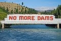
“The Clutha River Forum,” says Lewis Verduyn, “is firmly opposed to further dams on the Clutha River. Large dams are a gamble and it’s time that we recognised the serious risks that they impose on communities. New Zealand needs a credible ‘Dam Safety Authority’ that can enforce safety baselines and hold dam owners accountable for the impacts of their dams.”
The Clutha River Forum is an alliance of:
Upper Clutha River Guardians, Clutha Mata-Au River Parkway Group, Central Otago Environmental Society (Save Central), Beaumont Residents Group, Lower Clutha River Guardians, Forest & Bird (Dunedin / Central – Lakes), and concerned individuals throughout Otago and New Zealand.
Saturday, May 29, 2010
Call To Improve Water Quality
Call for council to improve water quality
By John Edens, on Saturday 29 May 2010
Southland Times
Public Health South yesterday called for the Central Otago District Council to improve the sediment-laden drinking water supply in Lake Roxburgh Village.
But the council has missed out on government funding and residents face continuing contamination of the water supply from the Clutha River.
The council often issues boil water notices after heavy rain floods the river or Contact Energy lowers the Roxburgh hydro lake, which shifts sediment along the catchment to the dam and beyond. About 60 houses are affected.
The latest boil water notice was issued yesterday.
Southern District Health Board public health group manager Pip Stewart said the village's "undesirable" supply was below national drinking water standards and she encouraged the council to make improvements.
Last year the council applied for a $900,000 Health Ministry subsidy, to connect a new supply to the village from Roxburgh township.
The ministry turned down the grant bid, to review the cost and because a public health risk management plan approved an upgrade for the village, not a new scheme.
Ministry principal public health engineer Paul Prendergast said the department asked for the expensive grant bid to be reviewed and this was "not unusual".
In September, the Government announced its drinking-water subsidy scheme was on hold, which meant the council missed the latest round of grants.
Roxburgh Community Board chairman Stephen Jeffery this week travelled to Wellington with council water services manager Peter Greenwood to ask the ministry whether another grant bid was feasible.
Mr Jeffery said the meeting was unsuccessful and it was impossible to say whether funding was available.
When asked whether the council made a mistake in its application, he said "you could say that" but one could also argue a cash-strapped ministry chose to selectively interpret the grant bid.
He said he accepted water supply upgrades were needed and he was urgently pushing for change.
Phil and Kim Winterbottom, the owners of Lake Roxburgh Lodge, said there were numerous unanswered questions regarding moves by the council to secure funding.
Mr Winterbottom said he was aghast the council planned to use water meters to bill ratepayers on large sections when the village supply was "Third World".
Mrs Winterbottom said it was simple – residents were entitled to a clean supply of drinking water but there appeared to be no accountability. "We should be able to turn the tap on and drink the water but we can't."
THE RUNDOWN
Lake Roxburgh Village
Domestic connections: 60
Built: 1960s
Water production: 150 cubic metres a day
Estimated cost to upgrade: $500,000.
Saturday, May 22, 2010
Village Furious Over "Dirty" Water
Village furious over 'dirty' water
By John Edens, on Saturday 22 May 2010
Southland Times
Lake Roxburgh Village residents are furious because of continuing contamination of the water supply from the sediment-laden Clutha River.
The Central Otago District Council issued a boil water notice on April 28 after heavy rain flooded the Clutha River and Contact Energy lowered the Roxburgh hydro lake, shifting sediment along the catchment to the dam and beyond.
Water was "extremely dirty" and residents were told to boil drinking water until further notice.
Lake Roxburgh Lodge, run by Phil and Kim Winterbottom, continued to boil water for family and guests almost a month after the heavy rain.
Mrs Winterbottom said she used boiled water more often than not.
"We're constantly having to boil water to supply bottled water for guests.
"It's clogged up all the water filters so it's costing us money," she said.
It was a citizen's right to expect a clean, efficient water supply in a developed country and the Central Otago District Council should do more to help, she said.
The Roxburgh Village has about 60 connections, supplied by a filtration and chlorination system that draws water from the hydro lake.
Roxburgh township has 460 connections on a separate supply, which has been granted $400,000 from the Health Ministry for an upgrade.
Roxburgh Community Board chairman Stephen Jeffery said he was travelling to Wellington this week to discuss a grant application with the ministry.
The village's water supply was "shocking" but it was not an easy fix because of the cost, he said.
Central Otago District Council water services manager Peter Greenwood said the council was applying for a $287,000 subsidy to upgrade the village water supply with a new ultraviolet filtration system.
Funding from the council would contribute to a proposed $415,000 pot.
The existing filters were overwhelmed by sediment and not capable of handling high flows, he said.
"It doesn't have the ability to move solids, the only way to do it is to put extra treatment in.
"It's a matter of whether the Government is prepared to chip in."
The council has provided a treated-water tanker near the village hall.
Thursday, April 29, 2010
Water Levels Fall
Water levels fall short of previous highs
By Lynda Van Kempen, on Thursday 29 April 2010
Otago Daily Times
Contact Energy generation manager Graham Quinn said although flows were "reasonably high", they were nowhere near the flood levels of 1994, 1995 and 1999.
"We're less than a third of those levels," he said.
"We probably don't need all four spillways open at Clyde, but it gives us an even flow."
Spilling water regulated the level of Lake Dunstan and Lake Roxburgh.
The mean flow of the Clutha at Clyde is 490cumecs and the river was flowing at 1068cumecs at 3pm yesterday.
"We'll be keeping a close eye on those [weather] fronts forecast in the next few days and are very much in a `wait and see' mode at this stage, to see how much more rain there is upstream," he said.
The dams could cope with a much greater flow than at present, but it was relatively unusual to have to spill water in late autumn.
It happened mostly in spring, Mr Quinn said.
One of the positive spin-offs from the increased flow was that flushing of sediment from Lake Roxburgh could occur.
Contact had dropped the level of Lake Roxburgh by 6m on Monday and flushing had been carried out since then.
Lowering the level of the lake speeds up the velocity of the water passing over it and as it moves, it scours out the sediment and moves it downstream.
As part of its consents issued in 2005 to continue operating the Roxburgh and Clyde hydro dams, Contact was required to reduce the volume of sediment in Lake Roxburgh and in the Manuherikia River, to help mitigate the risk of flooding during high flows.
The optimum time to flush sediment was when the river flow was about 1100cumecs, so it was " a bit marginal now" but still worth doing, Mr Quinn said.
Otago Regional Council environmental information and science director John Threlfall said Lakes Wakatipu and Wanaka were "pumping up the Clutha" but there was no concern about the level of the Manuherikia river.
The Clutha River at Balclutha was flowing at 1083.7cumecs at 5.30pm yesterday, which is down on Tuesdays level of 1141.6cumecs.
Clutha District Council Civil Defence officer Selwyn Vigers said river levels on the Clutha were being monitored, and he did not believe there was anything to worry about.
Mr Vigers said he was aware about 1100cumecs was being passed through Roxburgh dam.
"When you add that to the Pomahaka, that's what we're getting - about 1200cumecs down here [in Balclutha]," he said.
"We are monitoring it through the day ... and at the moment, there is not a lot going on."
The Department of Conservation has lifted the high alert warning issued during the weekend in relation to the Young Valley landslip dam.
Backcountry users may now return to the Gillespie Pass Circuit Track in Mt Aspiring National Park but should be prepared for adverse conditions, particularly the high rivers and streams in the region, Doc Wanaka community relations manager Annette Smith said yesterday.
Wednesday, April 28, 2010
Lake Roxburgh Dropped 6m
Lake Roxburgh dropped by 6m to cope with rising flood levels in Clutha
By John Edens, on Wednesday 28 April 2010
Southland Times
Contact Energy dropped Lake Roxburgh by six metres in the 24 hours to yesterday afternoon to cope with rising flood levels in the Clutha River after heavy rain.
The Otago Regional Council recorded 1141 cubic metres per second at Balclutha yesterday, almost triple the flow of a few days ago when the river dipped below 400 cumecs. The ORC's first flood warning was triggered after the flow reached 1140 cumecs.
Alexandra District Flood Action Society president Stan Randle said water was some distance from breaching the Millenium track, which runs beside the Clutha between Alexandra and Clyde.
"As far as I'm concerned, as long as water doesn't go on to the track it's a good indicator Contact are within guidelines."
The Narrows – about 2km from the confluence of the Manuherikia and Clutha rivers towards Roxburgh – was the main bottleneck, he said.
When a peak flow in the Manuherikia occurs during a high flow in the Clutha, then floods will be worse. This happened in 1978, January 1994 and December 1995.
Flood barriers were built to protect Alexandra from a flood crest of 143.25m, 1m above the highest previous flood peak in November 1999.
Contact Energy generation manager Graham Quinn said spillways were opened on Monday to drop Lake Roxburgh from 131.75m above sea level to 125.75m in 24 hours.
Heavy flows were harnessed to flush out sediment in the river and on the Lake Roxburgh bed, especially around The Narrows, he said.
Contact Energy dispatch trader Kirk Pritchard said the four Clyde dam spillways discharged 360 cumecs. Two of three spillways at Roxburgh dam were also opened.
By reducing the lake level, combined with fast flows, it creates a steeper gradient from Alexandra to the dam and sediment was flushed further up Lake Roxburgh and beyond. Sediment in the Clutha increased after the Roxburgh dam was built in 1956.
Tuesday, February 2, 2010
Calls for Contact Report Scrutiny
Calls for contact report scrutiny
By Lynda Van Kempen, on Monday 1 February 2010
Otago Daily Times
The Clutha Management Committee wants scrutiny of consent processes surrounding Clutha hydro lakes. Contact Energy reports prepared as a condition of resource consents to raise Lake Roxburgh and to operate the Roxburgh and Clyde hydro dams should be studied by experts, the Clutha Management Committee believes.
At its recent meeting in Cromwell, the committee received a copy of Contact's annual compliance report, required as part of the conditions to continue operating the hydro dams.
It was also told about an amenity plan being prepared for the shores of Lake Roxburgh as one of the conditions of gaining consent to raise the operating level of the lake.
The committee agreed to ask Central Otago District Council staff to look closely at the reports and prepare a summary of them, flagging any issues they had.
"I need to be reassured that Contact are doing what they're supposed to be doing," committee member Tony Lepper said.
Contact environmental adviser Daniel Druce said Mr Lepper could be assured Contact was meeting all its requirements.
Alexandra resident Jolyon Manning, who attended the meeting, said it was important for there to be transparency in any dealings between Contact and local and regional authorities.
He said the Contact reports should be peer-reviewed.
As part of its consents issued in 2005 to continue operating the Roxburgh and Clyde hydro dams, Contact was required to reduce the volume of sediment in Lake Roxburgh and in the Manuherikia River to help mitigate the risk of flooding during high flows.
The committee was told by the Lake Dunstan Education and enforcement officer, Shayne Hitchcock, that the entrance to Bannockburn inlet had narrowed because of the build-up of silt in the lake.
Several boats had run aground there this summer, he said.
Committee members discussed whether the silt build-up should be addressed in the amenity plan for the lake.
Mr Druce said reducing sediment in the Manuherikia River, as part of the hydro consent conditions, would begin next week at Galloway.
The work would take about two months, and 50,000 cubic metres of gravel would be removed.
Wednesday, January 13, 2010
Old Goldmining Sites at Risk
Old goldmining sites at risk
Wednesday, 13 Jan 2010
Otago Daily Times
Contact Energy may need to take steps to protect archaeological sites when it goes ahead with plans to raise Lake Roxburgh, south of Alexandra, later this year.
The company has been granted consent to raise the lake by 600mm, providing a boost to the Roxburgh power station, the Southland Times reported.
However, the area was also home to two goldrush-era hut sites, a cottage and historic tracks.
New Zealand Historic Places Trust Otago/Southland area manager Owen Graham told the newspaper the Roxburgh area's extensive gold mining history was not taken into account when the dam was built.
The trust and Contact have reached an agreement by which sites will be monitored and work done, where needed, to preserve them.
Saturday, March 7, 2009
Roxburgh Reservoir Silt Rising?
Opposition to plan for raising lake
By Lynda Van Kempen on Sat, 7 Mar 2009
Otago Daily Times
The Alexandra District Flood Action Society will oppose plans to raise Lake Roxburgh, and a commercial operator on the lake also has concerns about the impact of the change on recreational users.
The society met on Thursday night to discuss Contact Energy's application to the Otago Regional Council to raise the maximum operating level of the lake by 60cm. Society president Stan Randle said the group wanted more information aside from that provided in the application.
"We can't afford to get our own independent engineering report done but the regional council will do one, but not until after the date submissions close [on March 13]," Mr Randle said.
"So essentially, we're not going into battle against it, but we don't think we have enough information to make an informed decision yet, so we want to see an independent evaluation of the proposal. By opposing the application, we'll get the regional council's report, as a submitter."
The society was there to protect the community's interests, and although according to Contact it was all "peaches and cream", the group wanted more information on different aspects of the report, including the flood mitigation measures, he said.
Clutha River Cruises owner Steve Toyer said he believed boat users and jet skiers around the Alexandra bridge area would be affected by the higher lake.
"I don't think people realise how much of the beach there will be gone in summer time if the lake is raised; there might be nowhere to land your boat," Mr Toyer said.
He said he was the person who probably used the lake the most, as a commercial operator, and had noticed the area around the bridge had become very popular with water sports enthusiasts, especially in the past year or two.
The mean operating level of the lake would be up to 50cm higher, if the change was approved.
"If the lake is high, the 50cm extra at Alexandra will be on top of that high level, and that will have quite an impact here," Mr Toyer said.
He would be making a submission on the matter and urged recreational users of the lake to do likewise.
"It's too late to complain afterwards."
The flood action society also resolved to keep an eye on any proposals for more dams along the Clutha river.
"We've been told that any firming up of plans are a long way off, and that Contact will consult with us, so we're happy with that," Mr Randle said.


