Showing posts with label Roxburgh. Show all posts

Saturday, January 11, 2014

Beaumont's Rising Fortunes

Beaumont's Rising Fortunes 
By John Gibb, on Saturday 11 January 2014
Otago Daily Times 

Moves are afoot to make the small Otago township of Beaumont the thriving community it once was. John Gibb finds out about Beaumont's changing fortunes.
 
Once a fading rural backwater, the township of Beaumont now seems destined for a much brighter future.

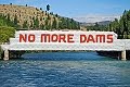
People who have lived near the inland Otago township, on the Clutha River/Mata-au, for 20 years or more will remember earlier sometimes divisive and frustrating conflicts over proposed big hydro-electric dams, which would have flooded the area.

One proposal, by the Electricity Corporation of New Zealand (ECNZ) in 1992, was to build a dam at Tuapeka Mouth that would have flooded 3000ha, including all of Beaumont. But among a series of more promising developments the long-delayed replacement work involving the nearby 19th century Beaumont Bridge is at last due to start next year.

This is one of the oldest bridges in the country still operating on a major state highway.

And more walkers and cyclists are already starting to move through the township since the 73km-long Clutha Gold Trail- which runs between Roxburgh and Lawrence, and includes Beaumont- was opened by Prime Minister John Key on October 24. Long-time resident, historian and writer Bill Dacker (61) is well aware of the area's previously somewhat mixed fortunes.

''It was a little backwater that we enjoyed as a backwater,'' he recalls.

But then a series of dam proposals came along and changed everything, he said.

Some locals, including some facing tough economic times, had agreed to sell their land.

Others, including the ''Hands Off Beaumont'' lobbyists, were determined to resist and to safeguard all they found precious in the area, including its rich history and its attractive and distinctive environment.
Mr Dacker highlights the significance of the bridge replacement work.

The current bridge had been around since 1887 and had struggled to cope with some of the ''huge trucks'' now passing through.

Mr Dacker, who is a long-standing member of the Clutha Gold Trail Trust Board, says the newly opened trail and other developments mean brighter times are coming for Beaumont, which will boost the local economy by bringing in more visitors and potential new residents. Strengthening Beaumont was also important strategically, because it gave the area a better chance of influencing its own destiny in future, he said.
''Unless we're going to make the place strong in a different way, other people are [still] going to see it as a backwater,'' he says.

Dave Crawford is an experienced jet boater and co-owner-operator of Beaumont Jet, with his wife Ali, And he is also a Gold Trail board member.

It was ''great'' to see the cyclists already starting to flow along the track, through Beaumont.
''It can only be good for this area,'' he says.

When he and his wife moved to Beaumont and began jet boat operations in 2004, he had long known the area had strong potential.

The nearby Clutha River/Mata-au is ''probably the best part of the Clutha River'', he adds.

These stretches of the river were also as good as ''anything in New Zealand'' and offered plenty of variety, including ''huge rapids'' and other ecologically appealing areas.

And he is not content with Beaumont being one of the region's and New Zealand's best-kept secrets.
''The more people the better.''

Mr Dacker, who these days divides his time between Beaumont and Port Chalmers, has lived in Beaumont for much of his life, having grown up there.

His father, Harry Dacker, had initially found work there as a rabbiter in the 1920s.

Bill Dacker said the idea of building a''cycle-cum-walking trail through the district, along the river and through the farmland to Lawrence, was a direct response - a way of creating economic opportunity by bringing people into this area as well as the other areas connected by the trail''.

The idea had come from the trust's Roxburgh-based chairman, Rod Peirce, who was a ''retired orchardist from Millers Flat with long-standing connections in Beaumont as well as to the other communities along the trail.''

The lessees of the Beaumont Hotel had also contributed to the upturn in Beaumont's fortunes by continuing to develop and support ''events tailored to hunters and fishermen while adding cyclists to those they wish to give hospitality to''.

And the pub also served ''the best blue cod meals this side of Iceland'', Mr Dacker said.

Widespread support from the Beaumont community for the trust, as well as backing from ''other communities connected by the trail'', had been key to the success of the trail development.

This sense of unity and support stood in ''stark contrast to divisions in the communities'' sparked by the ECNZ dam proposal in 1992, and was ''a wonderful thing to experience''.

Alison Mills, who leases the hotel with her husband, Gunni Egilsson, is also optimistic about the future, and says patrons with different interests and from range of backgrounds, including tourists, were using the hotel and nearby camping ground.

Mr Dacker noted there had been some ''recent controversy'' over suggestions of fees for using the trail.
He emphasised there was no official fee for using it, ''but the trust asks for a koha [donation], a contribution for its maintenance from its users as at the moment the trust is solely responsible for costs of its maintenance''.

Mr Peirce (76) said there were early signs that the new trail would prove positive, and help revive smaller communities such as Beaumont and Millers Flat.

''It's very satisfying. There's a general air of enthusiasm.''

Mr Peirce, who was also once chairman of the Friends of Beaumont group, had opposed various proposals to establish big new dams nearby.

And he is positive about the new trail's benefits.

''I thought, if there's any legacy I can leave, it may well be more like the trail, which is more positive, rather than being an activist against everything.

''I'd like to be seen as someone who left something for the benefit of the community.''

People were already starting to come from far afield to ride or walk the new trail, and local families were also enjoying it.

''We've had a tremendous amount of support from Contact Energy.''

And $3.8 million from the Government's New Zealand Cycle Trail project funding had been used to support the trail's development. Through the years Mr Peirce has noticed rural decline, including loss of population and services, in some of the smaller communities.

''It's very positive. I think that the smaller villages will definitely gain a tremendous amount over the next several years and into the future from the trail.''

And Beaumont was already looking up. The school had closed some decades ago, but ''rural visitors'' were increasing and the pub was humming - ''it's quite a busy little pub'', Mr Peirce said.

The gold trail was also good for Millers Flat - ''it's the only town that the trail actually goes right through the middle of.''

And Mr Dacker highlights Beaumont's distinctive geographical position, and its historical significance.

Beaumont is the first crossing place of the Clutha River/Mata-au when travelling on SH8 from Milton to Central Otago, and its many attractions. And the area was ''one of the major entrance and exit points'' for the Clutha Gold Trail walkway.

The Clutha River/Mata-au is one of the outstanding natural features of the newly opened trail, which follows the river ''on its journey across the river flats below Roxburgh, through the Beaumont Gorge, before it turns toward Lawrence at Beaumont'', Mr Dacker says. The river crosses the Beaumont Flat and then passes through the Rongahere Gorge, the ''last major river flat and gorge respectively of the schist peneplain or block mountain system of the Central Otago highlands''.

Beaumont was a true border between very different geographical zones.

''On the Rongahere side the climate is wetter and cooler, more like that of coastal Otago than Central Otago. On the Beaumont Gorge side the climate is hotter and drier, marking the beginning of Central Otago proper.''

The Maori name for the district is Te Kohai and here the ancestors of Kai Tahu Whanui also crossed the river, but on mokihi (traditional rafts), on their journeys into the interior.

There was also once a moa-hunting era village at Beaumont.

The town of Beaumont grew around the river crossing, where a ferry operated, accompanied by a supporting structure of hotels and shops. The natural vegetation of the nearby gorges reflected the ''borderland'' characteristics.

The dominant tree on Upper Birch Island - also known locally as Native Island - in the Beaumont Gorge is mountain beech, indicating the drier and hotter conditions there. The far larger Birch Island, or Moanui, in the Rongahere Gorge below Beaumont, and the bush of the gorge itself, has a covering of a mixed podocarp forest that includes sphagnum moss, mountain and silver beech as well as totara and matai.

''Both the gorge and the island are home to rare and nearly extinct insect species, protected on the island from rat predation by the swift waters of the river,'' Mr Dacker says.

''Beaumont's fortunes have fluctuated over the years according to major changes in the economic, gold-mining and agricultural history of the province.''

First the search for gold, then the arrival of the railways and the rise of horticulture on the river flats of Central Otago followed by the development of exotic forest plantations in the Blue Mountains all contributed to its growth.

But, subsequently, the closure of the railway branch line, the decline in gold extraction, the rise of large land holdings, changes in the horticultural sector, and finally the closure of the Beaumont Forest headquarters had also contributed to the community shrinking.

Closures of the railway, shops, the race track, churches and the school had all followed ''but always a significant minority clung on'' and many people, including some who had left, showed ''a remarkable dedication to the area'', Mr Dacker said.

And he emphasises that, for the first time in 40 years, there were ''signs of growth at Beaumont again''.
Margaret Healy, who helped organise a series of ''Back to Beaumont'' days, held over the years, has always been optimistic about the township's future.

''The aim is to get people and their families to come back to their grassroots, reminisce and enjoy Beaumont,'' she said.

It was a great place to raise a family and she was keen for Beaumont to become a ''thriving community'' again.


Beaumont
• Beaumont is a township on State Highway 87, at a crossing of the Clutha Mata-Au River, close to Central Otago, between Balclutha and Roxburgh, and is 6km southeast from Raes Junction.
• The township is one of the main entry and exit points on the 73km-long Clutha Gold Trail, between Lawrence and Roxburgh.
• The gold trail's development was backed by $3.8 million in New Zealand Cycle Trail project funding and was opened by Prime Minister John Key in October.
• The trail includes parts of an old Maori trail, sections of the former railway line route, and parts of a former road.
• An earlier proposal in 1992 by ECNZ was to build a dam at Tuapeka Mouth that would have flooded several thousand hectares, including all of Beaumont.

More...

Saturday, October 12, 2013

Otago Prepares To Open New Cycleways

Otago prepares to open new cycleways
Saturday 12 October 2013
3 News

Central Otago's semi-arid dry lands and the green farmlands of the Clutha District in the South Island are being opened up to cyclists and walkers.

The Roxburgh Gorge Trail and Clutha Gold Trail will be officially opened on October 24 by Finance Minister Bill English, the MP for Clutha-Southland, adding new cycling and walking options near the Otago Central Rail Trail, which already attracts an estimated 12,000 people a year.

The new trails have been developed by the Roxburgh Gorge Charitable Trust and Clutha Gold Charitable Trust over eight years.

The Roxburgh Gorge Trail runs 33km from Alexandra to Lake Roxburgh Dam in three stages - a 10km stretch from Alexandra to Doctors Point, a boat transfer to Shingle Creek and a 12km track to Lake Roxburgh Dam.

Rod Peirce, chair of the Clutha Gold Charitable Trust, said the trails had been the collective vision of so many for so long that opening day would mark the transition from a long-held dream to a reality.

Cyclists on the Roxburgh Gorge Trail are expected to take between three and six hours, depending on fitness levels, boat transfer connection times, and time taken to view landmarks. Walkers are expected to take eight to 10 hours, including the boat transfer.

The trail runs down the western side of the Clutha River and most of the route is close to the river. The Clutha Gold Trail is a one-to-two day easy 73km ride from Lake Roxburgh Village to Lawrence.

The first stage from Commissioner Flat to Beaumont mainly runs beside the Clutha River before heading along a defunct railway corridor from Beaumont to Lawrence.

Users are asked to pay $25 per person or $50 for a family, yearly, for a maintenance contribution tag which covers both trails. The charge will not be policed, the Otago Daily Times reports.

More...

Friday, September 13, 2013

Part Of Structure, Trust Chairman Says

Part of Structure, Trust Chairman says
Friday 13 September 2013
Otago Daily Times

Cycle trails are becoming increasingly common around the country and Central Otago is no exception. Inland Otago Conservation Awards winner Clutha Gold Trail Charitable Trust's chairman Rod Peirce talks about constructing the 73km-long trail from Roxburgh to Lawrence.  

What is it about the project you are involved in that got you interested in conservation and drives your work?
''It was probably providing easy access to the river bank for the public, and the historical aspect of the Clutha River like the dredging remnants. I have lived on the river since the 1960s. We used to find old dredge buckets and observe the wrecks of the dredge so I have become, in my mid-70s, part of the structure of the river. It's been a lifetime of a developing interest that has come to a peak with this project.''

How does the project you're involved in benefit conservation?
''There's quite a lot of flora down there that we are still discovering as trustees. Things keep popping up all the time. For example, across the river, on the opposite side to the trail, we discovered 600-year-old native totara trees. The lower Clutha, from Roxburgh through to Beaumont was very rich with history - gold-mining history and Maori history. It's a learning curve for us, all the time history is being uncovered.''

What do you get out of your work in conservation?
''There's the enjoyment of dealing with a range of people - corporate people, archaeologists and contractors. But the core thing for me - I have always been a tramper, climber and skier - is that I have got older and found that cycling really fits the bill for older people. There has been a lot of physical work to be done in the construction of the trail and riding it to test it out, so healthwise it's great. It lengthens my life.''

What challenges have you faced and how have they been overcome?
''It's been a huge challenge for the whole trust really because we are a group of volunteers who have come together with an idea and are now making it a reality. Negotiating with landowners [to gain easements] was a challenge. In a lot of cases we ended up working through a process and resolved most issues. I think in many cases the landowners were a bit apprehensive. We were taken to the Environment Court but that was resolved too.''

In what direction do yousee your conservation work going in the future?
''One of the trust's key functions is to maintain the trail and maintain the quality. It is very important for us to have a continued sound relationship with our easement providers and trail neighbours and that's a commitment we gladly take. We are also prepared to support other groups with similar projects. What happens in the future, though, is hard to be exact about.''

More...

Wednesday, December 5, 2012

Cycle Trail Work Progresses Steadily

Cycle trail work progresses steadily
By Sarah Marquet, on Wednesday 5 December 2012
Otago Daily Times

Construction of two cycle trails between Alexandra and Lawrence is progressing steadily, with more money uplifted from funders and hopes to have some sections open to the public early next year.

With a budget of $3.4 million, $2 million of which came from the Government, construction of the 34km Roxburgh Gorge Cycle Trail between Alexandra and the Roxburgh dam started just over a year ago.

Recently, with government funds running low, Central Lakes Trust and the Otago Community Trust granted a total of $670,000.

Trail trust chairman Stephen Jeffery said that was not because there was a time limit on the government funds, but because they decided to use that money before approaching other funders.

The project was also costing more than expected.

He said contractors were within their tender budgets but the entire project was not running to budget because of costly realignment issues at the Alexandra end of the trail. The contractor was due back there in about a week and it was hoped that section, about 10km, would be complete by April.

A 12km section at the Roxburgh end was almost finished. Only grading, gravelling and signage had to be completed before it could be open to locals, although that was not expected to happen until early next year, he said.

Once the trails were complete, jetties would be built in the Roxburgh Gorge so cyclists and walkers could catch a boat between the two sections of the trail, as the trust still did not have permission from the Miller family to build the centre section. Construction of the 73km Clutha Gold Cycle Trail from the Roxburgh dam to Lawrence, on the opposite side of the river to the Roxburgh Gorge trail, began at the start of this year.

Trail trust chairman Rod Peirce said most of the trail was under construction and was within the $5.5 million budget, $3.8 million of which came from the Government.

The 13km section from the dam to Pinders Pond was complete except for a bridge over the Teviot River, and it was hoped that could open in the new year.

Construction from the Lawrence end was now about 2km short of Beaumont and construction on another section, from Millers Flat to the Talleburn River, was due to start soon.

Both chairmen said they had hoped the trails would be further along by now.

Mr Jeffery said there were ''things thrown at us that slowed us down ... things beyond our control''.

Mr Peirce said the Clutha Gold trail was also held up by small things but he was ''extremely pleased'' with how it was looking.

It was hoped the trail would be completed and open by next April, although ''with an [almost] 80km-long trail, it's hard to be definitive''.

Mr Jeffery said the Roxburgh Gorge trail trust would be ''trying to hurry things along'' now.

The trails are two of the 18 ''Great Rides'' in the Government's New Zealand Cycle Trail project.

More...

Thursday, July 19, 2012

Another Section Of Clutha Gold Trail

Another section of Clutha Gold trail takes shape
By Helena de Reus, on Thursday 19 July 2012
Otago Daily Times

Work has begun on the Beaumont to Lawrence section of the Clutha Gold Trail.

Trail charitable trust chairman Rod Peirce said SouthRoads staff started building the 15km section from Beaumont to Evans Flat on Monday, while other contractors worked to install bridges between Evans Flat and Lawrence.

Construction of the cycle trail at Beaumont began at the SH8 Clutha River bridge, across the road from the Beaumont Millennium Track.

Mr Peirce said contractors began scraping off topsoil, laying base gravel and putting culverts in place.

"From the bridge to Weardale St we're utilising the road reserve, and then carrying on through the [Beaumont] township, with most of this trail section on private property."

The 73km trail, which will cost an estimated $5.5 million, was the first in Central Otago to receive funding under the New Zealand Cycle Trail project, getting $3.8 million from the Government. A 20km section is planned in the Clutha district, between Beaumont and Lawrence; the remaining 53km will be in Central Otago, from Lake Roxburgh to Beaumont.

The trail section near the Roxburgh Bridge is nearing completion.

Mr Peirce said the 8km section from Evans Flat to Lawrence followed the old railway line from Lawrence to Milton, and track construction was almost complete.

Fencing in this area was done by Lawrence-Tuapeka area residents as a fundraiser for the Tuapeka Aquatic Centre - a project which Mr Peirce said the trust was happy to support.

The Clutha District Council is running workshops designed to help facilitate ideas and identify opportunities for the community arising from the Clutha Gold Trail.

The first workshop was held in November last year, with the fourth due to be held in Lawrence on July 31.

More...

Thursday, June 28, 2012

Trust Gives Cycleway Grant Of $300,000

Trust gives cycleway grant of $300,000
By Helena de Reus, on Thursday 28 June 2012
Otago Daily Times

The Clutha Gold Trail has received a $300,000 boost for the Beaumont to Lawrence leg of the cycleway.

The Otago Community Trust yesterday announced the large donation, which has been welcomed by the trust behind the trail.

The 73km trail, which will cost an estimated $5.5 million, was the first in Central Otago to receive funding under the New Zealand Cycle Trail project, with $3.8 million from the Government.

A 20km section is planned in the Clutha district, between Beaumont and Lawrence, and the remaining 53km will be in Central Otago, from Lake Roxburgh to Beaumont.

Otago Community Trust chief executive Keith Ellwood said the trust was very supportive of the cycleway development in the region, which would benefit the community in terms of economic development, health, recreation and exercise.

Clutha Gold Trail Charitable Trust chairman Rod Peirce said trustees were "pleased and very excited" with the donation.

"We have our Government funding but we needed our co-funding. The full amount we requested from the Otago Community Trust was granted, which is just what we needed."

Mr Peirce said work on the trail was well under way.

"In construction terms we're more than halfway through."

The trail is being constructed in six sections.

Stage one from Roxburgh dam to Roxburgh was almost finished, but awaiting the construction of two bridges.

Further downstream, the 8km stretch near Lawrence was being worked on by Homer Contracting.

Mr Peirce said the 8km section followed the old railway line from Lawrence to Milton so track construction was almost complete.

Bridges in the Lawrence-Tuapeka area of the trail were due to be installed soon.

The trust hopes to have the Clutha Gold Trail completed by the end of the year.

More...

Friday, June 22, 2012

Trust Hopes Trail Open By End Of Year

Trust hopes cycle trail completed by end of year
By Helena de Reus, on Friday 22 June 2012
Otago Daily Times

Work on the Clutha district leg of the Clutha Gold Trail will start next week, with the trust behind the cycle trail hopeful the whole trail will be completed by the end of the year.

Clutha Gold Charitable Trust chairman Rod Peirce said contractors would start work at Beaumont, finishing at Cockleshell Rd in the Evans Flat area near Lawrence.

SouthRoads won the contract for that section of the trail, with Waitahuna-based Homer Contracting due to work on the Evans Flat to Lawrence section later in the year.

Trail project manager Tim Dennis, of Southern Land CKL, said SouthRoads staff were due to begin construction of the trail next week on the 15km section from Beaumont to Evans Flat.

The 73km trail, which will cost an estimated $5.5 million, was the first in Central Otago to receive funding under the New Zealand Cycle Trail project, with $3.8 million from the Government.

A 20km section is planned in the Clutha district, between Beaumont and Lawrence, and the remaining 53km will be in Central Otago, from Lake Roxburgh to Beaumont.

The trail is being constructed in six sections.

Stage one from Roxburgh Dam to Roxburgh was "virtually concluded", but awaiting the construction of two bridges.

Mr Peirce said workers had reached Millers Flat, with work on the next stage between Millers Flat and the Millennium Track in the Beaumont Gorge due to begin in a few weeks.

"Progress is going quite well. We'd like to think it would be finished by the end of the year, or at least the beginning of next year. Either way, some of the trail should be open for the summer."

The trust had hoped to begin work on the trail last year, but was unable to do so as contractors were not available any earlier.

The Clutha District Council is running workshops designed to help facilitate ideas and identify opportunities for the community arising from the Clutha Gold Trail.

The first workshop was held in November last year, with the third held on Tuesday night.

Council development manager Jill Borland said the council wanted a forum to help create ideas and identify opportunities for the local community arising from the Clutha Gold Trail.

The public "Trail Opportunities Forum" aimed to identify those with an interest in the trail development and establish a mode of communication.

She hoped it would also identify community resources, skills and interests to maximise potential trail-related opportunities.

Two more workshops have been planned for July 31, and August 14.

More...

Friday, November 18, 2011

CDC Hosting Trail Forum

CDC hosting trail forum
By Helena de Reus, on Friday 18 November 2011
Otago Daily Times

With construction of the Clutha Gold Trail between Lake Roxburgh village and Lawrence expected to begin this month, a forum has been organised to promote ideas around the trail and how it will benefit communities.

The forum, hosted by the Clutha District Council, will be held in Lawrence on Tuesday to help generate ideas and identify opportunities for the local community arising from the Clutha Gold Trail.

All consents are in place for the 73km cycle trail, which will follow the Clutha River from Roxburgh to Lawrence.

Clutha Gold trustee Graham Dillon said construction would begin at the Roxburgh end in the next few weeks.

CDC development manager Jill Borland said, with construction on the trail due to start soon, the council wanted a forum to help create ideas and identify opportunities for the local community arising from the Clutha Gold Trail.

The public "Trail Opportunities Forum" aimed to identify those with an interest in the trail development and establish a mode of communication. She hoped it would also identify community resources, skills and interests to maximise "potential trail-related opportunities".

The council's role in the forum would be to facilitate discussions among local community members, Ms Borland said.

"We want to work with the Central Otago District Council and the community to promote the trail as a whole and to identify skills in both districts."

The Lawrence-Tuapeka Community Board briefly discussed the forum on Wednesday, and encouraged members to attend.

A tourism workshop hosted by Central Otago District Council will be held in Millers Flat on November 28.

The workshop is aimed at present and future tourism operators across the Teviot Valley and into Lawrence, and will include information on characteristics of the cycling market, lessons learned from the Otago Central Rail Trail, collective marketing and opportunities created by the Clutha Gold Trail.

More...

Tuesday, November 1, 2011

Roxburgh Gorge Trail Gets Green Light

Troubled trail gets green light
By Sarah Marquet, on Tuesday 1 November 2011
Otago Daily Times

The only thing left in the way of the first 10km of the controversial 34km Roxburgh Gorge cycle trail is the contractor's diary - the trail trust received the final sign-off from Land Information New Zealand (Linz) late last week.

Trust chairman Stephen Jeffery said technically that meant construction could start straight away, but the trust still had to meet successful tenderers John Sutton Contracting to discuss a start date. He expected to do so over the next couple of days.

John Sutton told the Otago Daily Times yesterday he did not have a start date in mind.

Mr Jeffery said a section in that first 10km, bordering Bruce and Leigh Johnston's property, was still a "bit rocky". The trust opted to use the marginal strip along that section but the exact whereabouts of the strip is being challenged by the Johnstons.

Initially they agreed to work with the trail trust but they have since issued the trust and the contractors with a trespass notice.

They declined to comment but the ODT understands they intend to commission a formal survey of their property boundary.

Mr Jeffery said by using old maps and GPS, the trust had pinpointed the marginal strip.

The budget for the trail is around $3.4 million. A grant of $2 million has been made by the New Zealand Cycle Trail project and the rest is expected to come from community funders.

Concern about the trail has been raised by other Central Otago residents, including Otago Central Rail Trail chairwoman Daphne Hull. She and others had spoken of concern for the environment and the visual impact of the trail.

Mr Jeffery said the trail's impact would be more pronounced initially "but over time it will blend in".

The New Zealand Cycle Trail organisation had suggested the trust look at replanting the area.

Mrs Hull said her concerns were eased by the news the trail trust had systems in place to deal with the lasting visual aspect and if done well it would be "a lovely add-on to the Otago Central Rail Trail and great for Roxburgh."

Mr Toyer also raised concerns about historical sites in the gorge and how they would be protected.

Historical points of interest identified along the trail route are the stone bridge piers at Alexandra, a stone wall in Old Bridge Road and Herron's Cottage in the Roxburgh Gorge. The Flat Top Hill conservation area contains significant and native plants.

The trail trust had had an archaeological assessment done and would continue to work with the New Zealand Historic Places Trust and the Department of Conservation to avoid any adverse effects on those sites, as required by the resource consent.

This first section of the trail, from Alexandra to Flat Top Hill, is the only part of the trail secured so far but Mr Jeffery said it was close to securing the rest of the trail route to the Roxburgh dam.

They were talking to two major pastoral leaseholders, the next two landowners after Flat Top Hill, and trying to work some compensation into their tenure reviews for the land the trail would cover.

However, there was still an issue surrounding the Miller Family's farm at Shingle Creek, as the Millers had said the trail would not cross their land.

At this stage, the proposal was to transport cyclists by boat to a point further down the river, bypassing the Millers' property.

Mr Jeffery said this was not necessarily a bad thing, as it would provide this trail with a point of difference.

The rest of the trail, from Shingle Creek to the Roxburgh dam, was looking "favourable".

Once the trail has been completed, it will be the trail trust's responsibility to maintain it and raise the funds for the maintenance.

The Roxburgh Gorge trail will eventually link up with the Clutha Gold Trail, which will take cyclists from Lake Roxburgh and Lawrence.

Although a separate track, the Clutha Gold trail also received funding from the New Zealand Cycle Trail project and its construction is expected to begin soon.

More...

Thursday, September 29, 2011

Trail Work May Start Next Week

Trail work may start next week
By Sarah Marquet, on Thursday 29 September 2011
Otago Daily Times

Roxburgh Gorge Trail Trust deputy chairwoman and Vincent Community Board chairwoman Clair Higginson stands at the spot in Alexandra where the Roxburgh Gorge trail will start. Photo by Sarah Marquet. Construction of the first stage of the controversial $3.3 million Roxburgh Gorge cycle trail could begin next week as the trail trust irons out paperwork to get the final approval from Land Information New Zealand (Linz).

The trust this week received a letter from Linz which gave the all clear, but it contained a few conditions, trust chairman Stephen Jeffery said.

"They are technical issues that need to be addressed and included in the agreement, then [we can] get the sign-off ... mostly minor legal things."

He said the new wording will be incorporated into the agreement and sent back to Linz to be signed off which should take "about a week".

Work could then begin immediately on the first 10km of the 34km trail from Alexandra to Flat Top Hill, on a mix of marginal strip and Department of Conservation land.

Tenders have already been let and a contractor was ready to start, with the work expected to take six months to complete.

The rest of the trail, to the Roxburgh dam, was reliant on negotiating land access.

"We are still negotiating with land owners over the rest of the trail but we are making steady progress," Mr Jeffery said.

Since its conception, there had been strong opposition to the trail from landowners along its path, with concern mostly over the negative impact it could have on the land.

Devon Miller, whose family farms at Shingle Creek, has aired issues, including the overall viability of the trail, insurance liabilities and people wandering off the track.

Because the trust failed to get easement agreements from some landowners, it opted to use the marginal strip where possible.

A recent survey of the Otago Central Rail Trail found it generated more than $12 million annually for the local economy, which is something the Roxburgh Gorge Trail Trust hopes its trail can do just as well for its local area's economy.

"To grow the economy we need more people and targeting tourists ... and the trail is the most obvious way to do that," said trail trust member and Alexandra businessman, Russell Ibbotson.
(Editorial note from Clutha River Guardian: The river-length trail was envisioned to better enable local communities to benefit from their river asset, economically and in every way, and to enable them to better care for that asset.)

The Roxburgh trail would also link with the proposed Clutha Gold Trail.

That trail would stretch 73km from Roxburgh to Lawrence.

Both the Clutha Gold and the Roxburgh Gorge trails received funding from the Government under Nga Haerenga, the New Zealand Cycle Trail project.

A $2 million funding grant for the Roxburgh Gorge Trail was approved in September last year. The trail trust needs to raise the remaining $1.3 million.

More...

Friday, February 18, 2011

Trail Landowners Criticise Process

Trail landowners criticise process
By Colin Williscroft, on Friday 18 February 2011
Otago Daily Times

Landowners opposed to the proposed Clutha Gold Trail have criticised the way the organisation behind it has gone about the project.

They voiced their dissatisfaction during a two-day hearing in Roxburgh this week that heard an application by the Clutha Gold Trail Charitable Trust for resource consent to build structures associated with the construction, operation and maintenance of a walking and cycling trail.

The proposed Clutha Gold Trail will run along the true left side (east) of the Clutha River, from the Roxburgh dam to Beaumont.

It will be built mainly on the marginal strip next to the river, although some parts will be in Crown-owned land, land vested in the Central Otago District Council and private property, including some owned by Contact Energy.

Ruth Huwes, of Millers Flat, told Hearings Commissioner Denis Nugent the proposal had been characterised by a lack of transparency and communication.

Mrs Huwes and her husband Colin met trust members in 2008 to discuss what impact the trail might have on a retreat they were building on their property next to the marginal strip, as they were concerned the trail and accompanying cyclists would invade the privacy of their future guests.

They were told their concerns would be listened to but Mrs Huwes said they did not hear from the trust until it was announced last year the trail would largely follow the river.

"We had continued to build our retreat but we now had very serious doubts as to the intentions of the trust with regard to our property. We were devastated," Mrs Huwes said.

"We had tried to be proactive in 2008 but now felt betrayed."

Since that time they have been told they were "uncivic" in opposing the trail.

"I feel that we are being singled out as objecting to and trying to stymie the whole project. That is not the case. We are merely wanting a level playing field and [to be] given sufficient information and time to assess what the impacts are on us," she said.

Ken Franklin, of Christchurch, but who has owned a property next to the marginal strip by the Clutha River for seven years, echoed some concerns.

"There has been a lack of adequate consultation in terms of the location [of the trail]," he said.

The trust had not chosen the best possible route for the trail, he said, in terms of public safety, visual amenity and construction and maintenance costs.

"There needs to be wider consultation about other alternatives."

Anita Dawe, of Clyde, a senior planner with BTW South who represented the trust at this week's hearing, said there had been a variety of consultation and information meetings, phone calls and news articles about the trail. "We submit that consultation has been exhaustive and continuous."

Consultation does not mean to reach agreement, although that is the desired outcome, but to engage, participate and adjust proposals if possible, she said. Meetings with affected residents were held until February 28.

"Despite the best intentions and goodwill of all parties, unfortunately, no agreement could be reached," she said.

Mr Nugent reserved his decision.

More...

Thursday, February 10, 2011

Missing Man's Body Returned Home

Missing man's body returned home
By Barbara Withington, on Tuesday 10 February 2011
Southland Times

For some it meant closure, others saw it as nothing short of a miracle.

Family members gathered at the Beaumont Jet office yesterday morning as the body of Paul Wilson was bought ashore from the swollen Clutha River, ending seven days of searching since the 28-year-old civil engineer went missing in the Talla Burn stream while collecting water samples.

With the Clutha River flowing at about 1300 cumecs (normal flow about 800 cumecs), dropping from a high of almost 1550 cumecs on Tuesday morning, fears had been held Mr Wilson's body would never be recovered.

In normal river flow, the body of 16-year-old Darryl Walker, who dived into the Clutha River 1km south of Roxburgh on November 11, 2008, was never found.

In a media release, Detective Sergeant Derek Shaw said Dave Crawford, of Beaumont Jet, continued to observe the river and had discovered Mr Wilson's body about 11am.

"We believe Mr Wilson has always been within the search area but had only recently become visible," Mr Shaw said yesterday.

Police also thanked Central Otago LandSar, volunteer searchers, local farmers and Contact Energy, who all assisted in the search.

Mr Wilson had been the project engineer for Talla Burn Generation, a run-of-the-river power scheme developed by his father Jeff Wilson in partnership with Beaumont Station owner Alan Hore.

The scheme began producing up to 2.6megawatts of power in early November.

One of the conditions placed by the Otago Regional Council on the project was that regular water samples be taken, and it was while he was carrying out sampling of the Talla Burn in flood that Mr Wilson disappeared.

Senior Sergeant Andy Reed, who was involved in the search for and recovery of Mr Wilson, was a neighbour of Mr Wilson's parents but said he felt the loss no more than anyone else.

"Anyone in Roxburgh who has anything to do with the family will be feeling it for them," Mr Reed said.

The matter has been referred to the coroner.

Mr Wilson's family asked for privacy

More...

Wednesday, December 1, 2010

Cycle Trail Route Change Proposed

Cycle trail route change proposed
By Lynda Van Kempen, on Wednesday 1 December 2010
Otago Daily Times

An alternative route has been proposed for the Beaumont to Lawrence section of the Clutha Gold cycle trail and trust chairman Rod Peirce is confident it will proceed.

That section of the 73km trail from Roxburgh East to Lawrence is subject to engineering studies and the approval of the New Zealand Transport Agency, but Mr Peirce said initial discussions with the agency were "positive."

The alternative route involves the use of some highway road verge, combined with access through some private property. NZTA coastal Otago manager Roger Bailey agreed the talks were "promising" and said safety was the paramount concern. Engineering studies had to be carried out to see if the trail would fit safely.

Mr Peirce confirmed that changes to the route were made to work around a landowner who had declined to give permission for his land to be used.

"But we've always been working on achieving our aim, to get from Roxburgh through to Lawrence. That's the main priority and we're still confident of meeting our target. This variation won't make a huge difference to the trail, and we're pretty happy with the route," Mr Peirce said.

"The key factors of the route are still there - the farmland from Roxburgh to Beaumont and the Clutha River section."

The trail was the first in Central Otago to receive government funding under the New Zealand Cycle Trail project, with a grant of $2.5 million for the 50km Roxburgh East to Beaumont section. The feasibility study for the 33km Beaumont to Lawrence section is being updated to reapply for government funding for that section.

There are 150 landowners along the entire length of the planned route.

Mr Peirce was unsure whether the route change would alter the estimated $3.8 million cost of the project.

"We're making savings in one part and spending in other parts has increased, so we'll need to work those figures out."

The second part of the trail had certainly not "stalled", he said.

The Roxburgh East to Beaumont route has been finalised and the trust has applied for resource consent for works and structures on that portion, which is all within the Central Otago district.

A hearing will be held before independent commissioner Denis Nugent, of Wanaka, probably in early February.

The application has attracted 17 submissions, nine opposing, five in support and three neutral, the Central Otago District Council's planning team leader Ann Rodgers said.

More...

Friday, October 15, 2010

Roxburgh Gorge Trail Gets $2 Million

Roxburgh Gorge Trail Receives $2 million from New Zealand Cycle Trail Project
Tourism Media Releases, on Friday 15 October, 2010, 5.00pm
http://www.fourcorners.co.nz/

Nga Haerenga, The New Zealand Cycle Trail project will sign its contract for the new Roxburgh Gorge Trail at a formal event in Alexandra today.

The trail is a joint initiative of Roxburgh Gorge Trail Charitable Trust and The New Zealand Cycle Trail project.

New Zealand Cycle Trail Programme Manager John Dunn says the Government is investing in the new trail to encourage increased economic activity and employment in the Central Otago region.

“The Roxburgh Gorge Trail will be a spectacular one-day cycle ride between Alexandra and the Roxburgh Dam along the Clutha Mata-au River,” Mr Dunn says.

“The Roxburgh Gorge has bluffs rising almost 350 metres on either side of the river at its most dramatic point and has been described as New Zealand’s own ‘Grand Canyon’. Opening up this gorge, which has no road access, will open up access to a truly iconic environment.

“I think that the opportunity to explore well preserved mining relics set within an imposing and inspiring landscape is something that will really appeal to people,” Mr Dunn says.

Central Otago District Council Mayor elect Tony Lepper says this is an exciting addition to our trail network, traversing a fantastically remote part of our district which boasts a rich cultural heritage. “I am sure that the Alexandra and Roxburgh communities will seize this opportunity to develop another vibrant attraction for visitors to Central Otago,” Mr Lepper says.

Roxburgh Gorge Trail Charitable Trust Chairman Stephen Jeffery says an idea that came out of community consultation, researched by the combined Community Boards of Roxburgh and Vincent will now become possible thanks to funding from the New Zealand Cycle Trail project. “The economic benefits will be significant and have the potential to revitalise business in the Teviot Valley,” Mr Jeffery says.

The 34km Roxburgh Gorge Trail starts in Alexandra and follows the Clutha Mata-au River through the Roxburgh Gorge to the Roxburgh Dam, linking with the Otago Central Rail Trail and the Clutha Gold Trail.

Within a short distance from Alexandra the trail heads into the gorge. Along the trail are old schist huts built into the rock by Chinese miners and remains of two small mining settlements. Near Roxburgh Dam the hills become less steep and the swirling currents of the river are replaced by the still waters of Lake Roxburgh.

“The Roxburgh Gorge Trail will be one of a series of 18 Great Rides under Nga Haerenga, The New Zealand Cycle Trail that will showcase the very best that New Zealand has to offer in terms of landscape, culture and communities,” Mr Dunn says.

“The latest edition of Lonely Planet has already rated the Otago Peninsula as one of the best cycling destinations in the world. The confirmation of the Roxburgh Gorge Trail, along with the nearby Clutha Gold and Alps 2 Ocean Cycle Trails can only add to this outstanding reputation,” Mr Dunn added.

More...

Saturday, September 25, 2010

Roxburgh Gorge Trail Funding

Roxburgh Gorge cycle trail funding confirmed
By Colin Williscroft, on Saturday 25 September 2010
Otago Daily Times

Confirmation of the Roxburgh Gorge cycle trail is good news for the Teviot Valley, the chairman of the trust set up to administer the project says.

However, Stephen Jeffery, who last week was elected chairman of the Roxburgh Gorge Charitable Trust, which will take over governance of the project from the Central Otago District Council, said confirmation of government funding was only another step along the path towards making the cycle trail a reality.

"Don't get me wrong; it is good news to have the funding there but there are still plenty of hurdles to get through yet," Mr Jeffery said.

That included negotiating easements for the 11 private properties, and Department of Conservation, Land Information New Zealand and Contact property the trail would go through, he said.

The Roxburgh Gorge trail, which will be built on the State Highway 8 side of Lake Roxburgh, between Alexandra and Roxburgh, was given $2 million of government funding on Thursday, under Nga Haerenga, the New Zealand Cycle Trail project.

The 34km trail is expected to cost $3.3 million, with the trust tasked with finding the rest of the money.

The trail would be a boost to the district, Mr Jeffery said.

More...

Friday, September 10, 2010

Agreement Signed For Trail Funding

Agreement signed for trail funding
By Linda Van Kempen, on Friday 10 September, 2010
Otago Daily Times

Cycle trails are the "least invasive form of tourism on the planet" Clutha Gold Trail Trust chairman Rod Peirce said as he signed an agreement for $2.54 million in funding for the project yesterday.

Planning began four years ago and signing the contract between the New Zealand Cycle Trail project and the trust was a real milestone, he said.

National cycle trail programme manager John Dunn, Central Otago mayor Malcolm Macpherson, Clutha Mayor Juno Hayes, Clutha and Central Otago district councillors, Lawrence-Tuapeka and Roxburgh Community Board members attended the signing in Roxburgh.

The Government funding is for the first stage of the Roxburgh-Lawrence trail, from Roxburgh to Beaumont. Funding for the second stage, from Beaumont to Lawrence, is still under review.

"There's still some land access issues we have to sort out but we're confident that will happen," Mr Peirce said.

"Signing this contract is another stage of the journey and gets us closer to construction."

Planning had already started well before the Government announced the national cycle trails initiative but the funding available accelerated the likely starting date for the project.

He hoped the first construction work on the trail could be under way by July next year.

Mr Dunn said the title of the trail summed up the reasons why it was successful in gaining funding.

"The first thing is the Clutha, the river, the landscape you go through; what could be better than cruising along with the water beside you."

"Then there's the gold mining culture. A lot of our trails have one string to their bow - the landscape, but you have a second string, which is the mining history of the area."

Towns were evenly spaced along Clutha Gold's 73km length, at Roxburgh, Beaumont and Lawrence, so were well-placed to cater for the visitors attracted to the area by the new trail, he said.

"The national cycle trails will revitalise communities and attract New Zealanders and overseas people to your towns."

Roxburgh Community Board chairman Stephen Jeffery said there was a "huge groundswell of support" for the trail in the Teviot Valley.

"Every day I have people asking me when it's going to get under way. This is a step in the right direction, " he said.

Central Otago Mayor Malcolm Macpherson said the economic benefits from the Otago Central Rail Trail had highlighted the importance of such projects.

Clutha Mayor Juno Hayes said Mr Dunn was welcome to visit any time - "especially if you bring a cheque with you".

The trail will link into the proposed Roxburgh Gorge Trail, from Alexandra to Roxburgh.


CLUTHA GOLD TRAIL

• 73km, following true left of Clutha River.

•Stretches from Roxburgh dam to Lawrence.

•$2.54 million approved for Roxburgh-Beaumont section.

•Construction work could begin in July.

•Will link to Roxburgh Gorge trail.

•Promoted by Clutha Gold Trail Trust.

More...

Thursday, September 9, 2010

Funding Sign-Off For Clutha Gold Trail

Funding Agreement For Clutha Cycleway
Thursday, 9 September 2010, 7.00am
TVNZ

The Clutha Gold Trail cycleway in Central Otago will today be given $2.54 million by the government to fund a 54km cycleway between Lake Roxburgh and Beaumont.

Nga Haerenga, The New Zealand Cycle Trail, will sign its contract to help fund the cycle trail at a formal event in Roxburgh today.

The trail will start at the Lake Roxburgh Dam, upstream from Roxburgh and about 35km southeast of Alexandra, and would head southeast following the Clutha Mata-Au River and pass through the Teviot District and Millers Flat to reach the rural town of Beaumont.

"The Clutha Gold Trail is an easy-to-ride multi-day cycle experience that will be achievable for most fitness levels," New Zealand Cycle Trail programme manager John Dunn said.

"It forms part of an extensive network of great rides in Otago and is intended to link directly with the well known Otago Central Rail Trail."

Central Otago District Council mayor Malcolm Macpherson said the project would be of great benefit to the region.

"It will put wind in the sails of the other cycleway projects in Otago and Southland, reinforce our position as one of the world's premier recreational cycling destinations, and provide a timely boost to the local economy."

Funding for a second section of trail, from Beaumount to Lawrence, is under review.

The idea of establishing a national cycle trail was hatched at last year's Job Summit and Prime Minister John Key, who is also minister for tourism, has taken a personal interest in advancing it.

More...

Clyde Dam Highly Problematic

Since the filling of the Dunstan reservoir behind the Clyde dam was completed in 1993, the Clyde dam controversy has faded in the minds of most New Zealanders. But the woes of the last 'think big' project have not gone away. Despite extensive and costly mitigation measures, issues remain regarding gorge instability, faultlines, and reservoir sediment build-up.

The Cairmuir-Dunstan Fault cuts across the gorge just above the dam, and the River Channel Fault disects the dam and the powerhouse. The discovery of the River Channel Fault came as a surprise to dam workers, who uncovered the micro-fractured rock running in a wide band along the riverbed. Obviously, fissured rock is not suitable for dam foundations. The first solution was to pump vast amounts of slurry concrete into the fault, but concerns mounted over the extent and depth of the faultline, and the likely futility of 'dental' concrete.

Finally, experts were called in to determine the extent of the fault issue. It was calculated that the River Channel Fault was 12-15km deep. This lead to a dam re-design in 1982 (during which a sluice channel was omitted leading to later modifications that reduced the dam's MW output by one-third). Subsequent investigations carried out by a team of some 40 geologists revealed serious instability issues throughout the gorge. The result was an incredibly expensive gorge stabilization programme, costing $936 million dollars (2005 value), resulting in the total cost of the project blowing-out to $1.4-1.8 billion dollars. The exact cost is unavailable or unknown, suggesting the true cost could be even higher.

There was considerable doubt over whether or not the dam would be safe, but in the end the government of the day, under Prime Minister Robert Muldoon, refused to admit that the project had been botched, and it was finished, complete with a controversial 'slip-joint' to accommodate earthquakes up to, supposedly, 7 on the Richter Scale.

The 'slip-joint' was hailed as an engineering achievement, but one of New Zealand's most respected geo-technical scientists at the time, Gerald Lensen, insisted that it was designed incorrectly, because the River Channel Fault is 'tensional' (pulling apart) and not 'lateral' (slipping sideways). Needless to say, this fact has been kept quiet ever since.

Now, according to GNS scientists, the 'big one' is overdue along the Alpine Fault (bigger than the 7.8 Fiordland quake in July 2009). Meantime, the 6,500 measuring and monitoring stations quietly observe the landslide movements, reduced but not stopped, and visible silting up continues in the Kawarau Arm at an alarming rate estimated to be 1.46 million cubic metres per year, building up the reservoir bed profile by an estimated 1.85m annually.

The Decline of Large Hydro

In the 21st century, energy that is "renewable" is defined as energy from a source that is both naturally replenishing and environmentally safe and sustainable. The term “new” renewable energy has also been used to define the latest wave of renewable technologies that are truly environmentally sustainable.

By such standards, hydropower over 10 MW is no longer considered renewable because the negative impacts of large hydropower outweigh the so-called renewable benefits, which have inherent limitations.

In New Zealand, we are told that to maintain our present society and standard of living we need a minimum increase in power availability of 2.5% per annum (peak power), with 170 MW of new generation added each year. Based on this figure, we would need the equivalent of one Luggate dam (86 MW) every 6 months, or one Tuapeka dam (350 MW) every 25 months, or another Clyde dam (432 MW) every 29 months. Clearly, this is not a credible long-term solution.

World-wide, large hydropower declined in the 1990s because of mounting opposition that culminated in the World Commission on Dams report (2000), which acknowledged that large dams do not meet best practice guidelines in the water and energy sector. The global recession spurred more large dam projects, especially in developing countries, but the tide has turned and large hydro is again in decline as new renewable technologies sweep the world.

The intrinsic problems associated with large dams have long been glossed over. Hydroelectricity is often falsely promoted as cheap and reliable. While the operating costs of hydroelectric dams can be relatively low, their construction costs are extremely high, running into the billions of dollars for major projects. They are also prone to cost overruns. The WCD (World Commission on Dams, 2000) found that on average dams cost 56% more than forecast. And 55% of the hydroelectric projects studied by the WCD generated less power than planners promised.

New Zealand's Clyde dam is an obvious example of disastrous cost overruns. According to the public record, the 1982 winning bid from the joint venture of W. Williamson & Co. of Christchurch and Ed. Zublin AG of Stuttgart, was $102.6 million. Ten years later when the dam began producing power, the cost had climbed to $1.4 – 1.8 billion. Conversely, the planned generation of 612 MW had fallen to an actual capacity of 432 MW.

Typically, construction and mitigation costs are under-estimated, long-term costs are ignored, the value of the proposed dam and mitigation measures are inflated, while the value of the current and potential benefits from the existing environment are under-reported.

The proponents of large dams also invariably claim that large hydropower is "green" energy. However, the carbon footprint of a large-scale hydro project is anything but "green". A comparative study at the University of Auckland found that large hydro has a full-life carbon footprint that is 2.5 times larger than that of tidal energy.

A similar comparative study in the U.K. found that in terms of grams of CO2 equivalent per kWh of electricity generated, large hydro in the U.K. comes in with a carbon footprint 2 to 6 times larger than that of wind power. Specifically, large hydro has been measured at 10-30gCO2eq/kWh while wind has been measured at only 4.64gCO2eq/kWh, the lowest except for nuclear (Carbon Footprint of Electricity Generation, 2006).

It is easy to understand why large dams rate so poorly. For example, the Clyde dam contains 1 million cubic metres of concrete, equivalent to about 3 million tonnes. Manufacturing one tonne of cement requires 4.7 million BTU’s of energy, which is the amount contained in about 170 litres of oil or 190 kilograms of coal. Obviously, this combined with emissions from machinery involved in earthworks for foundations, roading, terrain forming, landslide mitigation, and through the loss of river corridor carbon sink forests or vegetation, adds up to an enormous carbon footprint.

There are over 54,000 large dams in the world, some 5,000 of which are over 50 years old. The typical design-life of such dams is 80 years, and an increasing number of old dams are being classified as high risk. It is a telling fact that more dams are being decommissioned than built in the U.S., but dam owners typically avoid decommissioning issues and try to evade the considerable costs associated with dam removal and river restoration. This scenario points to a looming dam safety crisis.

In the past, the benefits of large dams were viewed as outweighing their obvious short and long-term environmental impacts. That has changed.

Large hydropower once represented the epitome of 20th Century technology and a passport to prosperity, projecting a misguided belief that Nature could be controlled without consequences. In the 21st Century, we face a new reality, for which 20th Century energy solutions are unacceptable.

Roxburgh Dam Decommissioning?

The Roxburgh dam was commissioned in 1956, and it is New Zealand's oldest concrete gravity dam. Such dams have a design lifespan of 80-100 years, but the actual lifespan of a dam depends on the rate at which its reservoir fills with sediment. Assessing the remaining life of a dam and reservoir is complex, but reservoir flooding events indicate that time is running out.

When other issues are added to the picture, questions must be asked.

The Roxburgh dam - like the Clyde dam, has faultine and landslide issues that are potentially catastrophic (something which has been kept quiet). However, when the Roxburgh dam was built, there was minimal geotechnical investigation and mitigation undertaken, despite obvious evidence of major landslides in the Roxburgh Gorge, notably at Island Basin.

But reservoir sedimentation is the most problematic issue. In fact, within 15 years of the dam's commissioning, the dam's two low level sluice gates were inoperable, and since then the silt burden has filled much of the Roxburgh reservoir reaching back to Alexandra. In 1995, ECNZ estimated that 1.5 million cubic metres of silt had entered the Roxburgh reservoir every year before the Clyde dam was built, and that a total 50 million cubic metres of silt had accumulated in the reservoir, raising the bed profile 'considerably'. Attempts to 'flush' the silt have had little effect, and have not reversed this process. This is probably because of the 'Gates of the Gorge,' a narrow bottleneck just below Alexandra.

As a result, Alexandra has become flood-prone, and has installed flood defence walls along the river. But even these will not be high enough to prevent future flooding, because the riverbed will gradually keep rising. It was thought that by building the Clyde dam that this sedimentation problem would be largely solved, but some silt still gets through to continue choking the reservoir and river, and the Manuherikia River still contributes silt when it is high.

Efforts continue to "buy time" for the Roxburgh dam. More "flushing" will only move some of the sediment load further toward the dam. (Flushing has failed to remove sediment wherever it has been tried, including on the Colorado.) Physically removing millions of cubic metres of sediment is not practicable because of the costs involved. An interim measure is to remove some sediment from the Manuherikia confluence, and also from the Galloway area, but this does not address the major constriction at the 'Gates of the Gorge.'

The most desperate strategy is to raise the operating level of the Roxburgh reservoir, and this was done in 2009 when a rise of .6m was consented. While this allows water to reach the dam more easily, it also increases the risks associated with flooding events, both at Alexandra and the dam. In the life cycle of a dam, this is the "Russian roulette phase."

The dam owners and the Crown must face up to the fact that the Roxburgh dam and reservoir will not last forever, and that enormous risks are imposed on communities in the meantime. A feasibility study is needed to determine the most effective decommissioning and de-silting methodology. Where such dam removal projects have been undertaken overseas, the costs as a proportion of construction, range from 35% to 150%.

However, since there has been no provision for the ultimate decommissioning of the Roxburgh dam (typical of the hydropower industry), there is something of a head-in-the-sediment policy on this issue.

Questions should be asked, including the most difficult question of all ... when the time comes to decommission the dam, who will pay?
© Clutha River Guardian 2009-2015