
Another section of Clutha Gold trail takes shape
By Helena de Reus, on Thursday 19 July 2012
Otago Daily Times
Work has begun on the Beaumont to Lawrence section of the Clutha Gold Trail.
Trail charitable trust chairman Rod Peirce said SouthRoads staff started building the 15km section from Beaumont to Evans Flat on Monday, while other contractors worked to install bridges between Evans Flat and Lawrence.
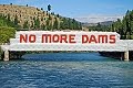
Construction of the cycle trail at Beaumont began at the SH8 Clutha River bridge, across the road from the Beaumont Millennium Track.
Mr Peirce said contractors began scraping off topsoil, laying base gravel and putting culverts in place.
"From the bridge to Weardale St we're utilising the road reserve, and then carrying on through the [Beaumont] township, with most of this trail section on private property."
The 73km trail, which will cost an estimated $5.5 million, was the first in Central Otago to receive funding under the New Zealand Cycle Trail project, getting $3.8 million from the Government. A 20km section is planned in the Clutha district, between Beaumont and Lawrence; the remaining 53km will be in Central Otago, from Lake Roxburgh to Beaumont.
The trail section near the Roxburgh Bridge is nearing completion.
Mr Peirce said the 8km section from Evans Flat to Lawrence followed the old railway line from Lawrence to Milton, and track construction was almost complete.
Fencing in this area was done by Lawrence-Tuapeka area residents as a fundraiser for the Tuapeka Aquatic Centre - a project which Mr Peirce said the trust was happy to support.
The Clutha District Council is running workshops designed to help facilitate ideas and identify opportunities for the community arising from the Clutha Gold Trail.
The first workshop was held in November last year, with the fourth due to be held in Lawrence on July 31.
Thursday, July 19, 2012
Another Section Of Clutha Gold Trail

Friday, June 22, 2012
Trust Hopes Trail Open By End Of Year
Trust hopes cycle trail completed by end of year
By Helena de Reus, on Friday 22 June 2012
Otago Daily Times
Work on the Clutha district leg of the Clutha Gold Trail will start next week, with the trust behind the cycle trail hopeful the whole trail will be completed by the end of the year.
Clutha Gold Charitable Trust chairman Rod Peirce said contractors would start work at Beaumont, finishing at Cockleshell Rd in the Evans Flat area near Lawrence.
SouthRoads won the contract for that section of the trail, with Waitahuna-based Homer Contracting due to work on the Evans Flat to Lawrence section later in the year.
Trail project manager Tim Dennis, of Southern Land CKL, said SouthRoads staff were due to begin construction of the trail next week on the 15km section from Beaumont to Evans Flat.
The 73km trail, which will cost an estimated $5.5 million, was the first in Central Otago to receive funding under the New Zealand Cycle Trail project, with $3.8 million from the Government.
A 20km section is planned in the Clutha district, between Beaumont and Lawrence, and the remaining 53km will be in Central Otago, from Lake Roxburgh to Beaumont.
The trail is being constructed in six sections.
Stage one from Roxburgh Dam to Roxburgh was "virtually concluded", but awaiting the construction of two bridges.
Mr Peirce said workers had reached Millers Flat, with work on the next stage between Millers Flat and the Millennium Track in the Beaumont Gorge due to begin in a few weeks.
"Progress is going quite well. We'd like to think it would be finished by the end of the year, or at least the beginning of next year. Either way, some of the trail should be open for the summer."
The trust had hoped to begin work on the trail last year, but was unable to do so as contractors were not available any earlier.
The Clutha District Council is running workshops designed to help facilitate ideas and identify opportunities for the community arising from the Clutha Gold Trail.
The first workshop was held in November last year, with the third held on Tuesday night.
Council development manager Jill Borland said the council wanted a forum to help create ideas and identify opportunities for the local community arising from the Clutha Gold Trail.
The public "Trail Opportunities Forum" aimed to identify those with an interest in the trail development and establish a mode of communication.
She hoped it would also identify community resources, skills and interests to maximise potential trail-related opportunities.
Two more workshops have been planned for July 31, and August 14.
Saturday, May 5, 2012
Bridges' Future Unaffected
Bridges' future unaffected
By Helena de Reus, on Friday 4 May 2012
Otago Daily Times
Contact Energy's recent announcement it is shelving plans for further development on the Clutha River will not affect the future of two Clutha bridges.
The 124-year-old bridge at Beaumont and the Clydevale Bridge, both one-lane bridges which span the Clutha River, are scheduled for replacement or upgrading.
Earlier this week, Contact Energy announced it had withdrawn plans for further hydro development on the Clutha River and it would review management and ownership of its land holdings near the river.
A search of property records by Clutha District Council staff showed Contact Energy held 37 properties in the Clutha district totalling 2989ha and with a capital value of $26.3 million (figures from 2008). It is unclear how much of this property was earmarked for use in potential dam projects at Beaumont and Tuapeka Mouth.
New Zealand Transport Agency acting Otago-Southland state highways manager Ian Duncan said Contact Energy's recent announcement it was shelving plans for the Clutha River would not make the replacement bridge at Beaumont a higher priority.
Mr Duncan said the agency was still looking at building a new bridge at Beaumont in the 2017-18 financial year. Investigation work was scheduled to begin by 2014.
The Beaumont Bridge is funded solely by the NZTA.
Clutha District Council district assets manager Jules Witt said the Clydevale Bridge already had "reasonably high priority" with the Otago Regional Transport Committee and he did not believe the bridge would have been affected even if Contact Energy's developments had gone ahead.
Last year the Clutha District Council decided to upgrade the Clydevale Bridge to class 1 load capacity. Strengthening the bridge to class 1 would cost about $974,000. The council's share was estimated to be $390,000. NZTA would foot the remainder of the bill. The decision whether to build a new bridge would be reconsidered in 20 years.
Mr Witt said the council had budgeted for the strengthening and repairs in the 2012-13 financial year.
Wednesday, May 2, 2012
Decision On Dams No Surprise
Decision on dams no surprise
By Lucy Ibbotson, on Wednesday 2 May 2012
Otago Daily Times
Contact Energy's decision to drop its hydro development plans for the Clutha River has come as no surprise to local government leaders in the district.
Clutha Mayor Bryan Cadogan had been "semi-aware" of Contact's intentions for some time.
He said the prospect of dams on the Clutha River had "polarised the community", and it was good to have some closure on a long period of uncertainty.
"I suppose if nothing else it gives certainty now for the future because for so long we've been saying 'Imagine if the dam happened' ... It's better to be dealing with the facts and move on with reality ... so onwards and upwards."
Mr Cadogan said there would never have been a "ready acceptance" of hydro development from the community if the project had proceeded.
"To have development in the district is something that we're always looking for, but it's got to be the right development and it's got to have community support."
The news Contact had cancelled its dam plans was not unexpected for Central Otago Mayor Tony Lepper, either.
"Only because I thought they were expensive power projects to go through with and obviously they've come to the same conclusion," he said.
"It's probably disappointing to miss out on the economic benefits, but I'm sure there's other economic benefits to come out of that river and we'll just have to make the most of those."
Mr Lepper said on a personal level, he was "rapt" there would be no dam proceeding at Luggate, where he regularly kayaked.
"I think that's one of the nicest stretches of river in New Zealand and I play on it all the time.
"I'm very pleased that it's going to be around for a bit longer."
Queenstown Lakes deputy mayor Lyal Cocks said the decision was "appropriate", based on information Contact had provided throughout the process and the division the dam proposals had caused within the district's communities.
"It's been an issue that we've been on the edge of for a while watching the progress ... I think it's an appropriate decision looking at the way the numbers stack up as they've [Contact] indicated to us."
He said there were other options for power generation that were more feasible
Thursday, April 12, 2012
Progress On Clutha Gold Trail
Considerable progress on Clutha Gold cycle trail
By Sarah Marquet, on Thursday 12 April 2012
Otago Daily Times
It's full steam ahead for the 73km Clutha Gold cycle trail between the Roxburgh dam and Lawrence. Construction is well under way on two sections at the Roxburgh end, and is about to start on another at the Lawrence end.
Trail trust chairman Rod Peirce said successful tenderer Homer Contracting was due to start on the Lawrence to Cockleshell Rd section, which would be relatively easy as it was on an old railway line.
"It's more like a tidy-up and spread some top gravel ...There are a couple of bridges to go in but they are under construction."
Earlier this year, construction began on other sections: 9km from the Roxburgh dam to Roxburgh, and a 23km section from Roxburgh to the mouth of the Beaumont Gorge at Minzion Burn. While Mr Peirce estimated between only 2km and 4km had been completed, he said the rest was not far away, some sections needing only a final top-dressing of gravel.
"It takes a while to do each section ... [We] need a heavy rain to be part of the process." Heavy rain would show weaknesses in the land, and any slips or potential slips could be fixed.
Two bridges are also to be installed in these sections: one at Butchers Creek in Roxburgh East and another over the Teviot River.
Mr Peirce described the trail section which passed Pinders Pond as a "trial" section where the contractor was fine-tuning construction methods. That section would be open to the public on Sunday from 2pm to 4pm to give people an idea of what the final product would be.
Although people are asked to leave their bikes at home because of the number of people expected, people would be able to walk 1km either way from the Pinders Pond campground and car park area.
Mr Peirce said trust members would be on hand to guide visitors and talk about the trail.
He said "a lot of people had been going to Pinders Pond to inspect the trail at weekends and the community was "beginning to take ownership" of the trail, and the trust was hearing "so many good comments" which had helped spark the plan for the open day.
However, Mr Peirce warned the trail was still a construction site and, as such, was effectively closed to the public, except for the open day. He warned contractors were still working on the trail during the week.
In its entirety, the trail will cross 11 private sections for which land-use easements have been obtained, Central Otago and Clutha District Council road verge, New Zealand Transport Agency road verge, Contact Energy, Land Information New Zealand and marginal strip land.
Mr Peirce said the completed trail between Roxburgh dam and Lawrence was scheduled to be opened early next year. It is part of the Nga Haerenga, New Zealand Cycle Trail network, will cost $5.5 million to build, $3.8 million of which will come from government.
It follows the true left of the Clutha River to Beaumont, then winds through rural valleys to Lawrence.
It is intended the trail will link up with the 34km Roxburgh Gorge cycle trail between the Roxburgh dam and Alexandra.
Construction at the Alexandra end of the gorge trail has slowed since the trail trust began renegotiations with Bruce and Leigh Johnston, landowners on the section, after the couple voiced safety concerns which effectively stalled construction around their land.
Trail trust chairman Stephen Jeffery said the delay brought a silver lining: it meant the contractor building the trail could begin work near the Roxburgh dam, speeding up progress at that end.
However, the Alexandra delay had pushed the trail timeframe back "a bit" and instead of the 10km Roxburgh Gorge section being completed by June as scheduled, it would now be "well into spring" before it was finished.
Work began on that section in November.
Mr Jeffery estimated a little more than 4km of the trail had been completed so far. The middle section was still a "work in progress".
Friday, November 18, 2011
CDC Hosting Trail Forum
CDC hosting trail forum
By Helena de Reus, on Friday 18 November 2011
Otago Daily Times
With construction of the Clutha Gold Trail between Lake Roxburgh village and Lawrence expected to begin this month, a forum has been organised to promote ideas around the trail and how it will benefit communities.
The forum, hosted by the Clutha District Council, will be held in Lawrence on Tuesday to help generate ideas and identify opportunities for the local community arising from the Clutha Gold Trail.
All consents are in place for the 73km cycle trail, which will follow the Clutha River from Roxburgh to Lawrence.
Clutha Gold trustee Graham Dillon said construction would begin at the Roxburgh end in the next few weeks.
CDC development manager Jill Borland said, with construction on the trail due to start soon, the council wanted a forum to help create ideas and identify opportunities for the local community arising from the Clutha Gold Trail.
The public "Trail Opportunities Forum" aimed to identify those with an interest in the trail development and establish a mode of communication. She hoped it would also identify community resources, skills and interests to maximise "potential trail-related opportunities".
The council's role in the forum would be to facilitate discussions among local community members, Ms Borland said.
"We want to work with the Central Otago District Council and the community to promote the trail as a whole and to identify skills in both districts."
The Lawrence-Tuapeka Community Board briefly discussed the forum on Wednesday, and encouraged members to attend.
A tourism workshop hosted by Central Otago District Council will be held in Millers Flat on November 28.
The workshop is aimed at present and future tourism operators across the Teviot Valley and into Lawrence, and will include information on characteristics of the cycling market, lessons learned from the Otago Central Rail Trail, collective marketing and opportunities created by the Clutha Gold Trail.
Friday, August 12, 2011
Further Step Towards Clutha Gold Trail
Further step taken towards Clutha Gold track
By Helena de Reus, on Friday 12 August 2011
Otago Daily Times
The Clutha District Council yesterday at its meeting appointed a commissioner to examine consent applications for the proposed Clutha Gold walking and cycling track between the Roxburgh dam and Lawrence.
The Clutha Gold Trail Charitable Trust last month applied to the Clutha District Council for a land use consent for the 20km section between Beaumont and Lawrence for which the council has jurisdiction.
Planning and environment manager Murray Brass said the council had asked Dunedin City councillor Colin Weatherall to be an independent commissioner, because the trust had asked for a non-notified consent. The council supported the proposal, so an independent commissioner was needed to decide whether to grant the consent.
However, Mr Weatherall would have to confirm a non-notified consent upon his return from the United Kingdom in a few weeks.
"It'll be nice to see everything under way, but this is only another step. There are plenty more to go," trust chairman Rod Peirce said The trust hoped to work on the trail in sections, joining them together later, he said.
The section of trail would begin at the Millenium Track, at the southern end of the Beaumont Bridge and take riders and walkers to Lawrence township.
Construction of the trail was expected to begin in the next two months, after the resolution of an appeal from the Society for the Promotion of an Alternative Route about some aspects of the trail.
In March, independent commissioner Denis Nugent, of Wanaka, granted land use consent to the trust for structures associated with the construction, operation and maintenance of a walking and cycling track.
The consent was subject to 48 conditions and applied only to the section within the Central Otago district, from the dam to Beaumont, where the trail would follow the true left bank (east) of the Clutha River.
The appeal has resulted in extra conditions being imposed about surveying in front of some properties, but the society had been unsuccessful in trying to get part of the trail realigned, the society's lawyer, Annabel Ritchie, said.
Mr Peirce said the trust was pleased by the decision because it had "only had one option - along the river", for the trail.


