
Earthquake
By Russell Garbutt, Dunedin
Saturday, 4 September, 2010
(Article written in February, 2010)
In light of the disaster in Canterbury, Russell Garbutt of Dunedin, writes:
At the beginning of the year I wrote a piece for publication and sent it to the Listener, North and South and New Zealand Geographic.
The subject was earthquakes and what was likely to happen in the event of a major movement on the Alpine Fault. As it happens, I was talking to a member of the Geology Department on Friday and he had just returned from Christchurch and the Coast working on exactly that – he said on Wednesday that a major movement was due “now”.
****
The recent earthquakes in Haiti, Samoa and Chile, and the continuing relatively small earthquakes in and around New Zealand should remind us all of our own vulnerability when it comes to the “big one”. Perhaps more importantly, these events should determine what actions we collectively should be taking to minimise the after-effects of the inevitable major damage that will be caused when it arrives. It certainly should cause us to examine what those public bodies that are responsible for dealing with the after effects of “the big one” have planned, and what influences that man-made structures on our waterways have had in modifying the natural ebb and flow of the effects of erosion and aggradation of our high country.
Some facts that we should all be aware of.
• The New Zealand Alpine Fault is one of the world’s most prominent and active fault lines
• The East Coast of the South Island is part of one of the earth’s tectonic plates
• The West Coast of the South Island is part of another plate
• The Southern Alps have grown 20,000 metres over the last 25 million years, but have eroded most of this growth away
• Much of the erosion of the high country ends up on the beaches of our coasts
• The Alpine Fault is due to move in a major way
• All of the above will impact upon us, or our children, and how will we continue to live in the “shaky isles”.
The New Zealand Alpine Fault is part of the “Ring of Fire” surrounding the Pacific Ocean. This “Ring of Fire” is the perimeter of the huge Pacific tectonic plate that extends from New Zealand across the eastern Pacific to the western coast of the USA, Alaska, across to the eastern Japanese coast, down through Indonesia and then back to New Zealand via some of the Pacific Islands. There are 15 major plates that cover the surface of the earth and they float on the earth’s mantle, much like the skin on a pot of simmering jam. The plates are in fairly constant movement and this movement leads to tectonic activity where plates collide or move in respect to each other. The activity can be volcanic, seismic, or both. Countries that are in the middle of these plates, such as Australia, are largely isolated from earthquakes or volcanic activity. The number of earthquakes that New Zealand experience in a year as a result of being on the junction of two major plates may come as some surprise, but the norm is about 15,000 with about 250 of them large enough to be felt. They are all recorded by GeoNet and can be viewed on their website – usually within an hour of the event.
The East Coast of the South Island sits on the Pacific tectonic plate and is dominated by large rivers that drain the inner Alpine regions and associated large alluvial plains. Nowhere else on earth are so many large braided rivers. These rivers transport vast quantities of rock, gravel, sand and clay to the East Coast and after heavy storms in the high country the amount of debris that is transported by each river is vast. Rocks get tumbled down the river, are reduced to stones then to gravel and finally to sand or clay and are transported out to sea with some of the debris coming back to land to form beaches and sand dunes. The other huge contributor to this debris is land-slips and erosion. But for the most part, the eastern side of the Alps has a much lower rainfall than the west and this fact can lead to some serious consequences after a major seismic event.
The West Coast of the South Island, which sits on the Australian Plate, has two distinctive features that separate it from the East. The first is the huge difference in rainfall. On the Coast, annual rainfall is measured in metres of rainfall per year, and when you consider that a metre of rain over a hectare weighs some 10,000 tonnes, some idea of how much rain falls in a year can be imagined. Parts of the Coast receive over 10 metres of rain per year equating to 100,000 tonnes of water per hectare, while the average towards the Tasman may be a third of this figure. This prodigious rainfall has rivers flowing regularly at high rates. There is little opportunity for rocks or sand to hang around for any long periods of time. The other distinctive feature is that the landscape is largely bush covered and there is little distance between the mountains and the Tasman Sea. Rivers are consequently steep and there is much less braiding in the shorter distance between mountains and the Tasman Sea.
The Southern Alps seem a fairly constant part of our landscape, but in reality, they are prodigious growers. As the Pacific Plate collides with its neighbouring Australian Plate the boundary between the two plates is thickened, crumpled and forced upwards. The amount of uplift is huge, and was perhaps best described by Abel Tasman’s description of the South Island as “a great land uplifted high”. Over the last 25 million years the Southern Alps have been pushed up well over 60,000 feet or 20,000 metres. Unless erosion at a similar rate to the amount of uplift had been occurring over this period, New Zealand would have also been home to the world’s highest mountains. Over this period of time all of this uplifted material has, for the most part, been carried down to the sea by the waterways on either coast. What must be appreciated is that while erosion is sometimes a gradual and constant process, the main erosion occurs in spurts of intense activity. This is where the New Zealand Alpine Fault comes in.
The New Zealand Alpine fault which stretches 650km from Fiordland to North Westland, is known to have been the host of five events of about Force 8 magnitude where the effects have either been observed or can be measured geologically. The dates that can be provided for past events are circa 1350, 1475, 1615, 1725 and 1826. Using these dates, published in the recent “Hostile Shores” by Dr Bruce McFadgen, the interval between major movements coming forward in time, has been 125 years, 140 years, 110 years, and 101 years. The average gap between major movements over these 660 years has been 119 years. Using this average, another major Alpine Fault movement could have been anticipated in 1945. In other words, we are overdue by some 65 years, although if the longest gap of 140 years is used, we are overdue by only 44 years. Other scientists may put these average gaps slightly higher, but the broad acceptance is that major movements on the Alpine Fault are both regular and of high magnitude. The message should be that while major movements cannot be accurately predicted, history shows that they occur moderately regularly and the current gap of 184 years is larger than any other gap in our recorded past. All present research shows that the tension along the Alpine Fault is reaching a point where the rocks along a very significant part of the fault will suddenly fracture and a major seismic event will occur. It is not a case of “if”, it is a case of “when”.
When the Alpine Fault moves it not only causes the above-mentioned crumpling and uplifting at the boundary, but the West Coast also slides northeast relative to the East Coast. The amount of this movement is also prodigious. It wasn’t until 1952, when Harold Wellman’s map showed for the first time that there was a match between rocks in Marlborough on the western side of the fault, and rocks in Otago on the eastern side of the fault, that proved that the land either side of the fault had shifted almost 500km over 25 million years – a movement about the same rate as your finger nails grow. But as has been pointed out, the movement is not continual or gradual – little or nothing happens for many years, and then there is a big and sudden movement.
So, how big a movement could be expected?
It is generally agreed between geologists from all round New Zealand that a Force 8 event would result in an 8 metre horizontal displacement and a 4 metre vertical displacement along the fault. Previous major events of this magnitude have resulted in movements of this degree. To put this into perspective, the 1968 Inangahua earthquake was a magnitude 7, but a magnitude 8 quake will release 30 times more energy. The immediate effects of this type of movement will be catastrophic the closer to the fracture area of the fault. Structures such as bridges, communications and roads and railways will be severely affected many hundreds of kilometres distant from the fault. It is likely that despite strong earthquake codes, that there will be significant loss of life if buildings collapse during the violent shaking. But the biggest effect will be landslips and other earth movements such as liquefaction. Countless millions of cubic metres of mountain sides will fall into valleys and waterways. On the West Coast, this debris will be rapidly swept to the sea by means of the huge rainfall. On the eastern side of the Alps it is possible or likely that the displaced debris will be stored in the high country until there is sufficient rainfall to start to carry it down the braided rivers to the Pacific Ocean. A magnitude 7 earthquake in Peru in 1970 killed about 80,000 people when a major landslip occurred that sent millions of cubic metres of rock, ice, water rushing at over 100mph down over towns on the side of the collapsed mountain, but the many millions of cubic metres of landslip debris didn’t get washed to the Coast until the El Nino storms of 1972. Within a further two years this debris was evident along the adjacent coastlines as newly formed sand dunes.
Liquefaction occurs in areas where the underlying land can be likened to a freshly lain pile of wet concrete. Wet concrete will stay as it is until it is shaken and then it will settle quickly with water rising to the surface and heavy objects settling into the now liquid goop. Many of the alluvial plains of the east coast such as the Canterbury Plains will, when violently shaken with a strong earthquake, undergo such liquefaction. The effects of shaking are amplified through such underlying geology and buildings and underground utilities such as sewers and water piping can either rapidly sink underground or, in some circumstances be forced out of the ground.
With all this background, it is worthwhile to examine what effects we have made on our landscape that has modified this natural sequence of events. There are four factors that immediately spring to mind.
• Firstly, the immediate area around the Alpine Fault continues to be sparsely populated,
• Some pockets of areas close to the Alpine Fault are densely populated,
• We have a major city on an area which will be subject to liquefaction,
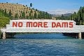
• We have put artificial barriers across waterways which have already affected our natural landscape along our coastline.
Unlike areas such as Peru or Haiti, New Zealand does not have major cities or towns on the Alpine Fault. Much of Fiordland and Westland is relatively sparsely populated, but the effects of a Magnitude 8 earthquake along the fault will not be confined to the valleys and peaks of the high country. Such an earthquake will be felt over the entire South Island and will cause damage over many areas a long way from the long epicentre. It is anticipated that structural damage would occur as far away as Dunedin. It is also true that while the Alpine Fault ends in the north of the South Island, Wellington sits across the Wellington Fault which is a major splinter fault of the Alpine Fault. It would be hard to believe that Wellington would be insulated from a magnitude 8 event on the Alpine Fault and in reality, it should be expected that considerable damage would also result in our capital city.
Some areas such as Queenstown, Te Anau, and Wanaka on the eastern side of the fault, and the towns of the West Coast on the western side of the fault would be severely shaken. Structures on hillsides could fail, and there seems to be no doubt that infrastructure such as bridges, roads and railways would be severely damaged or destroyed. Cellphone towers and power to them would be compromised or destroyed and power and telephone lines would be bought down over very wide areas.
Christchurch lies on an alluvial plain which could undergo amplification of the effects of a major earthquake with liquefaction affecting many major structures.
Rivers in the South Island act as huge flushing agents for the debris created by such events as a major earthquake on the Alpine Fault and largely have been left unhindered by man. But there are some notable exceptions. The biggest of these would be the Clutha River which is fed by two major river systems. Lake Wanaka is drained by the Clutha and is joined at Cromwell by the Kawarau which drains both Lake Wakatipu and the waters of the Shotover River. It is this latter river which is responsible for much of the debris that comes from the Otago hinterland.
The Shotover has its headwaters deep within the area most likely to be severely affected by landslips. This river or its many contributories would be filled with debris from countless landslips and the immediate effect of this will be the damming of sections of the river, new watercourses being formed, and a large amount of debris entering the waterway. The Kawarau will transport this debris down to the confluence with the Clutha, and as soon as the waterflow speed reduces at the start of Lake Dunstan, the debris will start to fall out of suspension in the water and will start to fill the lake. This will happen because of the hydro-electric dam at Clyde.
But this is not the only dam on the Clutha.
Before the Clyde dam was constructed, the dam at Roxburgh acted in a similar way and over the 37 years between the completion of the Roxburgh dam and the Clyde dam was completed, sand and gravel that would have normally been carried down to the East Coast was trapped behind the Roxburgh dam – mainly where the water speed dropped to a point where it could no longer support the sediment. Residents of Alexandra will no doubt be aware of the creation of such sand bars near the confluence of the Manuherika just below Alexandra. It is also interesting to note where these vast quantities of sand from perhaps a series of landslips far up Skippers Creek would have ended up prior to the construction of the dams on the Clutha.
The geological records from previous major aggradation caused by previous Alpine Fault movements show that a lot of the sand ended up on the beaches of Coastal Otago north of the mouth of the Clutha. A short time after each big earthquake in the past, the debris was carried down the Shotover and Kawarau rivers into the Clutha and what did not get washed out to sea was carried north along the coast line by the coastal current and washed up on the beaches. The lovely white sands of St Clair and the beaches north round into Blueskin Bay have, for their most part, their origins in the quartz of the rocks of Central Otago.
This natural draining of the hinterland, and the consequent replenishment of the coastal sands was effectively bought to a halt when the Roxburgh dam was built in 1956, and it should not be a surprise that the beaches of Coastal Otago have since that time undergone some change with much concern being expressed about possible sea incursions near Middle Beach. But this change is minimal compared to what will happen when the major event on the Alpine Fault occurs in the future. The relatively small amounts of debris now coming down behind Lake Dunstan will be dwarfed by what will flow into the lake after that event. Already the lake has shallowed dramatically where the Kawarau enters the lake and it can only be imagined what the lake will look like when countless cubic metres of gravel, sand and clay comes down the river in the first storm after the big event.
It is not at all clear just who has the responsibility for dealing with the consequences of the next major Alpine Fault event. Government will be responsible for many remedial works through national agencies, but it will also be up to local and regional Councils to deal with local emergencies and remedial works. What interests me is who will be responsible for ensuring that the mighty waterways of our region are able to handle transporting the vast quantities of sand to the sea. Initial indications are that it seems that it will be up to the dam operators who have this responsibility but it is hard to see how they are equipped to do so, or what plans they, or the Regional Council have, to dispose of these millions of cubic metres of gravel, sand and clay.
One thing is for sure – collectively we should be aware of the inevitability of the next Alpine Fault movement and what we need to do to be prepared for it.
Saturday, September 4, 2010
EARTHQUAKE
Subscribe to:
Post Comments (Atom)


0 comments:
Post a Comment