
River Park sale agreed
Saturday 11 April 2015
Otago Daily Times
Contact Energy and the Red Bridge River Park Trust have
agreed on sale conditions for a parcel of Luggate land sought
by the charitable trust to develop a community river park.
The resolution follows more than a year of discussions
between long-term tenant of the land and trustee Lewis
Verduyn-Cassels and Contact over the proposed sale of the
0.4ha property.
Mr Verduyn-Cassels said the trust was grateful for the
support of the Wanaka Community Board and the many donors who
had made the project possible.
As the original proposal for the river park included
neighbouring land that was sold to other individuals, the
trust would look at revising the project plan to reflect the
changed ownership.
As part of the agreed sale process, the trust will pay a
portion of the market sale price of the land up front and
further settlement is due within the next five years.
Contact is also finalising arrangements to gift a separate
1.9ha block of land next to the Luggate Bridge to the local
community, most probably through the Queenstown Lakes
District Council.
Contact has been progressively selling parcels of land it
owns in the Clutha region in recent years, following an
announcement in 2012 that it was no longer going ahead with a
proposed hydro generation development in the area.
Saturday, April 11, 2015
River Park Sale Agreed
Thursday, April 9, 2015
Contact And Trust Reach Agreement
Contact and River Park Trust pleased to reach agreement
Thursday 9 April 2015
www.scoop.co.nz
Contact and
trustees for The Red Bridge River Park Trust this week have
agreed sale conditions for a parcel of Luggate land sought
by the charitable Trust to develop a community river park
involving native fauna and flora restoration and freshwater
ecology. The positive resolution follows over a year of
discussions between long term tenant of the land and trustee
Lewis Verduyn-Cassels and Contact over the proposed sale of
the 0.4 ha property.
“We’re very pleased to reach an
agreement that enables both parties to move forward
positively, with the Trust able to now explore its plans to
develop the community river park,” says Contact’s
Generation & Development Project Manager, Neil Gillespie.
“We are grateful to the many people behind the scenes
who have contributed their support to this agreement. The
Wanaka Community Board, and numerous donors, have all made
this project possible,” said River Park Trustee, Lewis
Verduyn-Cassels.”
“As the original proposal for the
river park included adjacent land that was sold to other
individuals, the Trustees will be looking at revising the
project plan to reflect the changed ownership. We literally
have decades of work ahead of us as we progressively restore
and enhance the Red Bridge area.”
As part of the agreed
sale process the Trust will pay a portion of the market sale
price of the land up front, with further settlement due
within the next five years. Separate to the sale to the
Trust, Contact is in the process of finalising arrangements
to gift a 1.9 ha block of land adjacent to the Luggate
Bridge to the local community, most likely through the
Queenstown Lakes District Council.
Contact has been
progressively selling parcels of land it owns in the Clutha
region in recent years, following an announcement in 2012
that it was no longer progressing a proposed Hydo generation
development in the
area.
About Red
Bridge River Park Trust
The purpose of the Red
Bridge River Park Trust is to create and manage a river park
and native recovery centre on riverside land at the Luggate
Red Bridge, on the Clutha Mata-Au River, for the benefit of
the community in perpetuity.
www.redbridgeriverpark.blogspot.co.nz
Friday, January 30, 2015
'Good progress' in talks on riverside land
'Good progress' in talks on riverside land
By Lucy Ibbotson, on Friday 30 January 2015
Otago Daily Times
An agreement over the future of a piece of riverside land
near Luggate wanted for a conservation park is still several
weeks away.
Negotiations have been ongoing for almost a year between
Contact Energy, the owners of a 0.4ha site next to the Clutha
River at the Luggate Red Bridge, and Lewis Verduyn-Cassels,
who established the Red Bridge River Park Trust to help
realise his vision for a community conservation area on the
land.
The trust was given several extended deadlines to raise
$300,000 to buy the land, before entering into private
discussions with Contact towards the end of last year.
Contact's trading, development and geothermal resources
project manager, Neil Gillespie, said this week the power
company was ''still talking'' with Mr Verduyn-Cassels.
''We're making good progress.
''In the next three to four weeks we should be closer to
knowing where we're at.''
Wednesday, April 13, 2011
Hunt On For More Dams On Clutha
Hunt on for more dams on Clutha
By Che Baker, on Wednesday 13 April 2011
The Southland Times
Contact Energy has started geotechnical investigations for an 86-megawatt hydro dam on the Clutha River at Luggate, a project that has been slammed by environmental groups.
Project manager Neil Gillespie said Contact Energy was investigating a possible site at "The Nook", 2km downstream from the Luggate bridge where the Luggate Creek meets the Clutha River.

Digging work had been completed and, after Easter, a drilling rig was expected to be on site to drill bore holes and take geological samples of the area.
Geologists would prepare a report on the site, where a low height, 25m-tall dam was proposed, that would be presented to Contact.
If built, the dam would create a 350-hectare lake that would extend 15km up the Clutha Valley to near Albert Town.
It was estimated the power station, likely to be remotely controlled from Contact Energy's Clyde control centre, would have a capacity of 86MW and capable of generating about 500 GWh of electricity a year. It was expected to take four years to build.
Luggate was one of four possible options Contact was considering for hydro development on the Clutha River.
Geological data had been collected in "much greater detail" at the three other sites at Queensberry, Beaumont and Tuapeka Mouth but "no decision had yet to be made on a preferred development option", Mr Gillespie said.
The data gathered would give Contact a greater insight and understanding on the design and construction requirements at the site and would contribute to the overall assessment of future hydro options along the river, he said.
It was a "complex task" to build a dam and many factors including economic, community and environment costs would need to be considered in each scheme before a decision could be made, he said.
"We want to gain a comparable level of information for all four possible future options.".
The geological report was due to be completed next month.
Contact Energy started meeting Central Otago leaders in 2008 to gauge support for hydro plans after it announced it was looking at several "historic options" on the upper and lower Clutha at Queensberry and Luggate, and Tuapeka and Beaumont.
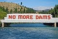
Yesterday, Lewis Verduyn, chairman of the Clutha River Forum, an alliance of environmental groups opposed to further dams on the river, said the proposal was "too destructive, too backward thinking, and too problematic".
The dam would be sited on top of "the most noticed feature" of the Upper Clutha, the Devil's Nook switchback, which was one of the rarest river features in the world.
Mr Verduyn said New Zealand had no place for more large dams as they could not provide a sustainable, reliable and expandable energy solution and other options, such as Cook Strait marine power, needed to be looked into.
FOUR HYDRO OPTIONS
Hydro options investigated by Contact Energy along the Clutha River:
Luggate
Type: Dam
Construction: Four years
Capacity: 86MW (megawatts)
Annual output: 500GWh (gigawatt hours)
Dam height above ground: 25m
Dam length at crest: 820m
Reservoir lake area: 350ha Number of turbines: 3
Queensberry
Type: Dam and canal
Construction: Four to five years
Capacity: 160MW
Annual output: 850GWh
Dam height above ground: 14m
Dam length at crest: 880m
Reservoir lake area: 240ha
Number of turbines: 2 + 1
Beaumont
Type: Dam
Construction: Four to five years
Capacity: 185MW
Annual output: 1070GWh
Dam height above ground: 30m
Dam length at crest: 350m
Reservoir lake area: 1100ha
Number of turbines: 4
Tuapeka Mouth
Type: Dam
Construction: Five years
Capacity: 350MW
Annual output: 1950GWh
Dam height above ground: 50m
Dam length at crest: 520m
Reservoir lake area: 3200ha
Number of turbines: 4
Drilling At Luggate Site
Drilling at Luggate site
By Matthew Haggart, on Wednesday 13 April 2011
Otago Daily Times
Contact Energy is undertaking a drilling project near Luggate to investigate whether geological conditions are suitable for the construction of a hydro-electric dam on the Clutha River.

threatened by Luggate dam
Contact Clutha hydro project manager Neil Gillespie, of Cromwell, said the geotechnical investigation and drilling programme did not indicate Luggate was the preferred option.
"The purpose is to gain more information on the geological conditions there. Currently, we have much greater detail on ... conditions at the other three possible sites [Queensberry, Beaumont and Tuapeka Mouth] than we do at Luggate and we want to gain a comparable level of information for all four possible future options," he said.
In 2009, Contact dusted off decades-old plans for Clutha River hydro-electric schemes, deciding to revisit options for the four potential dams.
The company has spent the past two years investigating the options at the four potential sites and consulting communities, amid opposition from Clutha River protectionist groups.
Mr Gillespie said a drilling rig was scheduled to begin exploratory testing to a depth of up to 30m at a site about 2km below the Luggate Red Bridge.
Upper Clutha River Guardians president Tim Ryan, of Wanaka, questioned the need for further investigation at Luggate when Contact had resource consent to install hydro-electric turbine generators at Lake Hawea.
"It is of major concern to us. Why aren't we seeing anything being built at [Lake] Hawea? Why do they have to go and investigate an area where a dam would destroy the whole valley back to Albert Town?" he said.
Mr Gillespie said there was still no expected time-frame for work to begin on installing turbine generators at Contact's Lake Hawea storage gates that would be capable of providing 17MW of electricity.
"Detailed" design plans were "yet to be completed", which would provide an outline for when construction might start.
However, Mr Gillespie did not know when those design plans for the consented turbine generators might be completed.
Clutha Matau-Au River Parkway Group chairman Lewis Verduyn, of Wanaka, said the Luggate dam proposal, "like all of Contact's old plans for large dams on the Clutha, is too destructive, too backward-thinking and too problematic".
Drilling was being carried out at the site to see if there was suitable bedrock capable of supporting large-scale foundations.
"They are doing their homework to further investigate costs associated with building dams. If there is no bedrock there, they may not be able to proceed because it could prove too costly," he said.
He also questioned the need for a dam, which, at nearly 1km wide, would have a profile across the Upper Clutha Valley "larger than the Clyde dam" and yet would generate only 86MW.
Mr Gillespie had consulted the River Parkway Group about its "geotechnical investigations" but "nothing I have learned about [their options] has made me feel better about the project", Mr Verduyn said.
Contact has already carried out preliminary digging at the drilling site, which is near where the Luggate Creek enters the Clutha River at the popular scenic area known as the Devil's Nook.
Mr Gillespie said pits about 4m deep had been excavated to check ground conditions before the holes were refilled.
The drilling-rig crew was expected to begin work after Easter, putting down six drill holes to depths of 10m-30m, during a projected three-week operation.
An ensuing geotechnical report about the potential site would be considered and would enable a clearer picture of possible costs of building a dam, he said.
The four sites:
Luggate: 25m-high embankment dam, located about 2km downstream of Luggate Red Bridge, creating 350ha lake extending 15km to near Albert Town.
Queensberry: 14m-high embankment dam to feed into either a 12km or 9.5km-long canal to down-river powerhouse, creating 240ha lake extending 9km up river to near Luggate.
Beaumont: 30m-high concrete gravity dam located about 2km from Beaumont township, creating 1100ha lake extending 29km upstream from dam.
Tuapeka Mouth: 50m-high concrete dam located about 2km upstream from Tuapeka Mouth, creating 3200ha lake extending 55km upstream to Millers Flat and flooding Beaumont township.
Monday, November 1, 2010
Wanaka Tracks
Wanaka Offers New Walking Tracks For Summer
Monday 1st November 2010
http://www.voxy.co.nz/
Lake Wanaka's position as one of New Zealand's most popular walking and hiking destinations has been further enhanced with the construction of a number of new tracks. Designed to highlight the region's spectacular scenery to walkers of all ages and abilities, the tracks offer a mix of scenic day and overnight excursions.
The recent completion of three river and lakeside tracks; the Glendhu Bay Track, Hawea River Track and Clutha River Track serve to link the outlying communities of Lake Hawea and Luggate offering stunning scenery and a variety of walks for locals and visitors with all levels of fitness.
Lake Wanaka now boasts over 750kms of recreational tracks and routes from gentle lakeside strolls to high alpine treks. Sections of the new network are incorporated in Te Araroa, a national walking and tramping trail from Cape Reinga in the north to Bluff in the south.
"Lake Wanaka is a walkers' paradise offering some of the most unforgettable hiking in New Zealand, with breath taking scenery and great variety, from short local walks along the rivers to multi-day guided adventures in Mt Aspiring National Park," said Lake Wanaka Tourism general manager James Helmore.
A keen walker in Wanaka can do a number of day walks from the town centre such as the gentle Outlet Track which winds along the Clutha River, the Mt Iron Walk with 360 degree views of the Clutha basin or the Waterfall Creek Track along the lake's western shores. The walks are all spectacular in autumn with the brilliant reds and golds of the poplar trees.
More adventurous hikers are well catered for with a number of good day and overnight walks in the Mount Aspiring National Park. A scenic drive up the peaceful Matukituki Valley or to Makarora at the head of Lake Wanaka provides access to the start points for many hikes. From Makarora the Wilkin-Young three day (58km) circuit travels through stunning valleys before heading over the 1490-metre Gillespie Pass with impressive views.
Last summer the Motatapu Track was opened, a challenging 34-kilometre, three- to four-day alpine tramp for experienced parties. It follows much of an historic route that linked Wanaka and Arrowtown areas during the gold mining era.
The Lake Wanaka region has a proactive community of hikers and community organizations, such as the Upper Clutha Tracks Trust and the Clutha Mata-Au River Parkway Group who work alongside the Department of Conservation and Queenstown Lakes District Council to develop the trails in the region.
"The 45kms of new tracks are a real conservation gain for the region. The range of recreational opportunities including walkers, runners, mountain bikers, events and fishermen will all make good use of the tracks. I hope many will take the opportunity to get out and enjoy them," said Paul Hellebrekers, DOC Wanaka.
Funding of the tracks has also come from various community trusts such as the Central Lakes Trust, Otago Community Trust, NZTA, and the Wanaka Walkers Trust.
Monday, September 13, 2010
Tracks Trust Blazes Trail For Groups
Tracks trust blazes trail for groups
By Matthew Haggart, on Monday 13 September 2010
Otago Daily Times
A leader in opening up public access by building tracks, the Upper Clutha Tracks Trust is a finalist in the Inland Otago Conservation Awards. Matthew Haggart talks to trust chairman Tim Dennis about its mission to develop a network of trails and public access around the region. Initial steps taken by the founding members of the Upper Clutha Tracks Trust might well provide a pathway for groups charged with establishing trails around New Zealand.
While much has been made of the Government-led National Cycle Trail projects, the trust has effectively already established its own regional trail network .
The trust has built a trail network of more than 100km around Wanaka during the past three years and was recognised at the TrustPower Community Awards recently when it won the heritage and environment category.
Trust chairman Tim Dennis said being nominated for the conservancy award was fantastic.
In 2006, the fledgling trust produced the Upper Clutha walking and cycling strategy for the Queenstown Lakes District Council.
Spurred on by the passionate vision of founding chairman, the late John Pawson, the trustees had always been focused on "making it happen", Mr Dennis said.
"For us, it has always been about getting out there, getting on with things, and making things happen on the ground," he said.
Alongside Mr Pawson and Mr Dennis, the founding trustees include Helen Tait, Rachel Brown, Grant Fyfe and John Wellington.
Lake Hawea Station farmer Tom Rowley was co-opted by the trust shortly after Mr Pawson died in a climbing accident in 2008.
Mr Pawson's early leadership, vision and drive had provided the trust with the inspiration to forge on , Mr Dennis said.
The trust's first project - the Hawea River Track - was launched in November 2006 with the assistance of a $25,000 seeding fund from the QLDC.
Since the 11km track, which follows the Hawea River and links the townships of Lake Hawea and Albert Town, was completed in July 2009, the trust has quickly moved to establish more trails.
A 14km trail linking Glendhu Bay and following the shoreline of Lake Wanaka to Roys Bay in Wanaka was completed in December 2009, and less than a year later a new track from Albert Town was completed along the Clutha River.
The trust has two more projects in its immediate sights - a track along the southern shoreline of Lake Hawea connecting the township to Johns Creek, plus an extension of the Clutha River Trail, which will connect the existing trail to Luggate.
"Each track has its own personality and attraction because of their different characteristics," Mr Dennis said. The achievements of the trust were a credit to the team involved.
Input and assistance was given by private landowners, the QLDC and the Department of Conservation, he said.
A long-term project for the trust was to establish a trail along the Clutha River, which will connect Wanaka to Clyde - a potential link in the National Cycle Trail which will connect with the existing Central Otago Rail Trail and with a planned Clutha Gold-Roxburgh Trail.
An initial approach to the New Zealand Cycle Trails project organisation for a trail between Wanaka and Clyde had been knocked back, but Mr Dennis remained hopeful it would, in time, be recognised as a valuable addition to a national tourism network.
Mr Pawson's galvanising influence on the trust remained, and it was his idea for the Wanaka-Clyde link, Mr Dennis said. (Webmaster note: John Pawson was a founding member of the Clutha Mata-Au River Parkway Group, and became a strong and valuable advocate for the river-length trail which was proposed before his membership as part of the river parkway and trail vision.)
"It was very clear that John was right in his vision. He would want us to go for it and stick to our guns."
• The winner of the Inland Otago Conservation Awards will be announced at a ceremony in Cromwell tomorrow night.
Wednesday, August 4, 2010
NZ Dam Safety Depends On 'Blind Faith'
NZ Dam Safety Depends On 'Blind Faith'
Clutha River Forum, Wednesday, 4 August 2010, 9:24 am
Scoop.co.nz
The Clutha River Forum, an alliance of environmental groups opposed to further dams on the Clutha River, is concerned that New Zealand’s long-awaited Dam Safety Scheme has been deferred.
The scheme was due to come into effect on 1 July 2010, but the Minister of Building and Construction, Maurice Williamson, says it will be delayed for two years following a report earlier this year which found that the scheme imposed rules and compliance costs on dam owners ‘out of proportion to the risks’ imposed on New Zealanders.
“Unlike most other developed countries, New Zealand does not have a ‘Dam Safety Authority’, says Lewis Verduyn, Forum Spokesperson, and Chairperson of the Clutha Mata-Au River Parkway Group. “Thousands of people live and work in the hazard paths of dams, and yet dam safety in New Zealand depends on the public having blind faith in dam owners.”
The report, which was released by the Department of Building and Housing, recommends a number of changes to the scheme, which would regulate the safety of an estimated 1150 dams. But the Clutha River Forum believes that some critical issues have not been addressed.
“The report doesn’t acknowledge that overtopping events are a leading cause of dam failures,” says Dr. Richard Kohler, Chairperson of the Central Otago Environmental Society. “When it comes to dam safety, reservoir-related risks such as landslide areas and active fault-lines are just as important as the dams themselves. Rainfall and earthquakes can trigger catastrophic landslides and overtopping waves, and sediment-filled reservoirs can cause devastating floods. Both Clutha dams have reservoir risk factors, however the report recommends that all reference to ‘earthquake-prone and flood-prone dams’ be removed from the Act.”
There are two large concrete dams on the Clutha River. The Roxburgh dam was commissioned in 1956, and has been blamed for serious floods in Alexandra because of reservoir sedimentation. It was re-consented in 2007 for a further 35 years. The Clyde dam was commissioned in 1992 after years of controversy arising from complex fault-line and landslide mitigation issues.
Mr. Verduyn says “Although the review acknowledges that dams degrade over time, there is no mention of criteria to establish when and how dams and reservoirs are decommissioned, when the risks they impose become unacceptable and cannot be fully mitigated. Large concrete dams have a design life of 80-100yrs, but reservoirs trap sediment from eroding catchments, usually reducing this lifespan. Dams older than 50 years with known issues, like the Roxburgh dam, should have decommissioning timetables. Forward planning is needed because the impacts and costs are substantial.”
According to a report by SPX Consultants, ‘Reversibility of Renewable Energy Developments’, released in 2008, decommissioning and river restoration costs for a large dam, as a proportion of construction costs, are between 35% and 150%.
Last year, Contact Energy, the owner of the Clutha dams, dusted off historic plans for four more large dams on the Clutha River.
“The Clutha River Forum,” says Lewis Verduyn, “is firmly opposed to further dams on the Clutha River. Large dams are a gamble and it’s time that we recognised the serious risks that they impose on communities. New Zealand needs a credible ‘Dam Safety Authority’ that can enforce safety baselines and hold dam owners accountable for the impacts of their dams.”
The Clutha River Forum is an alliance of:
Upper Clutha River Guardians, Clutha Mata-Au River Parkway Group, Central Otago Environmental Society (Save Central), Beaumont Residents Group, Lower Clutha River Guardians, Forest & Bird (Dunedin / Central – Lakes), and concerned individuals throughout Otago and New Zealand.
Tuesday, June 29, 2010
Riverrun Trail Series To Promote Tracks
Riverrun Trail Series to promote new tracks
Tuesday, 29 June 2010, 10:50 am
Press Release: eveNZ
A new trail running series designed to showcase the spectacular location of Lake Wanaka’s tracks and trails was today announced by the team behind the successful Challenge Wanaka triathlon.
The inaugural Riverrun Trail Series aims to encourage an active lifestyle and enjoy the recently developed tracks in the Lake Wanaka region: the Hawea River Track, the Upper Clutha River Track and the Damper Bay/Waterfall Creek Track. For all three races competitors will be treated to amazing scenery along a river or lakeside trail.
The Riverrun Trail Series provides people with the perfect opportunity to explore the new tracks in a fun and safe environment, with prizes for place getters and plenty of spot prizes to encourage wider participation. Runners can enter individual races or all three and compete for The John Pawson Trophy.
The Riverrun Trail Series begins 17 October with a 5km, 10km and half marathon option on the Hawea River Track. Race two on the 19 February 2011 is a 14.1km run from Albert Town to Luggate on the Clutha River Track with the final race on the 21 May from Glendhu Bay to Wanaka’s Roy’s Bay via the Damper Bay and Waterfall Creek Track, 14.3km.
Race director Victoria Murray-Orr is excited to be staging the series and is committed to encouraging new participation into running as well as further enhancing Lake Wanaka’s reputation as a sports destination.
“Creating a series encourages people to stay fit and healthy throughout the year and to set personal goals. We hope the events will appeal to serious runners as well as those looking for a social morning out with friends and family,’’ she said.
The event is delighted to have the support of Riverrun and the Pawson Adventure Fund as naming sponsor. Offering a high standard of accommodation and spectacular mountain views, Riverrun lodge is surrounded by 500 acres of farm land bordering the Clutha River and the trails incorporated in the series. The late John Pawson, co-owner of the property was passionate about the outdoors and instrumental in the development of the tracks with the Upper Clutha Trails Trust.
“I am very happy to be involved with this fantastic new event which makes such great use of the network of tracks opening up to us. John was always keen to get out and enjoy the amazing countryside Wanaka has to offer and I am looking forward to being on the start line in October!” said Riverrun owner Meg Taylor. “It is nice to have an easily accessible, post-winter race to aim for.”
Developing the tracks has been an ongoing project for many years with multiple organisations working together including the Upper Clutha Trails Trust, Queenstown Lakes District Council, Department of Conservation, Te Araroa Trust, Clutha Mata-Au River Parkway Group, adjoining landowners and with additional funding from Central Lakes Trust, Otago Community Trust, NZTA, and the Wanaka Walkers Trust.
The Riverrun Trail Series is created, promoted and staged by EveNZ Consultancy. For further information please visit www.trailseries.co.nz
Saturday, March 27, 2010
Enthusiasm For Clutha River Track
Enthusiastic response to Clutha River Track
By Marjorie Cook, on Saturday 27 March 2010
Otago Daily Times
A new section of the Clutha River Track will be officially opened at 10am today at Pawson's Crossing, Albert Town, but the track is already being used by large groups of cyclists and walkers.
The Upper Clutha Tracks Trust and Department of Conservation recently finished the 2.5km section linking Albert Town to Stevenson's Rd. There the track joins Reko's Point track to Shortcut Rd at Luggate.
Cyclists Roger and Sandra Cain, of Dunedin, were this week enjoying the track with friends for the first time and they all gave it a rave review.
The track was "excellent", "very well done" and "a great idea", they said.
The track's completion means people can now undertake an off-road cycle or walk of about 25km from Wanaka's lakefront to Luggate, following the lake shore and Clutha River all the way.
An off-road trip of similar distance is also possible from Lake Hawea to Luggate.
The new section of the Upper Clutha River Track was completed for $65,000.
It is the most challenging part of the track and traverses the Halliday Bluffs for 500m before rising on to natural terraces above the river.
Funding is being sought to continue the track to Luggate Creek.
Eventually, it will form part of the Clutha Mata-Au River Parkway from Lake Wanaka to Balclutha.
The Upper Clutha Tracks Trust will celebrate the opening informally at Pawson's Crossing - the new bridge across the Cardrona River just up from the confluence with the Clutha.
The public is invited to join in and then walk or bike along the track.
Among those attending today's opening is Alexander Reko Hesselin (known as Mick), who is a descendant of the Maori chief Reko, who in 1853 guided the first European, farmer Nathaniel Chalmers to Wanaka.
Third Leg Of Clutha River Track Ready
Third leg of Upper Clutha River track ready
By Cris Johntson, on Saturday 27 March 2010
Southland Times
A descendant of Maori chief Reko who in 1853 guided a farmer to what is believed to be the first European sighting of Wanaka will be the guest of honour at the opening of the Upper Clutha River track this morning.
The 13km track from Albert Town to Luggate's Shortcut Rd is the third in a series created by the Upper Clutha Tracks Trust and was constructed in conjunction with the Department of Conservation.
It completes the network of tracks from Glendhu Bay and Lake Hawea to the Clutha River and through the Rekos Point Conservation Area to Shortcut Rd.
DOC Wanaka area manager Paul Hellebrekers said the track had a rich history dating back to early Maori exploration followed by a period of goldmining and farming.
Chief Reko guided Clutha district farmer Nathaniel Chalmers over an inland route from Otago arriving at what is now the track site.
An area along the cycling and walking route "Rekos Point" had been named after the guide. A descendent, Alexandra (Mick) Reko Hesslin would attend the opening as a special guest, Mr Hellebrekers said.
Mike Allison of the Central Lakes Trust, one of the key funders of the project will perform opening ceremony duties.
"The opening of this track is made possible thanks to the patience and determination of members of the Upper Clutha Tracks Trust," Mr Hellebrekers said. "Their foresight in undertaking this project in conjunction with the department is a real conservation and recreational gain for the region. "I hope many people will take the opportunity to get out and enjoy it."
Today's opening ceremony will be held at 10am at Pawsons Crossing Bridge on the Cardrona River at Albert Town. Access is from Kinneberg St.
Thursday, December 3, 2009
Creation of River Trail Begins
Creation of river trail begins
By Matthew Haggart, on Thursday 3 Dec 2009
Otago Daily Times
The first steps towards creating a trail following the Clutha River from Lake Wanaka to the coast near Balclutha have started, with a new $65,000 joint construction project.
The Upper Clutha Tracks Trust (UCTT) and the Department of Conservation have awarded a contract, and construction is now under way on a section of track which joins Albert Town and Luggate.
Wanaka Doc area manager Paul Hellebrekers said the 2.5km long track above the true right bank of the Clutha River would probably be finished by February.
The "challenging" section of track involves a 500m climb over the Halliday Bluffs, from the confluence of the Clutha and Cardrona Rivers.
The track would rise to the natural terraces above the Clutha River and wind its way down towards Stevenson Rd, near the Wanaka airport, he said.
The joint walking and mountain-biking trail project demonstrated how successful initiatives could be when different groups worked together with the same objective in mind, Mr Hellebrekers said.
The new track is the most recent addition to a network of trails linking townships across the Upper Clutha district, an initiative first pushed for by the founding members of the UCTT.
The trail also heralds a further step towards the establishment of the Clutha Mata-Au River Parkway, which seeks to provide a public corridor from Lake Wanaka to Balclutha.
Public access to the new trail was provided for by landowners Meg Taylor and Lloyd Ferguson.
Monday, November 16, 2009
Contact Decision Unlikely Till Late 2010
Preferred hydro option unlikely until late 2010
By John Edens, on Monday Nov 16 2009
The Southland Times
A preferred hydro development option on the Clutha River would not be announced until the latter half of next year, Contact Energy said.
The energy firm is continuing to consult on its four proposals to build dams at Tuapeka Mouth, Beaumont, Queensberry and Luggate.
The energy firm announced a review of longstanding plans to dam the Clutha River in April.
The company believes adding to existing hydro schemes at Roxburgh and Clyde power stations would be in the country's best interests and help secure renewable supplies of electricity in the South Island.
But conservation and environmental protection groups oppose development as potentially damaging to landscape and environment.
Contact Energy spokesman Jonathan Hill said the firm would take as long as necessary to consult before making a decision.
"We are not going to be rushed. These proposals have been around for some time and I wouldn't be surprised if a decision ... was the latter half of 2010."
Clutha Mata-Au River Parkway Group chairman Lewis Verduyn said there had been some informal discussions about the dam proposals.
The group has advocated for the protection of the "mighty Clutha" and has plans to link tracks and trails from Wanaka to the east coast.
He said there had been no discussion with residents of Beaumont, and people would have to "wait and see."
Wednesday, July 29, 2009
US Watchdog Kept In Loop On Dams
US watchdog kept in loop on dams
By JOHN EDENS in Alexandra, Wednesday 29 July, 2009
The Southland Times
Central Otago conservationists continue to liaise with a United States environmental watchdog about Contact Energy's plans to review four proposals for dams along the Clutha River.
The Clutha Mata-Au River Parkway group, a conservation project opposed to development along the river, has proposed a meeting to discuss the dam proposals. International Rivers, an independent California-based environmental protection group, described Contact Energy's proposals for dams at Tuapeka Mouth, Beaumont, Queensberry or Luggate as potentially "river-wrecking".
At a Vincent Community Board meeting this month Clutha Mata-Au River Parkway secretary Barrie Wills said a meeting was being considered "to gauge opinion for or against" the dam proposals.
Mr Wills said a date or venue for the meeting had not been set but the group continued to liaise with the US organisation.
He said he did not know if International Rivers would send a representative to New Zealand.
Contact Energy's hydro project manager Neil Gillespie said there had been no correspondence with International Rivers or the Clutha group.
Tuesday, July 7, 2009
Global Watchdog Opposes Clutha Dams
Global Watchdog Opposes Clutha Dams
Unabridged statement as released
By Aviva Imhof, Campaigns Director, International Rivers Network,
and Lewis Verduyn, Chairman, Clutha Mata-Au River Parkway Group.
Tuesday, July 7, 2009
International Rivers' mission is to protect rivers and defend the rights of communities that depend on them. We oppose destructive dams and the development model they advance, and encourage better ways of meeting people’s needs for water, energy and protection from damaging floods. To achieve this mission, we collaborate with a global network of local communities, social movements, non-governmental organizations and other partners.
The large dams proposed by Contact Energy for New Zealand’s Clutha River are unacceptable and unnecessary development options.
World-wide, large hydro dams have devastated river ecosystems and the livelihoods of communities that depend on them. Dam projects are often more harmful than alternative forms of renewable generation, especially when placed across the main artery of a river. Having existing dams on a river, is not in itself justification for further dams, as problems are typically magnified as more large dams are added to a river system, resulting in an increased and cumulative loss of natural resources, habitat quality, environmental sustainability and ecosystem integrity.
Some of the worst impacts of global warming on both people and ecosystems will be felt on water and the hydrological cycle. Some areas will become much drier, some wetter. More extreme floods will threaten the safety of dams, and unprecedented droughts will drastically reduce the hydropower and water supply services that dams are built to provide. Minimizing the impacts of climate change will require moving away from a dependence on large dams for electricity generation and flood control.
The proposed dams at Tuapeka Mouth, Beaumont, Queensberry and Luggate are essentially ‘run of the river’ dams with minimal storage that would not contribute greatly to New Zealand’s energy security. New Zealand’s heavy dependence on hydropower, combined with climate change-induced water storage depletion during dry winters, and a complex distribution network spanning the length of the country, are obvious reasons to avoid compounding these issues with further large hydropower schemes.
It is vital to further diversify and decentralize the energy supply. New Zealand is fortunate to have a range of electricity generation options including wind, geothermal, and marine. These, combined with greater efficiencies in areas such as household insulation, have the potential to provide New Zealand with more than sufficient energy in the long-term.
New Zealand has the best wind energy resources in the world, and yet electricity generation from wind amounts to only 2.5% of installed capacity. By contrast, Denmark generates 20% of its electricity from wind, and Spain will generate 15% of its electricity from wind by 2010.
Marine generation also has the potential to be a major contributor of electricity in New Zealand. Cook Strait is an ideal location for marine generation and distribution. Neptune Energy has estimated that 7000MW could be generated in the Strait, which is almost equivalent to New Zealand’s total annual production.
International Rivers also works to address the legacies of existing projects, to improve development policies and practices, and promote water and energy solutions for a just and sustainable world. The Clutha River has proven to be a complex and challenging environment for dams, as evidenced by the serious siltation issues faced by the Roxburgh Dam, and the stability and seismic safety issues faced by the highly destructive and controversial Clyde Dam. There are serious concerns relating to the safety and sustainability of these existing dams.
Further, the long-term acquisition of some 4000 hectares of land for as yet unconfirmed projects has already had a significant negative impact on river communities by stifling local development.
The Clutha River has extraordinary natural, recreational, tourism and cultural values. The Clutha Mata-Au River Parkway Group and the Clutha Gold Trail Trust are two local groups working to protect and improve their river resource. These projects offer highly desirable outcomes from both an economic and an environmental perspective, locally and regionally. Authorities are urged to support local river communities in their river park and trail initiatives.
Forming another artificial lake in a region that already has several magnificent lakes, and removing a large wild river, where there are no other such rivers, is not a logical advantage for recreation and tourism. Free flowing rivers like the Clutha are scarce, and offer more recreational and tourism opportunities in their natural state, especially in the unique and spectacular environment that is Central Otago.
River-wrecking dams are the wrong choice for a warming world. There is no practical or ethical justification for further hydro dams on the famous Clutha River.
Wednesday, May 13, 2009
Dam Proposals: A 'Vulgar Affront'
Dam proposals: a 'vulgar affront'
By Glenda Turnbull
13 May, 2009
Queenstown Mirror
Contact Energy's dam proposals, which would wipe out New Zealand's largest river parkway along the entire Clutha Mata-Au corridor, have been called "vulgar".
Contact has released details of four possible projects for hydro-electric dams at Luggate, Queensberry, Beaumont and Tuapeka.
Local resident Gilbert van Reenan said Contact's dam proposals were a "vulgar affront" to the Upper Clutha landscape and an insult to the people who had chosen to live there.
"The plans and the company should be treated with the utmost contempt by the residents of the Upper Clutha Valley. The company has been highly disingenuous in the way it has presented the plans," Mr van Reenen said.
"Contact claims that hydro dams are sustainable and clean. They are nothing of the sort. They are permanent and would permanently destroy unique world-class landscape, amenity, heritage and ecological values which can never be replaced."
Mr van Reenen also felt the three existing dams on the river, owned and controlled by Contact have caused massive ecological and landscape degradation.
Clutha Mata-Au River Parkway Group chairman Lewis Verduyn also said his group was 100 per cent opposed to Contact Energy's dam proposals.
"Damming any of it again would earn international condemnation. I have recently received very negative feedback from overseas - the tourism values of this unique part of New Zealand would plummet should any of these schemes proceed," Mr Verduyn said.
"Parts of the new trail, planned and existing from Albert Town to Luggate, would be flooded if the Luggate dam went ahead, as would much of Reko's Point conservation area."
"Several sections of the route downriver from the Red Bridge and the Nook would also be flooded."
Contact Project manager Neil Gillespie said the company had not looked at anything in detail yet and there was no preferred option.
He said Contact's main objective was to work with communities to minimise the impacts and that it would take the rest of the year to look at the feedback from the community.
"Once a decision is made about an option we will then look at everything in finer detail," he said.
This would include looking at tracks along the river, which may be affected if a dam went ahead.
Environmental officer for Fish & Game John Hollows said it was hard to determine what effect any proposed dam would have on fish numbers as Contact had yet to determine what options they preferred, or even if a dam will be built.
Monday, April 20, 2009
Resolute Opposition to Dams
Clutha defenders damn dams
By JOANNE CARROLL - 05:00 20/04/2009
The Southland Times
The hefty economic potential of a proposed river parkway along the Clutha River would be destroyed by Contact Energy's plans to dam the river, according to the Clutha Mata-Au River Parkway Group.
Chairman Lewis Verduyn said the group was in "resolute opposition" to Contact Energy's dam proposals released on Friday.
It is the second community group to reject the proposals this week. The Friends of Beaumont group is reforming to oppose the plan and has said it is looking for support from groups like the Clutha Guardians and the Clutha River Group to jointly oppose the plans.
Contact released details of four possible projects for hydro-electric dams at Luggate, Queensberry, Beaumont and Tuapeka.
Mr Verduyn said the Parkway Group had been working since 2003 to create New Zealand's largest river parkway along the entire 338km Clutha Mata-Au corridor, including a river-length Clutha River Trail. The group was the umbrella body for community groups along the river like the Clutha Gold Trail Trust and the Upper Clutha Tracks Trust who were working on developing sections of the trail and parkway.
The Albert Town to Luggate section was "ready to go" this year, he said.
"The Clutha Mata-Au River Parkway project, together with the Clutha River Trail, offers truly long-term, sustainable and economic benefits to the local communities. Contact's dam plans do not offer us a better alternative."
He was unimpressed by the prospect of some 400 construction jobs. "Temporary jobs are not an incentive. The Clutha River Parkway and the Clutha River Trail will create many more jobs sooner and they will be permanent," he said.
None of the four options presented by Contact was supportable. "It is totally unacceptable to destroy unique conservation land, including the nationally important Birch Island, the Rongahere native corridor and the Upper Clutha conservation corridor," he said.
Parkway Group executive committee member Gilbert van Reenen said the Clutha River system was ranked as one of the finest in the world. "The Clutha River has already been vandalised to provide more than double Otago's entire industrial and residential electricity requirements," he said.
Contact's hydro development manager Neil Gillespie said he did not doubt that a Clutha parkway would have benefits for Otago.
"We believe our proposal will have benefits also," he said.
Contact was looking for feedback on the proposals, he said.
Parkway and Trail Better Than Dams
River park and trail group attacks dam plans
By Lynda Van Kempen on Mon, 20 Apr 2009
"Think Big" projects such as Contact Energy's four hydro-electric proposals for the Clutha River are outdated, says the chairman of a group working to create a parkway along the length of the river.
The Clutha Matau-Au River Parkway group was "resolutely opposed" to Contact's plans, group chairman Lewis Verduyn, of Wanaka, said yesterday.
"These kinds of 'Think Big' projects are not relevant in the 21st century," Mr Verduyn said.
"Large dams are considered undesirable by most Western countries because they are more destructive, expensive and less reversible than sustainable alternatives."
Contact outlined details of its proposals last Thursday and sought feedback on four options.
Mr Verduyn said the parkway group was not a "protest group" and had done an immense amount of work since 2003 towards its aim of creating New Zealand's biggest river parkway, along the 338km length of the Clutha river, together with a river-length trail.
It was working with groups right along the corridor who were investigating and planning walking and cycling trails along the river banks.
"It is too early to say what form our opposition to Contact's plans will take, and who will want to be involved, but obviously we believe that a healthy, living river is more desirable for tourism and recreation than a dead reservoir."
He said the group disapproved of all four hydro-electric options proposed, which it believed would destroy the vast economic potential of the river parkway and trail. Those two ventures - the parkway and trail - offered long-term, sustainable and economic benefits to the local communities, Mr Verduyn said.
"Tens of millions of dollars annually will be injected into communities along the river when the trail grows. In today's world, this natural asset is more valuable to us than another hydro dam."
This country was already over-reliant on hydro power, which had poor winter and dry-year security of supply, he said.
Monday, November 10, 2008
Native Restoration for Clutha Corridor
Seeds of Clutha plant regeneration sown
By Matthew Haggart, Monday 10 November 2008
Otago Daily Times
A lakeside nursery at Wanaka is hoping to sow the seeds of community involvement to help regenerate native plant species along the Clutha River corridor to the coast.
The Te Kakano Trust launched its new venture at Wanaka on Saturday, when chairman Nick Mills said they hoped to inspire other riverside communities along the Clutha to replicate the initiative.
Te Kakano is a maori translation for "the seed" and Mr Mills said the trust hoped the native plant regeneration programme from the lakeside nursery would be like a seed "flowing down the river to be taken up by others".
The inspiration behind the trust had come from the Clutha River Mata-au group's proposal to develop a trail along the Clutha from its Lake Wanaka source to the Pacific Ocean.
Mr Mills said the new nursery would be run by volunteers and the propagated plants and seedlings would be used for regeneration projects around Wanaka, and then along the Clutha River.
He hoped other riverside communities would establish their own regeneration programmes to replant the river corridor.
Wanaka farmers John and Jill Blennerhassett donated the land for the nursery, which is located alongside a Queen Elizabeth II Trust initiative founded by the pair to covenant a section of regenerated native bush alongside Lake Wanaka's Waterfall Creek track.
The nursery will have twice weekly morning sessions on Tuesday and Wednesday where community volunteers can participate in seedling and propagation nurturing programmes.


