
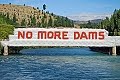
Cycleway talks with landowners start
By Mark Price, on Friday 21 November 2014
Otago Daily Times
Discussions are under way between the Upper Clutha Tracks
Trust and about 20 landowners along the Clutha River over the
possible route for a cycleway linking Wanaka and Cromwell.
Trustee Tom Rowley told the Otago Daily Times this week the
trust had received funding from the Central Lakes Trust to
carry out a feasibility study into extending by about 45km
the existing river track, which ends at Luggate at the Wanaka
end and Lowburn at the Cromwell end.
''At the moment we are trying to meet as many of the
landowners as we can and talk it through with them. That's a
bit of an involved process, really.''
Mr Rowley said discussions were going ''pretty well''.
''For the most part, we are getting a very good reception
from the landowners but we have got a few to work through
yet.''
Mr Rowley said some landowners already had a plan for the
cycleway through their properties when the company carrying
out the feasibility study arrived.
''I've been warning [landowners] that we are wanting to meet
with them and they have had time to think about it. So, some
of them have been outstanding really.''
Mr Rowley said the track would be fenced where necessary.
The intention was to ensure the track required as little
maintenance as possible.
''It's a big factor in what we are trying to do.''
He expected it would take ''a lot of money'' to build the
track and it would probably be built in stages.
Friday, November 21, 2014
Cycleway Talks With Landowners Start

Friday, August 8, 2014
Cromwell Could Become A Cycling Hub
Otago Daily Times
Cromwell could become ''the hub'' of new cycle trail networks if a proposed Luggate to Cromwell trail is successful, the trail promoters say.
The Upper Clutha Tracks Trust was given a grant of $25,000 by the Central Lakes Trust this week for a feasibility study into the proposed 40km trail.
Tracks trustee and treasurer John Wellington said the proposed trail would connect the Upper Clutha trail network to Cromwell and tie in with the wider Central Otago cycle trail network.
It would link with the proposed Cromwell to Gibbston trail and the proposed Cromwell to Clyde one as well, he said.
''Bit by bit, various groups have taken up the challenge of forming trails along the Clutha River and we're working our way towards Cromwell,'' Mr Wellington said.
When the proposed trails were completed, Cromwell would be the ''hub'' of the new trail network, he said.
The Luggate to Cromwell trail was mostly within the Central Otago district, on the true right of the Clutha River, and he believed the feasibility study would show it was ''do-able''.
''Then it will be a matter of getting other parties on side, talking to adjoining landowners and starting fundraising.''
The aim would be to have the trail on public land where possible, but some of the route would cross private land, so the trust would have to canvass landowners and negotiate with them.
Mr Wellington said the feasibility study could be completed by November and would include estimates of the trail cost.
''It's a longer trail than we've built previously, but it won't have much in the way of structures, so that will make it cheaper, but we really don't even have a ballpark figure at the moment.''
Unlike the trails on the ''Great Rides'' national cycle network, part-funded by the Government, this trail would have a ''lower scale finish'' and was likely to be 1.5m wide, narrower than trails on the national network, which were 2.5m to 3m wide. That would make it cheaper to develop.
''As soon as the feasibility study gives the green light, we'd look at getting it under way, maybe doing it in stages if we need to,'' Mr Wellington said.
Among the other grants by the Central Lakes Trust in its latest round of funding were $1500 for the Wanaka Preschool Early Childhood Centre, for two additional shade sails, and $4750 to the Drybread Cemetery Trust for a new concrete burial strip for headstones and the creation of 40 new graves. The Alexandra Musical Society was also granted a guarantee against loss of $7500 to enable it to stage the musical All Shook Up next month.
Friday, January 24, 2014
Almost 'A Clyde To Lawrence Trail'
Almost 'a Clyde to Lawrence trail'
Otago Daily Times
By Sarah Marquet, on Friday 24 January 2014
The Millenium track, between Clyde and Alexandra, the
Roxburgh Gorge Trail and the Clutha Gold Trail are being seen
by many cyclists as a package deal, Clutha trail trust chairman
Rod Peirce says.
''There seems to be a lot of people doing both trails and ...
there seems to be an association with the Clyde river trail
[Millenium Track], the Roxburgh Gorge and Clutha Gold trails
- it's almost like a Clyde to Lawrence trail.''
The Roxburgh Gorge trail, between Alexandra and the Roxburgh
dam, and the Clutha Gold trail, between the dam and Lawrence,
were officially opened on October 24 last year and were
experiencing ''heavy usage'', Mr Peirce said.
The number of cyclists around Roxburgh and Millers Flat
especially was ''phenomenal'' and anecdotal evidence
suggested they were enjoying the trails.
Not everyone was opting for the boat trip across the middle
section of the Roxburgh Gorge Trail - many were choosing to
do the trails in segments, he said.
The 12km boat trip crosses the middle section where the trail
has not yet been constructed because of various issues with
three properties.
That could be about to change for one property though,
Roxburgh Gorge Trail trust member Barrie Wills said.
The tenure review process of Obelisk Station was almost
complete.
''Chances are that maybe we can get on with continuing the
track later this year, but we'll have to look into
fundraising.'Dr Wills said he had been on the gorge trail
about once a week, tidying things up where needed.
That was usually midweek and he would see ''in excess of 30
to 40 people using it, so there would be a lot more in the
weekends.
''I see people walking their kids in prams, a lot of bikers
and a lot of walkers too.
''I've stopped and talked to a lot of people and they're just
blown away.''
With no counters on the trails, exact numbers of users were
unknown but the trusts were considering options to record
usage, both men said.
They are looking to install cameras to not only capture how
many people are using the trails but also age groups and
other information about usage.
When asked how many $25 maintenance contribution tags had
been sold, Central Otago District Council visitor centres
manager Pam Broadhead said she was no longer able to supply
that information as it was commercially sensitive, but the
trusts would release that information after a meeting later
this month.
Mr Peirce estimated between 500 and 600 had been sold and he
would have a clearer idea after a meeting on Monday
afternoon.
Saturday, January 11, 2014
Beaumont's Rising Fortunes
Beaumont's Rising Fortunes
By John Gibb, on Saturday 11 January 2014
Otago Daily Times
Moves are afoot to make the small Otago township of
Beaumont the thriving community it once was. John Gibb finds
out about Beaumont's changing fortunes.
Once a fading rural backwater, the township of Beaumont now
seems destined for a much brighter future.
People who have lived near the inland Otago township, on the
Clutha River/Mata-au, for 20 years or more will remember
earlier sometimes divisive and frustrating conflicts over
proposed big hydro-electric dams, which would have flooded
the area.
One proposal, by the Electricity Corporation of New Zealand
(ECNZ) in 1992, was to build a dam at Tuapeka Mouth that
would have flooded 3000ha, including all of Beaumont. But
among a series of more promising developments the
long-delayed replacement work involving the nearby 19th
century Beaumont Bridge is at last due to start next year.
This is one of the oldest bridges in the country still
operating on a major state highway.
And more walkers and cyclists are already starting to move
through the township since the 73km-long Clutha Gold Trail-
which runs between Roxburgh and Lawrence, and includes
Beaumont- was opened by Prime Minister John Key on October
24. Long-time resident, historian and writer Bill Dacker (61)
is well aware of the area's previously somewhat mixed
fortunes.
''It was a little backwater that we enjoyed as a backwater,''
he recalls.
But then a series of dam proposals came along and changed
everything, he said.
Some locals, including some facing tough economic times, had
agreed to sell their land.
Others, including the ''Hands Off Beaumont'' lobbyists, were
determined to resist and to safeguard all they found precious
in the area, including its rich history and its attractive
and distinctive environment.
Mr Dacker highlights the significance of the bridge
replacement work.
The current bridge had been around since 1887 and had
struggled to cope with some of the ''huge trucks'' now
passing through.
Mr Dacker, who is a long-standing member of the Clutha Gold
Trail Trust Board, says the newly opened trail and other
developments mean brighter times are coming for Beaumont,
which will boost the local economy by bringing in more
visitors and potential new residents. Strengthening Beaumont
was also important strategically, because it gave the area a
better chance of influencing its own destiny in future, he
said.
''Unless we're going to make the place strong in a different
way, other people are [still] going to see it as a
backwater,'' he says.
Dave Crawford is an experienced jet boater and
co-owner-operator of Beaumont Jet, with his wife Ali, And he
is also a Gold Trail board member.
It was ''great'' to see the cyclists already starting to flow
along the track, through Beaumont.
''It can only be good for this area,'' he says.
When he and his wife moved to Beaumont and began jet boat
operations in 2004, he had long known the area had strong
potential.
The nearby Clutha River/Mata-au is ''probably the best part
of the Clutha River'', he adds.
These stretches of the river were also as good as ''anything
in New Zealand'' and offered plenty of variety, including
''huge rapids'' and other ecologically appealing areas.
And he is not content with Beaumont being one of the region's
and New Zealand's best-kept secrets.
''The more people the better.''
Mr Dacker, who these days divides his time between Beaumont
and Port Chalmers, has lived in Beaumont for much of his
life, having grown up there.
His father, Harry Dacker, had initially found work there as a
rabbiter in the 1920s.
Bill Dacker said the idea of building a''cycle-cum-walking
trail through the district, along the river and through the
farmland to Lawrence, was a direct response - a way of
creating economic opportunity by bringing people into this
area as well as the other areas connected by the trail''.
The idea had come from the trust's Roxburgh-based chairman,
Rod Peirce, who was a ''retired orchardist from Millers Flat
with long-standing connections in Beaumont as well as to the
other communities along the trail.''
The lessees of the Beaumont Hotel had also contributed to the
upturn in Beaumont's fortunes by continuing to develop and
support ''events tailored to hunters and fishermen while
adding cyclists to those they wish to give hospitality to''.
And the pub also served ''the best blue cod meals this side
of Iceland'', Mr Dacker said.
Widespread support from the Beaumont community for the trust,
as well as backing from ''other communities connected by the
trail'', had been key to the success of the trail
development.
This sense of unity and support stood in ''stark contrast to
divisions in the communities'' sparked by the ECNZ dam
proposal in 1992, and was ''a wonderful thing to
experience''.
Alison Mills, who leases the hotel with her husband, Gunni
Egilsson, is also optimistic about the future, and says
patrons with different interests and from range of
backgrounds, including tourists, were using the hotel and
nearby camping ground.
Mr Dacker noted there had been some ''recent controversy''
over suggestions of fees for using the trail.
He emphasised there was no official fee for using it, ''but
the trust asks for a koha [donation], a contribution for its
maintenance from its users as at the moment the trust is
solely responsible for costs of its maintenance''.
Mr Peirce (76) said there were early signs that the new trail
would prove positive, and help revive smaller communities
such as Beaumont and Millers Flat.
''It's very satisfying. There's a general air of
enthusiasm.''
Mr Peirce, who was also once chairman of the Friends of
Beaumont group, had opposed various proposals to establish
big new dams nearby.
And he is positive about the new trail's benefits.
''I thought, if there's any legacy I can leave, it may well
be more like the trail, which is more positive, rather than
being an activist against everything.
''I'd like to be seen as someone who left something for the
benefit of the community.''
People were already starting to come from far afield to ride
or walk the new trail, and local families were also enjoying
it.
''We've had a tremendous amount of support from Contact
Energy.''
And $3.8 million from the Government's New Zealand Cycle
Trail project funding had been used to support the trail's
development. Through the years Mr Peirce has noticed rural
decline, including loss of population and services, in some
of the smaller communities.
''It's very positive. I think that the smaller villages will
definitely gain a tremendous amount over the next several
years and into the future from the trail.''
And Beaumont was already looking up. The school had closed
some decades ago, but ''rural visitors'' were increasing and
the pub was humming - ''it's quite a busy little pub'', Mr
Peirce said.
The gold trail was also good for Millers Flat - ''it's the
only town that the trail actually goes right through the
middle of.''
And Mr Dacker highlights Beaumont's distinctive geographical
position, and its historical significance.
Beaumont is the first crossing place of the Clutha
River/Mata-au when travelling on SH8 from Milton to Central
Otago, and its many attractions. And the area was ''one of
the major entrance and exit points'' for the Clutha Gold
Trail walkway.
The Clutha River/Mata-au is one of the outstanding natural
features of the newly opened trail, which follows the river
''on its journey across the river flats below Roxburgh,
through the Beaumont Gorge, before it turns toward Lawrence
at Beaumont'', Mr Dacker says. The river crosses the Beaumont
Flat and then passes through the Rongahere Gorge, the ''last
major river flat and gorge respectively of the schist
peneplain or block mountain system of the Central Otago
highlands''.
Beaumont was a true border between very different
geographical zones.
''On the Rongahere side the climate is wetter and cooler,
more like that of coastal Otago than Central Otago. On the Beaumont Gorge side the climate is hotter and drier,
marking the beginning of Central Otago proper.''
The Maori name for the district is Te Kohai and here the
ancestors of Kai Tahu Whanui also crossed the river, but on
mokihi (traditional rafts), on their journeys into the
interior.
There was also once a moa-hunting era village at Beaumont.
The town of Beaumont grew around the river crossing, where a
ferry operated, accompanied by a supporting structure of
hotels and shops. The natural vegetation of the nearby gorges
reflected the ''borderland'' characteristics.
The dominant tree on Upper Birch Island - also known locally
as Native Island - in the Beaumont Gorge is mountain beech,
indicating the drier and hotter conditions there. The far
larger Birch Island, or Moanui, in the Rongahere Gorge below
Beaumont, and the bush of the gorge itself, has a covering of
a mixed podocarp forest that includes sphagnum moss, mountain
and silver beech as well as totara and matai.
''Both the gorge and the island are home to rare and nearly
extinct insect species, protected on the island from rat
predation by the swift waters of the river,'' Mr Dacker says.
''Beaumont's fortunes have fluctuated over the years
according to major changes in the economic, gold-mining and
agricultural history of the province.''
First the search for gold, then the arrival of the railways
and the rise of horticulture on the river flats of Central
Otago followed by the development of exotic forest
plantations in the Blue Mountains all contributed to its
growth.
But, subsequently, the closure of the railway branch line,
the decline in gold extraction, the rise of large land
holdings, changes in the horticultural sector, and finally
the closure of the Beaumont Forest headquarters had also
contributed to the community shrinking.
Closures of the railway, shops, the race track, churches and
the school had all followed ''but always a significant
minority clung on'' and many people, including some who had
left, showed ''a remarkable dedication to the area'', Mr
Dacker said.
And he emphasises that, for the first time in 40 years, there
were ''signs of growth at Beaumont again''.
Margaret Healy, who helped organise a series of ''Back to
Beaumont'' days, held over the years, has always been
optimistic about the township's future.
''The aim is to get people and their families to come back to
their grassroots, reminisce and enjoy Beaumont,'' she said.
It was a great place to raise a family and she was keen for
Beaumont to become a ''thriving community'' again.
Beaumont
• Beaumont is a township on State Highway 87, at a crossing of the Clutha Mata-Au River, close to Central Otago, between Balclutha and Roxburgh, and is 6km southeast from Raes Junction.
• The township is one of the main entry and exit points on the 73km-long Clutha Gold Trail, between Lawrence and Roxburgh.
• The gold trail's development was backed by $3.8 million in New Zealand Cycle Trail project funding and was opened by Prime Minister John Key in October.
• The trail includes parts of an old Maori trail, sections of the former railway line route, and parts of a former road.
• An earlier proposal in 1992 by ECNZ was to build a dam at Tuapeka Mouth that would have flooded several thousand hectares, including all of Beaumont.
Saturday, October 12, 2013
Otago Prepares To Open New Cycleways
Otago prepares to open new cycleways
Saturday 12 October 2013
3 News
Central Otago's semi-arid dry lands and the green farmlands of the Clutha District in the South Island are being opened up to cyclists and walkers.
The Roxburgh Gorge Trail and Clutha Gold Trail will be officially opened on October 24 by Finance Minister Bill English, the MP for Clutha-Southland, adding new cycling and walking options near the Otago Central Rail Trail, which already attracts an estimated 12,000 people a year.
The new trails have been developed by the Roxburgh Gorge Charitable Trust and Clutha Gold Charitable Trust over eight years.
The Roxburgh Gorge Trail runs 33km from Alexandra to Lake Roxburgh Dam in three stages - a 10km stretch from Alexandra to Doctors Point, a boat transfer to Shingle Creek and a 12km track to Lake Roxburgh Dam.
Rod Peirce, chair of the Clutha Gold Charitable Trust, said the trails had been the collective vision of so many for so long that opening day would mark the transition from a long-held dream to a reality.
Cyclists on the Roxburgh Gorge Trail are expected to take between three and six hours, depending on fitness levels, boat transfer connection times, and time taken to view landmarks. Walkers are expected to take eight to 10 hours, including the boat transfer.
The trail runs down the western side of the Clutha River and most of the route is close to the river.
The Clutha Gold Trail is a one-to-two day easy 73km ride from Lake Roxburgh Village to Lawrence.
The first stage from Commissioner Flat to Beaumont mainly runs beside the Clutha River before heading along a defunct railway corridor from Beaumont to Lawrence.
Users are asked to pay $25 per person or $50 for a family, yearly, for a maintenance contribution tag which covers both trails. The charge will not be policed, the Otago Daily Times reports.
Tuesday, May 7, 2013
Water Taxi Service Looks To Be Starter
Water taxi service looks to be starter
By Lynda van Kempen, on Tuesday 7 May 2013
Otago Daily Times
Providing a water taxi service to connect the northern and southern sections of the Roxburgh Gorge Trail has already piqued the interest of three potential operators.
Trail charitable trust chairman Stephen Jeffery said the venture had already attracted the attention of three operators before the trust formally sought expressions of interest last week.
Others who wanted to be involved had until June 21 to record their interest.
Two sections of the $3.4 million, 34km walking and cycling trail from the Roxburgh dam to Alexandra were almost completed - a 10km stretch from Alexandra to Doctors Point and a 12km piece from Lake Roxburgh to Shingle Creek.
Those two sections were expected to open in spring and the water taxi service would cover 12km of the Clutha River and Lake Roxburgh to link them.
''Because of the interest it's generated already, we're confident there will be suitably qualified and experienced operators prepared to carry out the water taxi service,'' Mr Jeffery said.
''There's been no final details yet on pick-up times and at the end of the day, it'll be a commercial operation, so we expect operators may want to include other things in the package. We're keen to hear how they'll make it work and there's a whole raft of other possibilities for add-on services that might be included.''
The trust had to look closely at revenue-generating opportunities and the concession process for a water taxi service was one way of doing that, he said. Last week, the Queenstown Trails Trust announced it had bought the Motatapu race event to get revenue to develop trails in the Wakatipu area.
Mr Jeffery said he had just returned from the North Island after taking a closer look at a 48km mountain bike race held there. There was potential for a similar event to be carried out using the Roxburgh Gorge and Clutha Gold (Roxburgh to Lawrence) trails.
''It's been made clear to us that we need to look at revenue-generating possibilities. There's no point mucking around; everyone's told us to fund our own trail, so we need to generate an income,'' he said.
Although the trust hoped to open up part of the trail before winter, a range of factors meant that would not be possible.
''I'm happy with the progress we're making but disappointed in the delays, which are out of our control.''
The middle section of the trail, where the water taxi service would be used, covered three separate properties, two of which were in the tenure review process, he said.
''The trust is still optimistic of being able to complete the full length of the trail; we're not ruling that out, but it may be a longer-term option. The fact of the matter is, we have to play with the hand that we've been dealt.''
Wednesday, December 5, 2012
Cycle Trail Work Progresses Steadily
Cycle trail work progresses steadily
By Sarah Marquet, on Wednesday 5 December 2012
Otago Daily Times
Construction of two cycle trails between Alexandra and Lawrence is progressing steadily, with more money uplifted from funders and hopes to have some sections open to the public early next year.
With a budget of $3.4 million, $2 million of which came from the Government, construction of the 34km Roxburgh Gorge Cycle Trail between Alexandra and the Roxburgh dam started just over a year ago.
Recently, with government funds running low, Central Lakes Trust and the Otago Community Trust granted a total of $670,000.
Trail trust chairman Stephen Jeffery said that was not because there was a time limit on the government funds, but because they decided to use that money before approaching other funders.
The project was also costing more than expected.
He said contractors were within their tender budgets but the entire project was not running to budget because of costly realignment issues at the Alexandra end of the trail. The contractor was due back there in about a week and it was hoped that section, about 10km, would be complete by April.
A 12km section at the Roxburgh end was almost finished. Only grading, gravelling and signage had to be completed before it could be open to locals, although that was not expected to happen until early next year, he said.
Once the trails were complete, jetties would be built in the Roxburgh Gorge so cyclists and walkers could catch a boat between the two sections of the trail, as the trust still did not have permission from the Miller family to build the centre section. Construction of the 73km Clutha Gold Cycle Trail from the Roxburgh dam to Lawrence, on the opposite side of the river to the Roxburgh Gorge trail, began at the start of this year.
Trail trust chairman Rod Peirce said most of the trail was under construction and was within the $5.5 million budget, $3.8 million of which came from the Government.
The 13km section from the dam to Pinders Pond was complete except for a bridge over the Teviot River, and it was hoped that could open in the new year.
Construction from the Lawrence end was now about 2km short of Beaumont and construction on another section, from Millers Flat to the Talleburn River, was due to start soon.
Both chairmen said they had hoped the trails would be further along by now.
Mr Jeffery said there were ''things thrown at us that slowed us down ... things beyond our control''.
Mr Peirce said the Clutha Gold trail was also held up by small things but he was ''extremely pleased'' with how it was looking.
It was hoped the trail would be completed and open by next April, although ''with an [almost] 80km-long trail, it's hard to be definitive''.
Mr Jeffery said the Roxburgh Gorge trail trust would be ''trying to hurry things along'' now.
The trails are two of the 18 ''Great Rides'' in the Government's New Zealand Cycle Trail project.
Thursday, November 29, 2012
New Cycle Track Adds To Network
New cycle track adds 12km to network
By Cris Johnston, on Thursday 29 November 2012
Otago Daily Times
The Upper Clutha's network of walking and cycling trails will be officially expanded at the opening of the Newcastle Track on December 8.
The formalities will take place at the Albert Town end of the track on the true left of the Hawea River, over the Hawea River swing bridge, at 10am on Saturday, December 8. Riders and walkers will then be encouraged to cycle or walk the 12km track, which runs along the true left of the Clutha River.
The Upper Clutha Tracks Trust will hold a sausage sizzle from 11.30am at the other end of the track at the new car park on Kane Rd, just north of the Red Bridge at Luggate.
The Newcastle Track provides greater access to the Clutha River and has spectacular views, including the conservation area Rekos Point near Luggate, from the terrace above the track.
The track is named after the planned settlement of Newcastle, which was surveyed on the other side of the Clutha River from lower Albert Town, but never developed.
Thursday, July 19, 2012
Another Section Of Clutha Gold Trail
Another section of Clutha Gold trail takes shape
By Helena de Reus, on Thursday 19 July 2012
Otago Daily Times
Work has begun on the Beaumont to Lawrence section of the Clutha Gold Trail.
Trail charitable trust chairman Rod Peirce said SouthRoads staff started building the 15km section from Beaumont to Evans Flat on Monday, while other contractors worked to install bridges between Evans Flat and Lawrence.
Construction of the cycle trail at Beaumont began at the SH8 Clutha River bridge, across the road from the Beaumont Millennium Track.
Mr Peirce said contractors began scraping off topsoil, laying base gravel and putting culverts in place.
"From the bridge to Weardale St we're utilising the road reserve, and then carrying on through the [Beaumont] township, with most of this trail section on private property."
The 73km trail, which will cost an estimated $5.5 million, was the first in Central Otago to receive funding under the New Zealand Cycle Trail project, getting $3.8 million from the Government. A 20km section is planned in the Clutha district, between Beaumont and Lawrence; the remaining 53km will be in Central Otago, from Lake Roxburgh to Beaumont.
The trail section near the Roxburgh Bridge is nearing completion.
Mr Peirce said the 8km section from Evans Flat to Lawrence followed the old railway line from Lawrence to Milton, and track construction was almost complete.
Fencing in this area was done by Lawrence-Tuapeka area residents as a fundraiser for the Tuapeka Aquatic Centre - a project which Mr Peirce said the trust was happy to support.
The Clutha District Council is running workshops designed to help facilitate ideas and identify opportunities for the community arising from the Clutha Gold Trail.
The first workshop was held in November last year, with the fourth due to be held in Lawrence on July 31.
Thursday, June 28, 2012
Trust Gives Cycleway Grant Of $300,000
Trust gives cycleway grant of $300,000
By Helena de Reus, on Thursday 28 June 2012
Otago Daily Times
The Clutha Gold Trail has received a $300,000 boost for the Beaumont to Lawrence leg of the cycleway.
The Otago Community Trust yesterday announced the large donation, which has been welcomed by the trust behind the trail.
The 73km trail, which will cost an estimated $5.5 million, was the first in Central Otago to receive funding under the New Zealand Cycle Trail project, with $3.8 million from the Government.
A 20km section is planned in the Clutha district, between Beaumont and Lawrence, and the remaining 53km will be in Central Otago, from Lake Roxburgh to Beaumont.
Otago Community Trust chief executive Keith Ellwood said the trust was very supportive of the cycleway development in the region, which would benefit the community in terms of economic development, health, recreation and exercise.
Clutha Gold Trail Charitable Trust chairman Rod Peirce said trustees were "pleased and very excited" with the donation.
"We have our Government funding but we needed our co-funding. The full amount we requested from the Otago Community Trust was granted, which is just what we needed."
Mr Peirce said work on the trail was well under way.
"In construction terms we're more than halfway through."
The trail is being constructed in six sections.
Stage one from Roxburgh dam to Roxburgh was almost finished, but awaiting the construction of two bridges.
Further downstream, the 8km stretch near Lawrence was being worked on by Homer Contracting.
Mr Peirce said the 8km section followed the old railway line from Lawrence to Milton so track construction was almost complete.
Bridges in the Lawrence-Tuapeka area of the trail were due to be installed soon.
The trust hopes to have the Clutha Gold Trail completed by the end of the year.
Friday, June 22, 2012
Trust Hopes Trail Open By End Of Year
Trust hopes cycle trail completed by end of year
By Helena de Reus, on Friday 22 June 2012
Otago Daily Times
Work on the Clutha district leg of the Clutha Gold Trail will start next week, with the trust behind the cycle trail hopeful the whole trail will be completed by the end of the year.
Clutha Gold Charitable Trust chairman Rod Peirce said contractors would start work at Beaumont, finishing at Cockleshell Rd in the Evans Flat area near Lawrence.
SouthRoads won the contract for that section of the trail, with Waitahuna-based Homer Contracting due to work on the Evans Flat to Lawrence section later in the year.
Trail project manager Tim Dennis, of Southern Land CKL, said SouthRoads staff were due to begin construction of the trail next week on the 15km section from Beaumont to Evans Flat.
The 73km trail, which will cost an estimated $5.5 million, was the first in Central Otago to receive funding under the New Zealand Cycle Trail project, with $3.8 million from the Government.
A 20km section is planned in the Clutha district, between Beaumont and Lawrence, and the remaining 53km will be in Central Otago, from Lake Roxburgh to Beaumont.
The trail is being constructed in six sections.
Stage one from Roxburgh Dam to Roxburgh was "virtually concluded", but awaiting the construction of two bridges.
Mr Peirce said workers had reached Millers Flat, with work on the next stage between Millers Flat and the Millennium Track in the Beaumont Gorge due to begin in a few weeks.
"Progress is going quite well. We'd like to think it would be finished by the end of the year, or at least the beginning of next year. Either way, some of the trail should be open for the summer."
The trust had hoped to begin work on the trail last year, but was unable to do so as contractors were not available any earlier.
The Clutha District Council is running workshops designed to help facilitate ideas and identify opportunities for the community arising from the Clutha Gold Trail.
The first workshop was held in November last year, with the third held on Tuesday night.
Council development manager Jill Borland said the council wanted a forum to help create ideas and identify opportunities for the local community arising from the Clutha Gold Trail.
The public "Trail Opportunities Forum" aimed to identify those with an interest in the trail development and establish a mode of communication.
She hoped it would also identify community resources, skills and interests to maximise potential trail-related opportunities.
Two more workshops have been planned for July 31, and August 14.
Tuesday, May 29, 2012
Walking Track Projects Given $44,000
Walking track projects given $44,000
Tuesday 29th May 2012
Otago Daily Times
Five projects in Otago and Southland designed to improve access to the outdoors have received more than $44,000 in funding from the New Zealand Walking Access Commission's Enhanced Access Fund.
Fifty organisations across New Zealand applied for a portion of the $230,000 made available in this year's funding round, with 22 projects successful in their applications.
The contestable fund contributes to the commission's goal of free, certain, enduring and practical walking access to the outdoors.
The Lawrence-Tuapeka Community Board's Gabriel Gully Walking Track project received $10,000 to assist the formation of the last 400m of the 4km walking and cycling track from Lawrence to Gabriel's Gully.
Upper Clutha Tracks Trust also received $10,000 to assist in the creation of a 12.5km track which would provide walking, mountain biking and fishing access along the Clutha River, east of Wanaka.
The Newcastle Track would link with the Hawea River Track and the Upper Clutha River Track to create a loop.
Ten thousand dollars also went to the Queenstown Mountain Bike Club to help create the Golden Lakes Discovery Loop, a walking and cycling track which will take in lakes Wakatipu, Moke and Dispute.
The new loop track would combine existing and multiuse tracks with mining pack tracks and water races to provide a scenic walkway for locals and visitors to Queenstown.
Other recipients were the Otematata Wetlands Walkway project, driven by the Otematata Residents Association, which received $5400 funding for track markers and signs to access the walkway, on the shores of Lake Aviemore; the Mataura Community Board's Mataura Walkway project which received $5000 for construction of an 800m walkway to provide access along a flood bank between Asquith St and State Highway 1 at Mataura; and the Lower Shotover Conservation Trust's Lower Shotover Conservation Area Walking Access, which received $4007 for the installation of a gate and construction of a new 500m trail, linking the Lower Shotover Conservation Area to the neighbouring Tucker Beach Wildlife Reserve.
Friday, November 18, 2011
CDC Hosting Trail Forum
CDC hosting trail forum
By Helena de Reus, on Friday 18 November 2011
Otago Daily Times
With construction of the Clutha Gold Trail between Lake Roxburgh village and Lawrence expected to begin this month, a forum has been organised to promote ideas around the trail and how it will benefit communities.
The forum, hosted by the Clutha District Council, will be held in Lawrence on Tuesday to help generate ideas and identify opportunities for the local community arising from the Clutha Gold Trail.
All consents are in place for the 73km cycle trail, which will follow the Clutha River from Roxburgh to Lawrence.
Clutha Gold trustee Graham Dillon said construction would begin at the Roxburgh end in the next few weeks.
CDC development manager Jill Borland said, with construction on the trail due to start soon, the council wanted a forum to help create ideas and identify opportunities for the local community arising from the Clutha Gold Trail.
The public "Trail Opportunities Forum" aimed to identify those with an interest in the trail development and establish a mode of communication. She hoped it would also identify community resources, skills and interests to maximise "potential trail-related opportunities".
The council's role in the forum would be to facilitate discussions among local community members, Ms Borland said.
"We want to work with the Central Otago District Council and the community to promote the trail as a whole and to identify skills in both districts."
The Lawrence-Tuapeka Community Board briefly discussed the forum on Wednesday, and encouraged members to attend.
A tourism workshop hosted by Central Otago District Council will be held in Millers Flat on November 28.
The workshop is aimed at present and future tourism operators across the Teviot Valley and into Lawrence, and will include information on characteristics of the cycling market, lessons learned from the Otago Central Rail Trail, collective marketing and opportunities created by the Clutha Gold Trail.
Thursday, September 29, 2011
Trail Work May Start Next Week
Trail work may start next week
By Sarah Marquet, on Thursday 29 September 2011
Otago Daily Times
Roxburgh Gorge Trail Trust deputy chairwoman and Vincent Community Board chairwoman Clair Higginson stands at the spot in Alexandra where the Roxburgh Gorge trail will start. Photo by Sarah Marquet. Construction of the first stage of the controversial $3.3 million Roxburgh Gorge cycle trail could begin next week as the trail trust irons out paperwork to get the final approval from Land Information New Zealand (Linz).
The trust this week received a letter from Linz which gave the all clear, but it contained a few conditions, trust chairman Stephen Jeffery said.
"They are technical issues that need to be addressed and included in the agreement, then [we can] get the sign-off ... mostly minor legal things."
He said the new wording will be incorporated into the agreement and sent back to Linz to be signed off which should take "about a week".
Work could then begin immediately on the first 10km of the 34km trail from Alexandra to Flat Top Hill, on a mix of marginal strip and Department of Conservation land.
Tenders have already been let and a contractor was ready to start, with the work expected to take six months to complete.
The rest of the trail, to the Roxburgh dam, was reliant on negotiating land access.
"We are still negotiating with land owners over the rest of the trail but we are making steady progress," Mr Jeffery said.
Since its conception, there had been strong opposition to the trail from landowners along its path, with concern mostly over the negative impact it could have on the land.
Devon Miller, whose family farms at Shingle Creek, has aired issues, including the overall viability of the trail, insurance liabilities and people wandering off the track.
Because the trust failed to get easement agreements from some landowners, it opted to use the marginal strip where possible.
A recent survey of the Otago Central Rail Trail found it generated more than $12 million annually for the local economy, which is something the Roxburgh Gorge Trail Trust hopes its trail can do just as well for its local area's economy.
"To grow the economy we need more people and targeting tourists ... and the trail is the most obvious way to do that," said trail trust member and Alexandra businessman, Russell Ibbotson.
(Editorial note from Clutha River Guardian: The river-length trail was envisioned to better enable local communities to benefit from their river asset, economically and in every way, and to enable them to better care for that asset.)
The Roxburgh trail would also link with the proposed Clutha Gold Trail.
That trail would stretch 73km from Roxburgh to Lawrence.
Both the Clutha Gold and the Roxburgh Gorge trails received funding from the Government under Nga Haerenga, the New Zealand Cycle Trail project.
A $2 million funding grant for the Roxburgh Gorge Trail was approved in September last year. The trail trust needs to raise the remaining $1.3 million.
Friday, May 27, 2011
Luggate Walking Track Opening
Walking track to open this Sunday
By Marjorie Cook, on Friday 27th May 2011
Otago Daily Times
The Upper Clutha Tracks Trust project has been done in consultation with the Luggate Community Association, Department of Conservation, Wanaka Community Board, Contact Energy and other groups.

It is an extension of the Upper Clutha Track that begins at Albert Town.
Walkers and cyclists can now travel below the Luggate Red Bridge to the Nook, across a new bridge over the Luggate Creek and up to Luggate township, finishing a short distance from the Luggate Hotel.
"It's now truly pub to pub," trustee John Wellington said of the trust's trail network, which also includes Wanaka, Albert Town, Cardrona and Lake Hawea.
With Luggate now on the trail, just Hawea Flat and Makarora are out of the loop.
But the trustees said they were trying to think of ways to eventually link those townships to the network, plus extend the Luggate track down to the Queenstown Lakes District Council boundary at Queensberry.
Mr Wellington said the idea for the Luggate Creek extension was formed before the Upper Clutha Track between Albert Town and the Luggate Red Bridge had been completed.
Initially, the trust had wanted to cross the bridge and continue the track downstream on the Tarras side of the Clutha River.
That changed when the trust and association met to discuss access to the Nook, a whirlpool in a bend in the Clutha River.

Central Otago track advocates are also working on trails with the goal of a track all the way to Cromwell, Mr Wellington said.
Another Upper Clutha Tracks Trust concept is to complete a loop back from the Luggate Red Bridge to Albert Town on the true left of the Clutha River.
Mr Wellington said the trust was in the very early stages of developing that proposal and had to first negotiate with landowners, including Contact Energy.
"There is public land all the way up but we will have to also talk to neighbours," Mr Wellington said.
The Luggate Creek Track has cost about $100,000 to build so far, with the Department of Conservation and contractor John Sutton contracted to do parts of it.
That is not a final figure because the extension below the Nook has not been completed.
There is a new bridge across the Luggate Creek near the Nook.
The opening of the track will be celebrated at 10am on Sunday. Signposts explaining how to get to the track will be put on State Highway 6 at Luggate.
Monday, November 1, 2010
Wanaka Tracks
Wanaka Offers New Walking Tracks For Summer
Monday 1st November 2010
http://www.voxy.co.nz/
Lake Wanaka's position as one of New Zealand's most popular walking and hiking destinations has been further enhanced with the construction of a number of new tracks. Designed to highlight the region's spectacular scenery to walkers of all ages and abilities, the tracks offer a mix of scenic day and overnight excursions.
The recent completion of three river and lakeside tracks; the Glendhu Bay Track, Hawea River Track and Clutha River Track serve to link the outlying communities of Lake Hawea and Luggate offering stunning scenery and a variety of walks for locals and visitors with all levels of fitness.
Lake Wanaka now boasts over 750kms of recreational tracks and routes from gentle lakeside strolls to high alpine treks. Sections of the new network are incorporated in Te Araroa, a national walking and tramping trail from Cape Reinga in the north to Bluff in the south.
"Lake Wanaka is a walkers' paradise offering some of the most unforgettable hiking in New Zealand, with breath taking scenery and great variety, from short local walks along the rivers to multi-day guided adventures in Mt Aspiring National Park," said Lake Wanaka Tourism general manager James Helmore.
A keen walker in Wanaka can do a number of day walks from the town centre such as the gentle Outlet Track which winds along the Clutha River, the Mt Iron Walk with 360 degree views of the Clutha basin or the Waterfall Creek Track along the lake's western shores. The walks are all spectacular in autumn with the brilliant reds and golds of the poplar trees.
More adventurous hikers are well catered for with a number of good day and overnight walks in the Mount Aspiring National Park. A scenic drive up the peaceful Matukituki Valley or to Makarora at the head of Lake Wanaka provides access to the start points for many hikes. From Makarora the Wilkin-Young three day (58km) circuit travels through stunning valleys before heading over the 1490-metre Gillespie Pass with impressive views.
Last summer the Motatapu Track was opened, a challenging 34-kilometre, three- to four-day alpine tramp for experienced parties. It follows much of an historic route that linked Wanaka and Arrowtown areas during the gold mining era.
The Lake Wanaka region has a proactive community of hikers and community organizations, such as the Upper Clutha Tracks Trust and the Clutha Mata-Au River Parkway Group who work alongside the Department of Conservation and Queenstown Lakes District Council to develop the trails in the region.
"The 45kms of new tracks are a real conservation gain for the region. The range of recreational opportunities including walkers, runners, mountain bikers, events and fishermen will all make good use of the tracks. I hope many will take the opportunity to get out and enjoy them," said Paul Hellebrekers, DOC Wanaka.
Funding of the tracks has also come from various community trusts such as the Central Lakes Trust, Otago Community Trust, NZTA, and the Wanaka Walkers Trust.
Monday, September 13, 2010
Tracks Trust Blazes Trail For Groups
Tracks trust blazes trail for groups
By Matthew Haggart, on Monday 13 September 2010
Otago Daily Times
A leader in opening up public access by building tracks, the Upper Clutha Tracks Trust is a finalist in the Inland Otago Conservation Awards. Matthew Haggart talks to trust chairman Tim Dennis about its mission to develop a network of trails and public access around the region. Initial steps taken by the founding members of the Upper Clutha Tracks Trust might well provide a pathway for groups charged with establishing trails around New Zealand.
While much has been made of the Government-led National Cycle Trail projects, the trust has effectively already established its own regional trail network .
The trust has built a trail network of more than 100km around Wanaka during the past three years and was recognised at the TrustPower Community Awards recently when it won the heritage and environment category.
Trust chairman Tim Dennis said being nominated for the conservancy award was fantastic.
In 2006, the fledgling trust produced the Upper Clutha walking and cycling strategy for the Queenstown Lakes District Council.
Spurred on by the passionate vision of founding chairman, the late John Pawson, the trustees had always been focused on "making it happen", Mr Dennis said.
"For us, it has always been about getting out there, getting on with things, and making things happen on the ground," he said.
Alongside Mr Pawson and Mr Dennis, the founding trustees include Helen Tait, Rachel Brown, Grant Fyfe and John Wellington.
Lake Hawea Station farmer Tom Rowley was co-opted by the trust shortly after Mr Pawson died in a climbing accident in 2008.
Mr Pawson's early leadership, vision and drive had provided the trust with the inspiration to forge on , Mr Dennis said.
The trust's first project - the Hawea River Track - was launched in November 2006 with the assistance of a $25,000 seeding fund from the QLDC.
Since the 11km track, which follows the Hawea River and links the townships of Lake Hawea and Albert Town, was completed in July 2009, the trust has quickly moved to establish more trails.
A 14km trail linking Glendhu Bay and following the shoreline of Lake Wanaka to Roys Bay in Wanaka was completed in December 2009, and less than a year later a new track from Albert Town was completed along the Clutha River.
The trust has two more projects in its immediate sights - a track along the southern shoreline of Lake Hawea connecting the township to Johns Creek, plus an extension of the Clutha River Trail, which will connect the existing trail to Luggate.
"Each track has its own personality and attraction because of their different characteristics," Mr Dennis said. The achievements of the trust were a credit to the team involved.
Input and assistance was given by private landowners, the QLDC and the Department of Conservation, he said.
A long-term project for the trust was to establish a trail along the Clutha River, which will connect Wanaka to Clyde - a potential link in the National Cycle Trail which will connect with the existing Central Otago Rail Trail and with a planned Clutha Gold-Roxburgh Trail.
An initial approach to the New Zealand Cycle Trails project organisation for a trail between Wanaka and Clyde had been knocked back, but Mr Dennis remained hopeful it would, in time, be recognised as a valuable addition to a national tourism network.
Mr Pawson's galvanising influence on the trust remained, and it was his idea for the Wanaka-Clyde link, Mr Dennis said. (Webmaster note: John Pawson was a founding member of the Clutha Mata-Au River Parkway Group, and became a strong and valuable advocate for the river-length trail which was proposed before his membership as part of the river parkway and trail vision.)
"It was very clear that John was right in his vision. He would want us to go for it and stick to our guns."
• The winner of the Inland Otago Conservation Awards will be announced at a ceremony in Cromwell tomorrow night.
Friday, September 10, 2010
Agreement Signed For Trail Funding
Agreement signed for trail funding
By Linda Van Kempen, on Friday 10 September, 2010
Otago Daily Times
Cycle trails are the "least invasive form of tourism on the planet" Clutha Gold Trail Trust chairman Rod Peirce said as he signed an agreement for $2.54 million in funding for the project yesterday.
Planning began four years ago and signing the contract between the New Zealand Cycle Trail project and the trust was a real milestone, he said.
National cycle trail programme manager John Dunn, Central Otago mayor Malcolm Macpherson, Clutha Mayor Juno Hayes, Clutha and Central Otago district councillors, Lawrence-Tuapeka and Roxburgh Community Board members attended the signing in Roxburgh.
The Government funding is for the first stage of the Roxburgh-Lawrence trail, from Roxburgh to Beaumont. Funding for the second stage, from Beaumont to Lawrence, is still under review.
"There's still some land access issues we have to sort out but we're confident that will happen," Mr Peirce said.
"Signing this contract is another stage of the journey and gets us closer to construction."
Planning had already started well before the Government announced the national cycle trails initiative but the funding available accelerated the likely starting date for the project.
He hoped the first construction work on the trail could be under way by July next year.
Mr Dunn said the title of the trail summed up the reasons why it was successful in gaining funding.
"The first thing is the Clutha, the river, the landscape you go through; what could be better than cruising along with the water beside you."
"Then there's the gold mining culture. A lot of our trails have one string to their bow - the landscape, but you have a second string, which is the mining history of the area."
Towns were evenly spaced along Clutha Gold's 73km length, at Roxburgh, Beaumont and Lawrence, so were well-placed to cater for the visitors attracted to the area by the new trail, he said.
"The national cycle trails will revitalise communities and attract New Zealanders and overseas people to your towns."
Roxburgh Community Board chairman Stephen Jeffery said there was a "huge groundswell of support" for the trail in the Teviot Valley.
"Every day I have people asking me when it's going to get under way. This is a step in the right direction, " he said.
Central Otago Mayor Malcolm Macpherson said the economic benefits from the Otago Central Rail Trail had highlighted the importance of such projects.
Clutha Mayor Juno Hayes said Mr Dunn was welcome to visit any time - "especially if you bring a cheque with you".
The trail will link into the proposed Roxburgh Gorge Trail, from Alexandra to Roxburgh.
CLUTHA GOLD TRAIL
• 73km, following true left of Clutha River.
•Stretches from Roxburgh dam to Lawrence.
•$2.54 million approved for Roxburgh-Beaumont section.
•Construction work could begin in July.
•Will link to Roxburgh Gorge trail.
•Promoted by Clutha Gold Trail Trust.
Thursday, September 9, 2010
Funding Sign-Off For Clutha Gold Trail
Funding Agreement For Clutha Cycleway
Thursday, 9 September 2010, 7.00am
TVNZ
The Clutha Gold Trail cycleway in Central Otago will today be given $2.54 million by the government to fund a 54km cycleway between Lake Roxburgh and Beaumont.
Nga Haerenga, The New Zealand Cycle Trail, will sign its contract to help fund the cycle trail at a formal event in Roxburgh today.
The trail will start at the Lake Roxburgh Dam, upstream from Roxburgh and about 35km southeast of Alexandra, and would head southeast following the Clutha Mata-Au River and pass through the Teviot District and Millers Flat to reach the rural town of Beaumont.
"The Clutha Gold Trail is an easy-to-ride multi-day cycle experience that will be achievable for most fitness levels," New Zealand Cycle Trail programme manager John Dunn said.
"It forms part of an extensive network of great rides in Otago and is intended to link directly with the well known Otago Central Rail Trail."
Central Otago District Council mayor Malcolm Macpherson said the project would be of great benefit to the region.
"It will put wind in the sails of the other cycleway projects in Otago and Southland, reinforce our position as one of the world's premier recreational cycling destinations, and provide a timely boost to the local economy."
Funding for a second section of trail, from Beaumount to Lawrence, is under review.
The idea of establishing a national cycle trail was hatched at last year's Job Summit and Prime Minister John Key, who is also minister for tourism, has taken a personal interest in advancing it.
Thursday, July 8, 2010
Cycleways Funding Hailed; More Hoped
Cycleways funding hailed; more hoped
By Lynda Van Kempen, on Thursday 8 July 2010
Otago Daily Times
Central Otago is likely to get "two bites of the cake" in cycle trail funding.
Acting Minister of Tourism Jonathan Coleman announced $2.54 million funding on Tuesday for construction of the 54km Clutha Gold trail, from Roxburgh to Lawrence, one of eight trails approved under the New Zealand Cycle Trail Project.
The 34km Roxburgh Gorge trail, from Alexandra to Roxburgh, has also been earmarked for funds but has yet to meet the criteria.
A decision on its funding is expected by the end of October.
Cycle trail programme manager John Dunn said one of the interesting things about the Clutha Gold trail was that it linked small communities.
"It's nice coming down the [Clutha] river. It's different.
"It's got some quite nice history along it.
"Cyclists could stop and spend 10 minutes reading about it."
It would also be a potential addition to the Otago Central Rail Trail, Mr Dunn said.
Central Otago Mayor Malcolm Macpherson said the Clutha Gold and Roxburgh Gorge trails, which would interlink and also connect with the rail trail, would be a boon for the district.
"It's great news for the region and all credit to the teams behind these two projects.
"There's been a lot of work behind the scene to get to this point.
"Although there's still work to be done, there's a pretty solid indication that both these trails will go ahead.
"They'll give us a nice regional network of cycle trails and some extra capacity at peak times when the rail trail is busy."
The success of the rail trail had built a solid foundation for the new trails and also provided a mass of information about the benefits such projects could bring to small communities, he said.
"Probably we wouldn't have got as far as we've got or so quickly if we didn't have the rail trail as a model.
"And because we had some numbers about its success and evidence of its impact, those things all added real strength to our case."
The district was fortunate to get "two bites of the cake" in trail funding, Dr Macpherson said.
Clutha Gold trail trust chairman Rod Peirce, of Roxburgh, said the proposed route still had to be finalised and the trust was negotiating with the 103 landowners along the way.
"Some easements have been signed but we're still working through things with some landowners.
"In general, everyone has been very supportive of our plans."
Mr Peirce said the start of construction work depended on discussions with land owners but it was likely to be early next year before work began.
Central Otago District Council business development manager Jonathan Gadd said although the Roxburgh Gorge trail had fallen short at this stage, he was confident it would be successful in October, when the next round of funding would be announced.
"The cycle trail people have given us some minor issues that we need to address before it meets the criteria and I'm very confident we'll address those within the time frame.
"There's nothing there that's going to tip us over and count us out."
Both trails would contribute an estimated $3.5 million in annual gross domestic profit throughout Central Otago, Mr Gadd told a council meeting earlier this year.
CYCLEWAYS
Clutha Gold Trail
- 54km Roxburgh to Lawrence
- $2.54 million approved for Roxburgh-Beaumont section
- Negotiations with landowners still under way
- Construction may begin early next year
- Promoted by the Clutha Gold Trail Trust
Roxburgh Gorge Trail
- 34km Alexandra to Roxburgh
- One of 12 trails earmarked for funding
- Must resolve some issues to meet criteria
- Funding decision in October
- Promoted by the Central Otago District Council


