Monday, November 1, 2010

POWER Struggle

POWER Struggle
Saturday 30 October 2010
The Press

Wild river, a raft, a safety briefing.

Glenn Murdoch, our good natured and we hope responsible guide, goes through the drill. Forward paddle, backward paddle, hold, stop. Drambuie for everyone if you lose your paddle.

Then he gives us the worst-case scenario. This is when the raft capsizes with the crew in the river and not necessarily attached to the boat.

"Keep your legs in front of you and your head looking down the river," he instructs.

The chances of tipping our bulky craft seem remote to a rookie like me but Murdoch, I guess, has to go through the motions like a flight attendant giving a spiel about the aircraft crashing.

We are on the Mokihinui River, which is in a remote northern corner of the West Coast, about 40 kilometres north of Westport. The launching point for our expedition is well inland, just below the fork in the river where the North and South branches meet and just above the 16km Mokihinui Gorge.

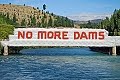
If state-owned Meridian Energy wins the day, most of the gorge will flooded up to an 85-metre dam to be built about 15km from the river's mouth. The resulting 14km-long lake will inundate 225 hectares of pristine lowland forest and obviously the stretch of wild river we hope to travel.

Meridian has the project on first base by obtaining the required resource consents from the West Coast Regional and Buller District councils. In March, commissioners decided, two to one, to grant the consents. The Department of Conservation (DOC), Forest & Bird and Whitewater NZ are appealing and the Environment Court is expected to hear the case in 2012.

Forest & Bird field officer Debs Martin, who is sharing a raft with Green Party co-leader Russel Norman (among others), explains Meridian faces another difficult hurdle: for the dam to go ahead, Meridian needs either permission from DOC to flood the land or it needs to acquire the DOC land by swapping it for other land which will provide a net benefit to conservation. Meridian has offered 700ha of land, two blocks of which are in the Mokihinui catchment below the dam.

DOC has completed its evaluation and a draft report recommends a firm "no" to Meridian on all counts. The final decision must be made by the conservation minister.

Martin hopes the area will end up in a conservation park, a process that was "on the table" before Meridian began the consent process.

She accepts the minister could direct the department to withdraw but thinks that unlikely because DOC has thrown "unprecedented" resources at the fight.

It all looks very difficult for Meridian but its Mokihinui project manager, Chris Evans (not on the trip), who has worked on the project for four years, says Meridian will persevere, concentrating for the moment on the appeal. Meridian has withdrawn its DOC flooding application so it can enter more open discussions.

The search for land to satisfy DOC continues, he says: "It's not an easy task when DOC already administers 80 per cent of land on the West Coast."

Back at the river, the launch is getting closer. About 120 people have gathered for a 6.30am start on a dull but mercifully dry morning.

Evidence before the commissioners showed only about 300 people use the area each year. We are certainly going to boost the average.

The event has been organised by the Christchurch White Water Canoe Club, more as a statement than a protest. The assemblage has its fair share of greenies but white water people come in all sorts of political stripes. Norman is the only politician on the trip.

The first step is for the rafts and kayaks to be bundled into nets and slung beneath helicopters for the trip up to the forks. One whitebaiter has set his net in the river just below the very site where the gear and people are loaded. In a scene reminiscent of Apocalypse Now, three helicopters flying neatly behind each other descend in an urgent racket of whining rotors.

The white water people are obviously not keen on the power project. The proposed lake does not stop them using the higher and difficult North Branch of the river but it means they face a dull 14km flat paddle on the descent which is currently broken by numerous boulder- strewn rapids, quieter stretches of green water, sandy beaches, striking rock features and healthy bush.

They concede their kayaks and rafts are not often seen on the river. As the day of our adventure shows, getting kayaks and rafts up the river is a major and expensive exercise.

Although the commissioners saw the loss of white water recreation as a "significant effect" they considered the dam would provide "a more diverse range of opportunities to a much wider group of people".

Hugh Canard, a Christchurch economic development and tourism consultant, whose heroic organisational abilities make the Mokihinui statement such a success, doesn't buy that argument.

He likens his white water colleagues to the endangered blue ducks who will be supplanted by the dam lake.

"We have the same rights as anybody else. Numbers shouldn't come into it. We are saying we are the blue ducks who have been using the river and minding their own business. Then along comes whoever and wants to take it away. You're going to displace blue ducks and introduce mallards."

While a lake would no doubt increase patronage of the area, by that logic a gondola up Aoraki/Mt Cook would be fine because it would do the same thing for the mountain, he says.

In his view the commissioners overlooked that the Mokihinui is one of only three reasonably accessible rivers on the West Coast that can be used by the majority of competent kayakers.

People who want a lake experience on the coast are spoiled for choice with about 100 naturally formed lakes that are under-utilised, he says.

Canard, 68, who has been kayaking since his late 30s, worries the lake will end up like Lake Dunstan at the head of the Clutha Dam - "dead".

"In my lifetime I've seen one river after another either getting diverted, drained or dammed. We've only got 20 per cent left. That's why the Mokihinui is important."

0 comments:

Clyde Dam Highly Problematic

Since the filling of the Dunstan reservoir behind the Clyde dam was completed in 1993, the Clyde dam controversy has faded in the minds of most New Zealanders. But the woes of the last 'think big' project have not gone away. Despite extensive and costly mitigation measures, issues remain regarding gorge instability, faultlines, and reservoir sediment build-up.

The Cairmuir-Dunstan Fault cuts across the gorge just above the dam, and the River Channel Fault disects the dam and the powerhouse. The discovery of the River Channel Fault came as a surprise to dam workers, who uncovered the micro-fractured rock running in a wide band along the riverbed. Obviously, fissured rock is not suitable for dam foundations. The first solution was to pump vast amounts of slurry concrete into the fault, but concerns mounted over the extent and depth of the faultline, and the likely futility of 'dental' concrete.

Finally, experts were called in to determine the extent of the fault issue. It was calculated that the River Channel Fault was 12-15km deep. This lead to a dam re-design in 1982 (during which a sluice channel was omitted leading to later modifications that reduced the dam's MW output by one-third). Subsequent investigations carried out by a team of some 40 geologists revealed serious instability issues throughout the gorge. The result was an incredibly expensive gorge stabilization programme, costing $936 million dollars (2005 value), resulting in the total cost of the project blowing-out to $1.4-1.8 billion dollars. The exact cost is unavailable or unknown, suggesting the true cost could be even higher.

There was considerable doubt over whether or not the dam would be safe, but in the end the government of the day, under Prime Minister Robert Muldoon, refused to admit that the project had been botched, and it was finished, complete with a controversial 'slip-joint' to accommodate earthquakes up to, supposedly, 7 on the Richter Scale.

The 'slip-joint' was hailed as an engineering achievement, but one of New Zealand's most respected geo-technical scientists at the time, Gerald Lensen, insisted that it was designed incorrectly, because the River Channel Fault is 'tensional' (pulling apart) and not 'lateral' (slipping sideways). Needless to say, this fact has been kept quiet ever since.

Now, according to GNS scientists, the 'big one' is overdue along the Alpine Fault (bigger than the 7.8 Fiordland quake in July 2009). Meantime, the 6,500 measuring and monitoring stations quietly observe the landslide movements, reduced but not stopped, and visible silting up continues in the Kawarau Arm at an alarming rate estimated to be 1.46 million cubic metres per year, building up the reservoir bed profile by an estimated 1.85m annually.

The Decline of Large Hydro

In the 21st century, energy that is "renewable" is defined as energy from a source that is both naturally replenishing and environmentally safe and sustainable. The term “new” renewable energy has also been used to define the latest wave of renewable technologies that are truly environmentally sustainable.

By such standards, hydropower over 10 MW is no longer considered renewable because the negative impacts of large hydropower outweigh the so-called renewable benefits, which have inherent limitations.

In New Zealand, we are told that to maintain our present society and standard of living we need a minimum increase in power availability of 2.5% per annum (peak power), with 170 MW of new generation added each year. Based on this figure, we would need the equivalent of one Luggate dam (86 MW) every 6 months, or one Tuapeka dam (350 MW) every 25 months, or another Clyde dam (432 MW) every 29 months. Clearly, this is not a credible long-term solution.

World-wide, large hydropower declined in the 1990s because of mounting opposition that culminated in the World Commission on Dams report (2000), which acknowledged that large dams do not meet best practice guidelines in the water and energy sector. The global recession spurred more large dam projects, especially in developing countries, but the tide has turned and large hydro is again in decline as new renewable technologies sweep the world.

The intrinsic problems associated with large dams have long been glossed over. Hydroelectricity is often falsely promoted as cheap and reliable. While the operating costs of hydroelectric dams can be relatively low, their construction costs are extremely high, running into the billions of dollars for major projects. They are also prone to cost overruns. The WCD (World Commission on Dams, 2000) found that on average dams cost 56% more than forecast. And 55% of the hydroelectric projects studied by the WCD generated less power than planners promised.

New Zealand's Clyde dam is an obvious example of disastrous cost overruns. According to the public record, the 1982 winning bid from the joint venture of W. Williamson & Co. of Christchurch and Ed. Zublin AG of Stuttgart, was $102.6 million. Ten years later when the dam began producing power, the cost had climbed to $1.4 – 1.8 billion. Conversely, the planned generation of 612 MW had fallen to an actual capacity of 432 MW.

Typically, construction and mitigation costs are under-estimated, long-term costs are ignored, the value of the proposed dam and mitigation measures are inflated, while the value of the current and potential benefits from the existing environment are under-reported.

The proponents of large dams also invariably claim that large hydropower is "green" energy. However, the carbon footprint of a large-scale hydro project is anything but "green". A comparative study at the University of Auckland found that large hydro has a full-life carbon footprint that is 2.5 times larger than that of tidal energy.

A similar comparative study in the U.K. found that in terms of grams of CO2 equivalent per kWh of electricity generated, large hydro in the U.K. comes in with a carbon footprint 2 to 6 times larger than that of wind power. Specifically, large hydro has been measured at 10-30gCO2eq/kWh while wind has been measured at only 4.64gCO2eq/kWh, the lowest except for nuclear (Carbon Footprint of Electricity Generation, 2006).

It is easy to understand why large dams rate so poorly. For example, the Clyde dam contains 1 million cubic metres of concrete, equivalent to about 3 million tonnes. Manufacturing one tonne of cement requires 4.7 million BTU’s of energy, which is the amount contained in about 170 litres of oil or 190 kilograms of coal. Obviously, this combined with emissions from machinery involved in earthworks for foundations, roading, terrain forming, landslide mitigation, and through the loss of river corridor carbon sink forests or vegetation, adds up to an enormous carbon footprint.

There are over 54,000 large dams in the world, some 5,000 of which are over 50 years old. The typical design-life of such dams is 80 years, and an increasing number of old dams are being classified as high risk. It is a telling fact that more dams are being decommissioned than built in the U.S., but dam owners typically avoid decommissioning issues and try to evade the considerable costs associated with dam removal and river restoration. This scenario points to a looming dam safety crisis.

In the past, the benefits of large dams were viewed as outweighing their obvious short and long-term environmental impacts. That has changed.

Large hydropower once represented the epitome of 20th Century technology and a passport to prosperity, projecting a misguided belief that Nature could be controlled without consequences. In the 21st Century, we face a new reality, for which 20th Century energy solutions are unacceptable.

Roxburgh Dam Decommissioning?

The Roxburgh dam was commissioned in 1956, and it is New Zealand's oldest concrete gravity dam. Such dams have a design lifespan of 80-100 years, but the actual lifespan of a dam depends on the rate at which its reservoir fills with sediment. Assessing the remaining life of a dam and reservoir is complex, but reservoir flooding events indicate that time is running out.

When other issues are added to the picture, questions must be asked.

The Roxburgh dam - like the Clyde dam, has faultine and landslide issues that are potentially catastrophic (something which has been kept quiet). However, when the Roxburgh dam was built, there was minimal geotechnical investigation and mitigation undertaken, despite obvious evidence of major landslides in the Roxburgh Gorge, notably at Island Basin.

But reservoir sedimentation is the most problematic issue. In fact, within 15 years of the dam's commissioning, the dam's two low level sluice gates were inoperable, and since then the silt burden has filled much of the Roxburgh reservoir reaching back to Alexandra. In 1995, ECNZ estimated that 1.5 million cubic metres of silt had entered the Roxburgh reservoir every year before the Clyde dam was built, and that a total 50 million cubic metres of silt had accumulated in the reservoir, raising the bed profile 'considerably'. Attempts to 'flush' the silt have had little effect, and have not reversed this process. This is probably because of the 'Gates of the Gorge,' a narrow bottleneck just below Alexandra.

As a result, Alexandra has become flood-prone, and has installed flood defence walls along the river. But even these will not be high enough to prevent future flooding, because the riverbed will gradually keep rising. It was thought that by building the Clyde dam that this sedimentation problem would be largely solved, but some silt still gets through to continue choking the reservoir and river, and the Manuherikia River still contributes silt when it is high.

Efforts continue to "buy time" for the Roxburgh dam. More "flushing" will only move some of the sediment load further toward the dam. (Flushing has failed to remove sediment wherever it has been tried, including on the Colorado.) Physically removing millions of cubic metres of sediment is not practicable because of the costs involved. An interim measure is to remove some sediment from the Manuherikia confluence, and also from the Galloway area, but this does not address the major constriction at the 'Gates of the Gorge.'

The most desperate strategy is to raise the operating level of the Roxburgh reservoir, and this was done in 2009 when a rise of .6m was consented. While this allows water to reach the dam more easily, it also increases the risks associated with flooding events, both at Alexandra and the dam. In the life cycle of a dam, this is the "Russian roulette phase."

The dam owners and the Crown must face up to the fact that the Roxburgh dam and reservoir will not last forever, and that enormous risks are imposed on communities in the meantime. A feasibility study is needed to determine the most effective decommissioning and de-silting methodology. Where such dam removal projects have been undertaken overseas, the costs as a proportion of construction, range from 35% to 150%.

However, since there has been no provision for the ultimate decommissioning of the Roxburgh dam (typical of the hydropower industry), there is something of a head-in-the-sediment policy on this issue.

Questions should be asked, including the most difficult question of all ... when the time comes to decommission the dam, who will pay?
© Clutha River Guardian 2009-2015