Thursday, March 31, 2011

Film On Life Before And After Dam

Documentary on life before and after dam
By Colin Williscroft, on Wednesday 30 March 2011
Otago Daily Times

Cromwell Junction, before the Clyde dam

Gemma Duncan is making the film as part of her master of arts degree in screen production at Auckland University.

During her undergraduate degree, at Unitec, she took large digital photos of historic sites around the South Island and spent two and a-half weeks in Cromwell.

"I just fell in love with the place. It's got a rich and in-depth history."

For the latest project, Miss Duncan hoped to interview individuals and representatives of community groups about what it was like to live in Cromwell before the dam was built and what it is like now.

She has already been in contact with the Cromwell i-SITE and the Cromwell and Districts Promotion Group.

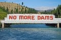
She is aware that construction of the dam was controversial.

"The last thing I want from the documentary is to make a statement about whether or not the dam should have been built. It's more about focusing on what was there and what still is.

"If physical history is lost, people still have their memories. It is about loss but it's also about community spirit." The length of the film was yet to be determined, she said.

"It all depends on what I find. It's very early in the game right now, so, although I have a vision, it's hard to say how long, as the nature of documentaries means everything changes as you meet the people along the way."

Historic footage might be included, but the focus would be on people's memories and what Cromwell was like to live in today.

Miss Duncan is working to secure funding for the film but hopes to be in Cromwell within the next month for pre-production work, before returning in August for filming.

She plans to have the film finished by the end of the year.

"Then I've got to look at getting it screened. I'm hoping a film festival might pick it up. I'd also like to think we could have some sort of community event in Cromwell, to show the residents."

More...

Saturday, March 12, 2011

Consent Granted For Trail Structures

Consent granted for trail structures

By Colin Williscroft, on Saturday 12 March 2011
Otago Daily Times

Planning consent has been granted for some aspects of the Clutha Gold Trail but the decision could still be appealed.

Independent commissioner Denis Nugent, of Wanaka, has granted the Clutha Gold Charitable Trust land use consent for structures associated with the construction, operation and maintenance of a walking and cycling track, following a hearing held in the middle of last month.

Consent is subject to 48 conditions.

The Clutha Gold Trail is proposed to run from the Roxburgh dam to Lawrence. The resource consent granted by Mr Nugent applies only to the section within the Central Otago district, from the dam to Beaumont, where the trail will follow the true left bank (east) of the Clutha River.

Consent was granted for 11 horizontal signs, each with a maximum area of 3sq m, for interpretation of items of interest along the trail, one kiosk sign in Millers Flat and three culverts.

Mr Nugent did not grant consent for the trail itself, as the trust's application did not ask for it.

"It was the applicant's contention that the trail itself was a permitted activity and therefore did not require resource consent," Mr Nugent said.

"As the applicant has limited the application to the structures listed, I need not explore whether that contention is correct or not, as I would have no jurisdiction to grant consent to something that has not been applied for."

If the trust found that it could not meet Central Otago District Council standards for a permitted activity during construction of the trail, it would need to stop work and apply for the necessary resource consent, he said.

The 73km trail was the first in Central Otago to receive funding under the New Zealand Cycle Trail project, with a grant of $2.5 million for the 50km section from the dam to Beaumont. Government funding for the second part of the trail is under review, due to unresolved issues with affected landowners.

Chairman of the Society for the Promotion of an Alternative Route Jim Barclay, of Millers Flat, said he expected Mr Nugent's decision.

"They've got consent for the structures associated with the trail but no-one knows whether the trail itself needs consent."

The society had yet to meet to consider what it would do next but Mr Barclay said that would happen soon. Only after that meeting was held could he comment on the likelihood of an appeal, which had to be made within 15 working days of the Mr Nugent's decision.

Trust chairman Rod Peirce, of Roxburgh, was pleased consent had been granted, but wanted to wait until the appeal period was over before making any comment. However, he hoped discussions with landowners affected by the other section of the trail would be successful and it, too, could go ahead.

More...

Wednesday, February 23, 2011

Objectors Not Against Trail

Objectors not against trail idea
By Colin Williscroft, on Wednesday 23 February 2011
Otago Daily Times

A group of landowners who objected to the route of the proposed Clutha Gold Trail are not against the trail itself.

Chairman of the Society for the Promotion of an Alternative route (Roxburgh Hydro - Lawrence) Inc, Jim Barclay, of Millers Flat, said all those people who spoke at the recent resource consent hearing for the trail said they supported its aims ''but like all good ideas, you have to get the local people to support more than just the aims''.

Everyone involved with the society was in favour of anything that promoted the district, Mr Barclay said.

The Clutha Gold Trail will run along the true left side (east) of the Clutha River, from the Roxburgh dam to Lawrence, although the resource consent hearing was only dealing with the section from the dam to Beaumont.

It will be built mainly on the marginal strip next to the river, although some parts will be in Crown-owned land, land vested in the Central Otago District Council and private property, including some owned by Contact Energy.

Mr Barclay said the 19 or 20 paid-up members of the society believed the proposed route of the trail by-passed significant Teviot Valley tourist attractions, such as the Lonely Graves and former gold panning areas.

''It would seem appropriate they were included in the trail.''

The society was formed by people as a way of pursuing their common interests, he said.

In its present form, the route was unnecessarily disruptive on some people, Mr Barclay said.

''There are alternatives available.

''The society would like to work with the trust to minimise the effects on established homes, farming and orchard seasonal work, as well as to minimise the cost of construction and maintenance of the trail.

''If we work together we could get everyone on the side of what could be a good idea.''

More...

Friday, February 18, 2011

Trail Landowners Criticise Process

Trail landowners criticise process
By Colin Williscroft, on Friday 18 February 2011
Otago Daily Times

Landowners opposed to the proposed Clutha Gold Trail have criticised the way the organisation behind it has gone about the project.

They voiced their dissatisfaction during a two-day hearing in Roxburgh this week that heard an application by the Clutha Gold Trail Charitable Trust for resource consent to build structures associated with the construction, operation and maintenance of a walking and cycling trail.

The proposed Clutha Gold Trail will run along the true left side (east) of the Clutha River, from the Roxburgh dam to Beaumont.

It will be built mainly on the marginal strip next to the river, although some parts will be in Crown-owned land, land vested in the Central Otago District Council and private property, including some owned by Contact Energy.

Ruth Huwes, of Millers Flat, told Hearings Commissioner Denis Nugent the proposal had been characterised by a lack of transparency and communication.

Mrs Huwes and her husband Colin met trust members in 2008 to discuss what impact the trail might have on a retreat they were building on their property next to the marginal strip, as they were concerned the trail and accompanying cyclists would invade the privacy of their future guests.

They were told their concerns would be listened to but Mrs Huwes said they did not hear from the trust until it was announced last year the trail would largely follow the river.

"We had continued to build our retreat but we now had very serious doubts as to the intentions of the trust with regard to our property. We were devastated," Mrs Huwes said.

"We had tried to be proactive in 2008 but now felt betrayed."

Since that time they have been told they were "uncivic" in opposing the trail.

"I feel that we are being singled out as objecting to and trying to stymie the whole project. That is not the case. We are merely wanting a level playing field and [to be] given sufficient information and time to assess what the impacts are on us," she said.

Ken Franklin, of Christchurch, but who has owned a property next to the marginal strip by the Clutha River for seven years, echoed some concerns.

"There has been a lack of adequate consultation in terms of the location [of the trail]," he said.

The trust had not chosen the best possible route for the trail, he said, in terms of public safety, visual amenity and construction and maintenance costs.

"There needs to be wider consultation about other alternatives."

Anita Dawe, of Clyde, a senior planner with BTW South who represented the trust at this week's hearing, said there had been a variety of consultation and information meetings, phone calls and news articles about the trail. "We submit that consultation has been exhaustive and continuous."

Consultation does not mean to reach agreement, although that is the desired outcome, but to engage, participate and adjust proposals if possible, she said. Meetings with affected residents were held until February 28.

"Despite the best intentions and goodwill of all parties, unfortunately, no agreement could be reached," she said.

Mr Nugent reserved his decision.

More...

Thursday, February 10, 2011

Missing Man's Body Returned Home

Missing man's body returned home
By Barbara Withington, on Tuesday 10 February 2011
Southland Times

For some it meant closure, others saw it as nothing short of a miracle.

Family members gathered at the Beaumont Jet office yesterday morning as the body of Paul Wilson was bought ashore from the swollen Clutha River, ending seven days of searching since the 28-year-old civil engineer went missing in the Talla Burn stream while collecting water samples.

With the Clutha River flowing at about 1300 cumecs (normal flow about 800 cumecs), dropping from a high of almost 1550 cumecs on Tuesday morning, fears had been held Mr Wilson's body would never be recovered.

In normal river flow, the body of 16-year-old Darryl Walker, who dived into the Clutha River 1km south of Roxburgh on November 11, 2008, was never found.

In a media release, Detective Sergeant Derek Shaw said Dave Crawford, of Beaumont Jet, continued to observe the river and had discovered Mr Wilson's body about 11am.

"We believe Mr Wilson has always been within the search area but had only recently become visible," Mr Shaw said yesterday.

Police also thanked Central Otago LandSar, volunteer searchers, local farmers and Contact Energy, who all assisted in the search.

Mr Wilson had been the project engineer for Talla Burn Generation, a run-of-the-river power scheme developed by his father Jeff Wilson in partnership with Beaumont Station owner Alan Hore.

The scheme began producing up to 2.6megawatts of power in early November.

One of the conditions placed by the Otago Regional Council on the project was that regular water samples be taken, and it was while he was carrying out sampling of the Talla Burn in flood that Mr Wilson disappeared.

Senior Sergeant Andy Reed, who was involved in the search for and recovery of Mr Wilson, was a neighbour of Mr Wilson's parents but said he felt the loss no more than anyone else.

"Anyone in Roxburgh who has anything to do with the family will be feeling it for them," Mr Reed said.

The matter has been referred to the coroner.

Mr Wilson's family asked for privacy

More...

Family Mourns Young Man

Family mourns 'young man with great ideas'
By Lynda Van Kempen, on Thursday 10 February 2011
Otago Daily Times

Roxburgh civil engineer Paul Wilson was instrumental in establishing the Talla Burn hydro-electric power scheme and was a young man with great ideas who would be sorely missed, a family friend said yesterday.

Mr Wilson's body was recovered from the Clutha River yesterday, a week after he went missing while collecting water samples from the flooded Talla Burn, next to Talla Burn Generation's powerhouse, 10km from Beaumont.

Friend Stephen Jeffery, who is also the Roxburgh Community Board chairman, said the 28-year-old was the driving force behind the power scheme.

"Paul was instrumental in getting that whole project up and running, and I'm not sure if that was the last of it ... He had some plans for the future.

"His death is a tragedy for the whole district and he'll be sorely missed, especially in the Teviot Valley.

"He was a really nice guy and had some great ideas," Mr Jeffery said.

The power generation company is locally owned and operated, and was established in 2007 by the Wilson and Hore families.

The powerhouse, located on the Talla Burn, has been generating electricity since November.

Mr Wilson was found about 5km upstream of the Beaumont bridge, by a commercial jet-boat operator who had been involved in the week-long search and continued to monitor the river, Detective Sergeant Derek Shaw, of Alexandra, said.

"I hope that being able to retrieve Mr Wilson will be a help in some way for those going through the grieving process.

"Having an unresolved search would have been disturbing for the family and for the searchers as well," Det Sgt Shaw said.

The Wilson family and police were grateful for the efforts of all those in the Teviot Valley and further afield who assisted in the search and in catering and providing accommodation for those involved, he said.

"It was a huge effort by the wider community, with people donating their time, jet-boat time, helicopter time and making a considerable effort to help with the search and recovery of Mr Wilson.

"That was appreciated by the family and the police."

The matter had been referred to the coroner.

"We still need to try and establish what exactly happened to Mr Wilson, who was last seen heading towards the Talla Burn and then found a week later in the Clutha - what happened in between those times has to be determined."

The area where the body was located was searched several times during the past week.

"The level of the Clutha has risen during the week and we believe Mr Wilson's body has moved within the river and only became visible today [Wednesday]," he said.

The immense flow of the river, swollen by rain, was one of the challenges faced by searchers.

"Being involved in the search and recovery, you get a sense of how much we underestimate rivers, the unrelenting energy of the Clutha especially," Det Sgt Shaw said.

More...

Tuesday, February 8, 2011

More Flooding For South Otago

More flooding tipped for South Otago
Tuesday, 8th February 2011
Otago Daily Times

The Otago Regional Council is predicting further flooding of rural farmland near Balclutha after heavy rain caused surface flooding in South and West Otago yesterday.

Although many rivers in the area are dropping, the ORC is predicting the Clutha River to peak at around 1900 cumecs at lunchtime today. This means low-lying areas close to the river, up and downstream of Balclutha, will flood, adding to the already high water levels in the lower Clutha delta.

Because Clutha river flows upstream at Roxburgh Dam are above 1400 cumecs, the lower Clutha is expected to remain high for several days.

More...

Clyde Dam Highly Problematic

Since the filling of the Dunstan reservoir behind the Clyde dam was completed in 1993, the Clyde dam controversy has faded in the minds of most New Zealanders. But the woes of the last 'think big' project have not gone away. Despite extensive and costly mitigation measures, issues remain regarding gorge instability, faultlines, and reservoir sediment build-up.

The Cairmuir-Dunstan Fault cuts across the gorge just above the dam, and the River Channel Fault disects the dam and the powerhouse. The discovery of the River Channel Fault came as a surprise to dam workers, who uncovered the micro-fractured rock running in a wide band along the riverbed. Obviously, fissured rock is not suitable for dam foundations. The first solution was to pump vast amounts of slurry concrete into the fault, but concerns mounted over the extent and depth of the faultline, and the likely futility of 'dental' concrete.

Finally, experts were called in to determine the extent of the fault issue. It was calculated that the River Channel Fault was 12-15km deep. This lead to a dam re-design in 1982 (during which a sluice channel was omitted leading to later modifications that reduced the dam's MW output by one-third). Subsequent investigations carried out by a team of some 40 geologists revealed serious instability issues throughout the gorge. The result was an incredibly expensive gorge stabilization programme, costing $936 million dollars (2005 value), resulting in the total cost of the project blowing-out to $1.4-1.8 billion dollars. The exact cost is unavailable or unknown, suggesting the true cost could be even higher.

There was considerable doubt over whether or not the dam would be safe, but in the end the government of the day, under Prime Minister Robert Muldoon, refused to admit that the project had been botched, and it was finished, complete with a controversial 'slip-joint' to accommodate earthquakes up to, supposedly, 7 on the Richter Scale.

The 'slip-joint' was hailed as an engineering achievement, but one of New Zealand's most respected geo-technical scientists at the time, Gerald Lensen, insisted that it was designed incorrectly, because the River Channel Fault is 'tensional' (pulling apart) and not 'lateral' (slipping sideways). Needless to say, this fact has been kept quiet ever since.

Now, according to GNS scientists, the 'big one' is overdue along the Alpine Fault (bigger than the 7.8 Fiordland quake in July 2009). Meantime, the 6,500 measuring and monitoring stations quietly observe the landslide movements, reduced but not stopped, and visible silting up continues in the Kawarau Arm at an alarming rate estimated to be 1.46 million cubic metres per year, building up the reservoir bed profile by an estimated 1.85m annually.

The Decline of Large Hydro

In the 21st century, energy that is "renewable" is defined as energy from a source that is both naturally replenishing and environmentally safe and sustainable. The term “new” renewable energy has also been used to define the latest wave of renewable technologies that are truly environmentally sustainable.

By such standards, hydropower over 10 MW is no longer considered renewable because the negative impacts of large hydropower outweigh the so-called renewable benefits, which have inherent limitations.

In New Zealand, we are told that to maintain our present society and standard of living we need a minimum increase in power availability of 2.5% per annum (peak power), with 170 MW of new generation added each year. Based on this figure, we would need the equivalent of one Luggate dam (86 MW) every 6 months, or one Tuapeka dam (350 MW) every 25 months, or another Clyde dam (432 MW) every 29 months. Clearly, this is not a credible long-term solution.

World-wide, large hydropower declined in the 1990s because of mounting opposition that culminated in the World Commission on Dams report (2000), which acknowledged that large dams do not meet best practice guidelines in the water and energy sector. The global recession spurred more large dam projects, especially in developing countries, but the tide has turned and large hydro is again in decline as new renewable technologies sweep the world.

The intrinsic problems associated with large dams have long been glossed over. Hydroelectricity is often falsely promoted as cheap and reliable. While the operating costs of hydroelectric dams can be relatively low, their construction costs are extremely high, running into the billions of dollars for major projects. They are also prone to cost overruns. The WCD (World Commission on Dams, 2000) found that on average dams cost 56% more than forecast. And 55% of the hydroelectric projects studied by the WCD generated less power than planners promised.

New Zealand's Clyde dam is an obvious example of disastrous cost overruns. According to the public record, the 1982 winning bid from the joint venture of W. Williamson & Co. of Christchurch and Ed. Zublin AG of Stuttgart, was $102.6 million. Ten years later when the dam began producing power, the cost had climbed to $1.4 – 1.8 billion. Conversely, the planned generation of 612 MW had fallen to an actual capacity of 432 MW.

Typically, construction and mitigation costs are under-estimated, long-term costs are ignored, the value of the proposed dam and mitigation measures are inflated, while the value of the current and potential benefits from the existing environment are under-reported.

The proponents of large dams also invariably claim that large hydropower is "green" energy. However, the carbon footprint of a large-scale hydro project is anything but "green". A comparative study at the University of Auckland found that large hydro has a full-life carbon footprint that is 2.5 times larger than that of tidal energy.

A similar comparative study in the U.K. found that in terms of grams of CO2 equivalent per kWh of electricity generated, large hydro in the U.K. comes in with a carbon footprint 2 to 6 times larger than that of wind power. Specifically, large hydro has been measured at 10-30gCO2eq/kWh while wind has been measured at only 4.64gCO2eq/kWh, the lowest except for nuclear (Carbon Footprint of Electricity Generation, 2006).

It is easy to understand why large dams rate so poorly. For example, the Clyde dam contains 1 million cubic metres of concrete, equivalent to about 3 million tonnes. Manufacturing one tonne of cement requires 4.7 million BTU’s of energy, which is the amount contained in about 170 litres of oil or 190 kilograms of coal. Obviously, this combined with emissions from machinery involved in earthworks for foundations, roading, terrain forming, landslide mitigation, and through the loss of river corridor carbon sink forests or vegetation, adds up to an enormous carbon footprint.

There are over 54,000 large dams in the world, some 5,000 of which are over 50 years old. The typical design-life of such dams is 80 years, and an increasing number of old dams are being classified as high risk. It is a telling fact that more dams are being decommissioned than built in the U.S., but dam owners typically avoid decommissioning issues and try to evade the considerable costs associated with dam removal and river restoration. This scenario points to a looming dam safety crisis.

In the past, the benefits of large dams were viewed as outweighing their obvious short and long-term environmental impacts. That has changed.

Large hydropower once represented the epitome of 20th Century technology and a passport to prosperity, projecting a misguided belief that Nature could be controlled without consequences. In the 21st Century, we face a new reality, for which 20th Century energy solutions are unacceptable.

Roxburgh Dam Decommissioning?

The Roxburgh dam was commissioned in 1956, and it is New Zealand's oldest concrete gravity dam. Such dams have a design lifespan of 80-100 years, but the actual lifespan of a dam depends on the rate at which its reservoir fills with sediment. Assessing the remaining life of a dam and reservoir is complex, but reservoir flooding events indicate that time is running out.

When other issues are added to the picture, questions must be asked.

The Roxburgh dam - like the Clyde dam, has faultine and landslide issues that are potentially catastrophic (something which has been kept quiet). However, when the Roxburgh dam was built, there was minimal geotechnical investigation and mitigation undertaken, despite obvious evidence of major landslides in the Roxburgh Gorge, notably at Island Basin.

But reservoir sedimentation is the most problematic issue. In fact, within 15 years of the dam's commissioning, the dam's two low level sluice gates were inoperable, and since then the silt burden has filled much of the Roxburgh reservoir reaching back to Alexandra. In 1995, ECNZ estimated that 1.5 million cubic metres of silt had entered the Roxburgh reservoir every year before the Clyde dam was built, and that a total 50 million cubic metres of silt had accumulated in the reservoir, raising the bed profile 'considerably'. Attempts to 'flush' the silt have had little effect, and have not reversed this process. This is probably because of the 'Gates of the Gorge,' a narrow bottleneck just below Alexandra.

As a result, Alexandra has become flood-prone, and has installed flood defence walls along the river. But even these will not be high enough to prevent future flooding, because the riverbed will gradually keep rising. It was thought that by building the Clyde dam that this sedimentation problem would be largely solved, but some silt still gets through to continue choking the reservoir and river, and the Manuherikia River still contributes silt when it is high.

Efforts continue to "buy time" for the Roxburgh dam. More "flushing" will only move some of the sediment load further toward the dam. (Flushing has failed to remove sediment wherever it has been tried, including on the Colorado.) Physically removing millions of cubic metres of sediment is not practicable because of the costs involved. An interim measure is to remove some sediment from the Manuherikia confluence, and also from the Galloway area, but this does not address the major constriction at the 'Gates of the Gorge.'

The most desperate strategy is to raise the operating level of the Roxburgh reservoir, and this was done in 2009 when a rise of .6m was consented. While this allows water to reach the dam more easily, it also increases the risks associated with flooding events, both at Alexandra and the dam. In the life cycle of a dam, this is the "Russian roulette phase."

The dam owners and the Crown must face up to the fact that the Roxburgh dam and reservoir will not last forever, and that enormous risks are imposed on communities in the meantime. A feasibility study is needed to determine the most effective decommissioning and de-silting methodology. Where such dam removal projects have been undertaken overseas, the costs as a proportion of construction, range from 35% to 150%.

However, since there has been no provision for the ultimate decommissioning of the Roxburgh dam (typical of the hydropower industry), there is something of a head-in-the-sediment policy on this issue.

Questions should be asked, including the most difficult question of all ... when the time comes to decommission the dam, who will pay?
© Clutha River Guardian 2009-2015